Mississippi, often painted with broad strokes of blues music and southern charm, conceals a landscape far more complex and geologically dynamic than its reputation suggests. Beneath its fertile Delta plains lie ancient volcanoes, while its coast has witnessed some of the most powerful natural forces ever recorded in the United States. Rivers that sing and flow backward, canyons that grow in real time, and forests that predate medieval Europe all contribute to a geographic tapestry rich with plot twists. This is a state where the land itself refuses to conform, constantly rewriting its own story.
Subterranean Secrets and Ancient Earth
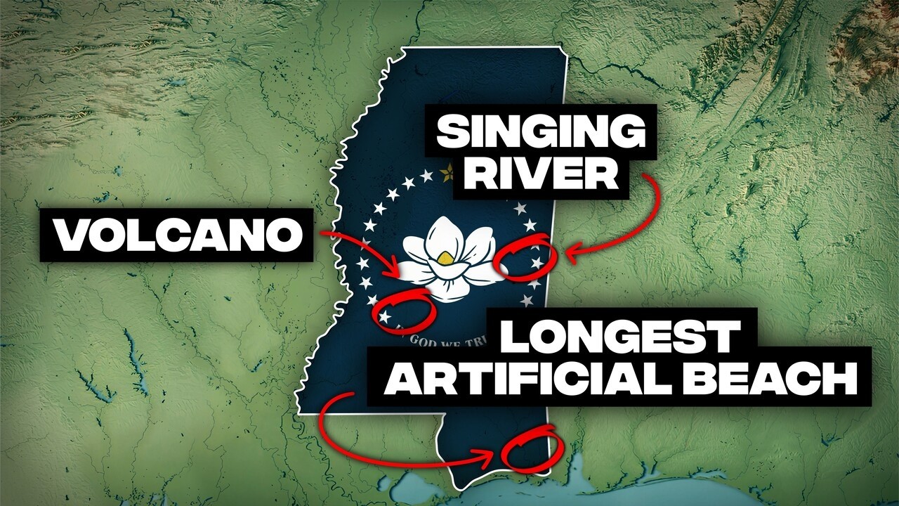
Capital city sits atop a buried 70-million-year-old volcano.
Mississippi's capital, Jackson, is built directly over a volcanic dome, approximately half a mile beneath the city. This 70-million-year-old structure formed during the late Cretaceous period when the area was a shallow sea, with the volcano emerging as a fiery island. Geologists confirmed its existence by mapping ancient igneous rock, making Jackson one of the few US state capitals with such a subterranean secret.
A second hidden volcano lies beneath the Mississippi Delta.
Jackson is not unique; Mississippi harbors a second buried volcano near the Delta community of Midnight. Like its capital counterpart, this volcano formed during the late Cretaceous period when magma pushed through the Earth's crust. Over millions of years, it became completely invisible, buried under layers of sediment and farmland, with cotton fields now covering where lava once flowed.
Ancient trees turned completely to stone in a petrified forest.
Near Flora, Mississippi, lies one of only two petrified forests east of the Mississippi River, where trees that fell roughly 36 million years ago are preserved in stone. During the Oligocene epoch, a log jam was buried, and silica-rich groundwater gradually replaced each wood cell with stone. Visitors can still observe growth rings and bark texture, witnessing a forest frozen mid-history.
Mississippi's highest point is a subtle 806-foot hill.
Woodall Mountain, Mississippi's highest elevation, stands at just 806 feet above sea level. This modest peak is lower than the lowest point in 16 other US states. It represents an older, erosion-resistant terrain that escaped the flattening forces shaping much of the state, a quiet defiance of gravity in a landscape dominated by flood plains.
The world's longest artificial beach stretches 26 miles.
Mississippi's Gulf Coast boasts the longest artificial beach on Earth, an uninterrupted 26-mile stretch from Biloxi to Pass Christian. Created in the 1950s, engineers dredged and imported massive amounts of sand to transform marshland into a continuous barrier. This man-made marvel serves both tourism and critical storm protection, absorbing wave energy before it reaches coastal towns.
Katrina brought the highest storm surge in US history.
In 2005, Hurricane Katrina delivered a storm surge of 28 feet along parts of Mississippi's coast, the highest ever recorded in US history. This wall of water, equivalent to a three-story building, erased entire neighborhoods in Bay St. Louis and Pass Christian. It proved storm surges are a hurricane's most destructive force, capable of reshaping coastlines in a single night.
Hurricane Camille's 190 mph winds redefined catastrophic storms.
Hurricane Camille, striking in 1969, brought winds approaching 190 mph, so powerful that measuring instruments failed before recording the peak. It stripped coastal neighborhoods down to concrete slabs and killed at least 259 people. For decades, Camille stood as the benchmark for worst-case hurricanes, remaining one of the strongest landfalling storms ever recorded in the Western Hemisphere.
Water's Unrelenting Hand
Deadliest river tornado killed 317 people in Natchez.
In 1840, a massive tornado struck Natchez, turning the Mississippi River into a death trap. The funnel moved directly up the river during peak business hours, hitting a waterfront packed with flatboats and steamboats. At least 317 people were killed, most drowning as vessels capsized. This combination of density, timing, and location made it one of the deadliest tornadoes in US history.

The Mississippi River briefly flowed backward during earthquakes.
During the New Madrid earthquakes of 1811 to 1812, the Mississippi River briefly reversed its direction. The quakes were so powerful they caused land to shift, creating upstream surges that forced water northward, causing boats to drift backward. These were among the strongest earthquakes ever recorded in North America, powerful enough to bend one of the continent's greatest rivers to geological will.
Cypress trees older than medieval Europe still stand tall.
Sky Lake Wildlife Refuge preserves bald cypress trees over 1,000 years old, with trunks so massive it takes three people to encircle them. These ancient sentinels sprouted around 700 AD, enduring centuries of floods, hurricanes, and climate shifts. Their bases emerge from dark swamp water like pillars, forming one of the largest old-growth cypress stands on Earth.
Prairie ecosystems surprisingly thrive in the Deep South.
Mississippi hides a band of native grassland, known as the Black Belt, stretching across its northeast. Formed on chalk deposited when the region was a shallow Cretaceous sea, its dark, mineral-rich soil once supported vast prairies. Before extensive farming, bison roamed here, and indigenous communities maintained the grasslands with controlled burns. Restoration efforts are now bringing these unique prairies back.
An artificial river larger than the Panama Canal was dug.
In the 1980s, Mississippi constructed the Tennessee-Tombigbee Waterway, a 234-mile channel connecting the Tennessee River to the Gulf. This monumental project required moving over 310 million cubic yards of earth, surpassing the volume of material excavated for the Panama Canal. Completed in 1985, the "Ten-Tom" permanently rewired eastern Mississippi's geography, proving that if Americans want a river, they will dig one.
Emerald Mound, an 8-acre monument built by hand.
Emerald Mound, covering 8 acres and rising 35 feet high, is the second largest indigenous earthwork in the United States. Built between 1200 and 1700 AD by the Natchez people, every basket of soil was carried by hand, without metal tools or animals. Its construction required careful engineering, erosion control, and organized labor across generations, long before modern construction existed.
Mississippi's famous Delta is not a true river delta.
Despite its name, the Mississippi Delta is not a delta in the geological sense, as it sits hundreds of miles inland. It is actually an alluvial flood plain, trapped between the Mississippi and Yazoo rivers. Early settlers mistakenly applied the name due to its triangular shape and swampy terrain. Over thousands of years, floods deposited nutrient-rich silt, creating some of the most fertile farmland on Earth.
The town of Rodney was abandoned by the Mississippi River.
Rodney was once a booming Mississippi Riverport, nearly becoming the state capital, until the river shifted its course in 1870. The Mississippi moved two miles west, leaving Rodney landlocked almost overnight. Commerce vanished, boats stopped coming, and residents fled, leaving behind a ghost town swallowed by forest, a stark reminder of geography's power to reshape human settlements.
America's Catfish Capital produces 65% of US farm-raised fish.
Mississippi proudly holds the title of America's Catfish Capital, producing about 65 percent of all US farm-raised catfish. The Delta's pancake-flat terrain and abundant freshwater transformed former cotton fields into aquaculture gold. Nearly 35,000 acres are now dedicated to catfish ponds, forming massive grids of water stretching as far as the eye can see, particularly around Belzoni.
"Hot Coffee" is a real, curiously named Mississippi town.
Yes, Hot Coffee, Mississippi, exists, its name dating back to the 1870s when a local store advertised hot coffee to travelers. The sign stuck, the name followed, and Hot Coffee officially appeared on maps in Covington County. It joins other unmistakably Mississippi place names like Soso, Why Not, and Possum Neck, proving the state's geography carries as much personality as terrain.
A hurricane cut Ship Island in half for 50 years.
In 1969, Hurricane Camille split Ship Island clean in two, carving a 3.5-mile channel straight through the barrier island. This "Camille Cut" divided the island into East and West halves for over five decades. In 2019, engineers began stitching it back together, pumping millions of cubic yards of sand to restore both the island's geography and its critical storm protection role.
America's largest undammed river flows through Mississippi.
The Pascagoula River is unique as America's largest undammed river by volume in the continental United States. It flows completely free, with no obstructions in its main channel, draining 8,800 square miles of wetlands. This untouched status has preserved one of the most intact river ecosystems in North America, supporting diverse wildlife that thrives in its natural flood cycles.
The world's longest artificial beach stretches 26 uninterrupted miles from Biloxi to Pass Christian.
Earth's Restless Surface and Atmospheric Fury
The Pascagoula River is known for its mysterious singing.
Still on the Pascagoula, for generations, people have reported a low, humming sound emanating from the river at dusk. While scientists suggest insects or fish creating synchronized vibrations, folklore offers a darker explanation: a Native American tribe chose death over capture, walking into the river singing, their voices still echoing from below. The sound is real enough that locals still experience it, turning skepticism into silence on calm summer nights.

A 1927 flood created an inland sea, submerging 2 million acres.
In spring 1927, a levee failure at Mounds Landing turned the Mississippi Delta into an ocean. Water exploded across the flood plain, eventually submerging over 2 million acres under 10 to 15 feet of water. This disaster displaced roughly 700,000 people and permanently changed how America handles floods, launching Herbert Hoover's political career and rewriting US flood control policy.
Vicksburg survived only by dragging its river back.
In 1876, the Mississippi River shifted its channel, abandoning Vicksburg and leaving the once booming riverport beside a stagnant oxbow lake. Commerce collapsed, and the city nearly died. It took 27 years of engineering to force a solution, digging the Yazoo Diversion Canal to reconnect Vicksburg to navigable water, a clear example of a city refusing to accept geography's verdict.
Mississippi's "Little Grand Canyon" is actively growing.
Red Bluff, in Marion County, is a 200-foot-deep canyon that looks wildly out of place amidst pine forests. Slicing into the land, it exposes bands of red clay, sand, and soil. This "Little Grand Canyon" is actively expanding, as rainfall aggressively erodes the soft sediment. Nearby highways have been relocated twice to avoid its collapsing edge, a canyon forming at human speed.
The state leads the nation in long-track tornado paths.
Mississippi is firmly within "Dixie Alley," leading the nation in average tornado track length. In April 2010, a single tornado tore a 149-mile continuous path across the state. Warm Gulf moisture colliding with cold fronts creates violent, long-lived storms, many striking at night or outside peak season, making them especially deadly and challenging for residents.
Three of America's deadliest tornadoes struck Mississippi.
Mississippi has been disproportionately affected by tornadoes, with three of the 10 deadliest in US history striking the state. The 1840 Natchez tornado killed at least 317 people, many drowning in the river. In 1936, a tornado leveled Tupelo, killing 216 and nearly taking the life of a one-year-old Elvis Presley. The state's resilience was built through these hard-earned lessons.
Nuclear bombs were detonated deep beneath pine forests.
Mississippi is the only state east of the Rockies where nuclear weapons were detonated. During the Cold War, the US government conducted two underground nuclear tests at the Tatum Salt Dome in Lamar County. In 1964, a 5.3 kiloton bomb exploded nearly half a mile underground, followed by a smaller device in 1966. Few realize Mississippi once hosted secret atomic fire beneath its soil.
Counties exist with more deer than human residents.
Issaquena County, Mississippi, is one of the emptiest places in the US, with approximately 1,400 people spread across a county of swamps, fields, and river bottomland. This results in one of the lowest population densities in the entire country. Drive for miles, and you are more likely to see soybeans, levees, and wildlife than houses, a true testament to geography winning out over human settlement.
The Human Imprint and Cartographic Oddities
Mississippi's tallest waterfall is a beautiful man-made illusion.
Dunn Falls, Mississippi's highest waterfall, looks natural but is actually a man-made illusion. Plunging about 65 feet along the Chunky River, it was created in the 1850s when a mill owner redirected a stream over a bluff to power his grist mill. The result stuck, with water still roaring over the ledge today, fooling most visitors into thinking it is a natural wonder.
A basketball-sized meteor exploded over Mississippi in 2022.
On April 27, 2022, a basketball-sized meteor tore across Mississippi's morning sky, detonating with sonic booms that rattled windows near Natchez. Doppler radar tracked the fireball, and scientists quickly recovered fragments, with one even gouging a highway. The Cranfield meteorite became one of the best-documented meteor falls in US history, offering a literal snapshot of asteroid geology.
A critically endangered frog reached the US Supreme Court.
The dusky gopher frog, a stocky amphibian that spends most of its life underground, is Mississippi's most unlikely legal heavyweight. By the early 2000s, fewer than 100 adults remained, triggering a landmark US Supreme Court case over habitat protection. Thanks to captive breeding and new ponds, its population has climbed into the hundreds, showcasing the intertwining of ecology, law, and geography.
State fossil was a 60-foot prehistoric killer whale.
Mississippi's official state fossil is Basilosaurus, a 60-foot prehistoric whale that once hunted in a shallow tropical sea covering the state around 35 million years ago. Despite its name meaning "king lizard," it was a fully aquatic whale with razor-sharp teeth. What makes it legendary are its tiny, functional hind legs, useless for walking but likely used during mating. Fossils are so common that Mississippi recognizes two whale fossils.
Pascagoula is site of America's most official alien abduction.
In 1973, two fishermen on the Pascagoula River reported being abducted by strange humanoid beings and examined aboard a UFO. What sets this case apart is the aftermath: Charles Hickson and Calvin Parker passed lie detector tests and maintained their accounts for decades. In 2019, Pascagoula made it official, installing a historical marker, calling it America's best documented alien abduction.
Mississippi is surprisingly one of America's greenest states.
Mississippi might not look green on a map, but it is environmentally. Roughly 65 percent of the state is forested, placing it among the most tree-covered states in America, rivaling places like New York. Huge pine plantations fuel a massive timber industry, while hardwood forests stretch across river bottoms and uplands, supporting diverse wildlife including black bears and wild turkeys.
Mississippi's rainfall can be biblical, with 15+ inches in 24 hours.
Mississippi holds one of the most extreme rainfall records in the country. In July 1968, Columbus recorded 15.68 inches of rain in just 24 hours, more than Phoenix typically receives in three years. When warm Gulf moisture collides with frontal systems, Mississippi's atmosphere can dump a month's worth of rain in a single afternoon, leading to dangerous flash flooding.
The state once hit 115 degrees Fahrenheit, its all-time record.
On July 29, 1930, Holly Springs recorded 115 degrees Fahrenheit, Mississippi's all-time heat record. This occurred during the Dust Bowl era, when drought and extreme heat gripped the entire South. Even today, summer heat indices regularly exceed 110 degrees Fahrenheit, turning the air into something closer to steam than oxygen, making adaptation a way of life.
Mississippi once plunged to -19 degrees Fahrenheit.
Mississippi and Arctic cold typically do not mix, but on January 30, 1966, temperatures in Corinth and Sardis plunged to -19 degrees Fahrenheit, the coldest ever recorded in the state. Pipes burst, magnolias froze, and even coastal towns dropped to 10 degrees Fahrenheit. These rare deep freezes prove Mississippi sits at the crossroads of competing air masses, reminding the Deep South that geography does not guarantee mercy.
Bioluminescent plankton create glowing blue nights on beaches.
On certain summer nights, Mississippi's beaches glow electric blue due to bioluminescent plankton called dinoflagellates. These organisms emit light when disturbed, turning breaking waves and footprints into neon streaks. The effect appears after calm, hot days when plankton bloom in Mississippi Sound's mix of fresh and saltwater, creating a rare, unpredictable, and unforgettable spectacle.
Cat Island was named due to a 300-year-old raccoon mix-up.
Cat Island's name is the result of a 300-year-old misunderstanding. When French explorers arrived in 1699, they encountered raccoons, animals unfamiliar to them, and mistakenly assumed they were wild cats. They named the place "Ilosa," and the mistake stuck permanently. No cats ever lived there, but plenty of raccoons do, making it a curious case of cartographic misidentification.
Same land area as Bangladesh, with 50 times fewer people.
Mississippi and Bangladesh are nearly identical in land area, each approximately 48,400 square miles. However, Bangladesh packs 170 million people into that space, while Mississippi has about 3 million. This represents a density difference of roughly 50 to 1. If Mississippi matched Bangladesh's population density, the entire US population could fit inside the state, highlighting Mississippi's expansive, often empty, landscapes.
Mississippi's Delta is not a delta in the geological sense, as it sits hundreds of miles inland.
Unseen Worlds and Primal Echoes
The Mississippi River builds land with 400 million tons of mud.
Before dams and levees, the Mississippi River carried 400 million tons of sediment to the Gulf every year, enough to bury downtown Jackson under 50 feet of mud annually. This immense sediment load built Louisiana's delta over thousands of years. Today, about 75 percent of that sediment is trapped upstream, starving the coast and accelerating erosion, yet the river's raw power is still visible in its thick brown waters.
Black bears are quietly reclaiming Mississippi's wilderness.
By 1930, Mississippi had nearly eradicated its black bears, with fewer than a dozen believed to survive. But protection efforts worked, and today, an estimated 150 to 300 black bears roam the state again, particularly in Delta forests and river bottoms. After nearly a century of absence, bears are now spotted across highways and near farms, reclaiming territory they occupied long before human settlement.
Mississippi is the birthplace of the beloved teddy bear.
The teddy bear exists because of a moment in Mississippi's woods. In 1902, Theodore Roosevelt was on a hunting trip in Sharkey County when guides tied a bear to a tree for an easy kill. Roosevelt refused, deeming it unsportsmanlike. A political cartoon, "Drawing the Line in Mississippi," went viral, inspiring a Brooklyn toy shop owner to create "Teddy's Bear." A roadside marker near Onward commemorates this ethical decision that created a global phenomenon.
Historic cities are built on dissolving loess cliffs.
Natchez and Vicksburg sit atop towering bluffs along the Mississippi River, made almost entirely of loess, a fine windblown silt. This material behaves less like rock and more like compacted dust, allowing for vertical cuts but also prone to collapse from heavy rain. Landslides have repeatedly reshaped these cities, threatening historic homes and roads, making it some of the most unstable solid ground in the country.
Carnivorous plant hotspots thrive in southern Mississippi.
South Mississippi's wet pine savannas flip the food chain, hosting one of North America's highest concentrations of carnivorous plants. In De Soto National Forest bogs, pitcher plants, sundews, butterworts, and bladderworts all thrive in nutrient-poor soil. Some sites support over a dozen carnivorous species in a single bog, rivaling tropical ecosystems. Fire is essential here, preventing trees from shading out these sun-loving predators.
A canyon carved 20 feet deep, solely by human footsteps.
The Sunken Trace, along the Natchez Trace Parkway, is a canyon carved not by rivers, but by people. For centuries, Native Americans, traders, soldiers, wagons, and livestock used the same path through soft loess soil. Each footstep scraped away a little more earth, and over generations, the trail sank deeper until its walls rose 20 feet high. It is eerie and claustrophobic, a testament to how human traffic can reshape geography.
Mississippi experiences earthquakes, just enough to surprise.
Mississippi sits close enough to the New Madrid seismic zone to feel its influence, experiencing occasional earthquakes. In 1931, a magnitude 4.7 quake struck near Charleston, toppling chimneys. Another shook Jackson in 1967, and small tremors rattled the state again in 2023. Because the ground transmits seismic waves efficiently, even moderate quakes can feel intense, reminding residents that even geologically quiet places are never completely still.
Snow once buried the Gulf Coast, transforming beaches.
In January 2025, a rare winter storm dumped 6 to 8 inches of snow across the Gulf Coast, matching records from 1963. Palm trees sagged under snow, and casinos, beaches, and piers disappeared under white drifts. Residents built snowmen on sand, with the Gulf behind them, creating instant folklore and images that went viral worldwide.
Town names like "Why Not" and "Soso" are surprisingly real.
Mississippi's map reads like a joke, but its curiously named towns are real. Places like Why Not (named after a sarcastic suggestion), Possum Neck (for the land's shape), Hot Coffee, Soso, Sweatman, Shookalac, and Panther Burn are all genuine. These names reflect layers of Native American, French, and English influence, mixed with Southern humor and practicality, serving as cultural fossils preserved on the map and proving Mississippi's geographic personality.
The Vietnam War reshaped Mississippi's Gulf Coast shrimping.
After 1975, thousands of Vietnamese refugees settled along Mississippi's Gulf Coast, drawn by familiar work in fishing and shrimping. Biloxi and nearby towns absorbed entire families, and though early tensions flared, Vietnamese fishermen introduced new techniques and efficiency. Today, Buddhist temples sit near Catholic churches, and Bonh Mi shops stand beside Po'boy joints, reflecting a global migration story written directly onto Mississippi's coastline, shaped not by rivers but by human movement after war.
A 14-foot, 802-pound monster alligator was pulled from Yazoo.
In August 2023, hunters pulled a 14-foot, 3-inch, 802-pound alligator from the Yazoo River, the largest ever recorded in the state. It took seven hours, winches, and multiple people to haul the massive animal out. Mississippi now hosts over 32,000 alligators, most hidden and harmless. This prehistoric survivor, largely unchanged since the dinosaurs, serves as a reminder that Mississippi's wetlands are active ecosystems where apex predators still quietly dominate beneath the surface.
From hidden volcanoes to rivers that defy physics, Mississippi offers a compelling narrative of a land shaped by immense forces, both natural and human. It reminds us that geography is never static, always evolving, and often stranger than any textbook could convey. The world, as seen through the lens of the Magnolia State, is a place of constant surprise, where deep history and unexpected phenomena are etched into every landscape.


