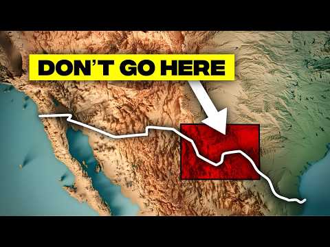
The US-Mexico border, often perceived through the lens of politics and policy, is a geographical marvel. Far from a static line on a map, this frontier is a dynamic tapestry woven from shifting sands, ancient volcanic fields, and rivers that constantly redraw their own paths. It is a place where deserts collide, mountains rise abruptly from plains, and ecosystems ignore human-drawn boundaries. This landscape, relentlessly shaped by titanic geological forces and the subtle whims of weather, offers a profound reminder that the Earth's processes are far more powerful than any treaty or fence. Prepare to discover 50 wild facts that reveal the true, untamed nature of this extraordinary region.
Shifting Sands and Fiery Earth
North America's sole sand sea dominates the border.
The Grand Desierto de Altar, spanning hundreds of square miles along the US-Mexico border, stands as North America's only active sand sea, or URG. Unlike most deserts, which are rocky basins, this environment is rare globally. Its wind-driven dunes constantly shift and reshape, acting like frozen waves in slow motion.
Border dunes tower higher than 60-story buildings.
Within the Grand Desierto de Altar, some dunes reach an astonishing 650 feet, roughly 200 meters. This height rivals that of a 60-story building. These colossal formations are sculpted over millennia by relentless winds, yet their peaks are not permanent. Windstorms can literally move the highest point, remaking the dune structure in a matter of seasons.
Colorado River sediments formed colossal border dunes.
A significant portion of the Grand Desierto's sand originated from the Colorado River. Over vast periods, river sediment traveled to the delta, dried out, and was then swept inland by the wind. These airborne particles eventually accumulated, forming the massive dunes. You are literally looking at ancient riverbed particles that migrated from water to sky.
Volcanic rock and desert dunes dramatically collide.
The Pinacate Reserve in northwestern Mexico presents a stark geological collision: black volcanic rock meets golden desert dunes. Nowhere else on the continent do such extensive lava fields and a massive URG directly abut each other. This creates a surreal, Mars-like terrain where active geology confronts active erosion.
Massive craters are steam explosions, not meteor impacts.
The Pinacate region features numerous large, circular craters that appear to be meteor impacts from above. However, these are steam explosion craters called maars. They formed when underground magma encountered groundwater, causing rapid expansion and violent explosions that ripped out perfectly round holes in the Earth's surface.
The border straddles an active, spreading continental rift.
The Salton Trough, extending from Southern California into Northern Mexico, is an active continental rift zone. The land here is slowly pulling apart, with GPS data showing several millimeters of stretching annually. This tectonic activity is an early stage of an ocean basin forming, connecting to the San Andreas fault system.
A 7.2 earthquake tore the borderlands in 2010.
On April 4, 2010, the El Mayor-Cucapah earthquake, a magnitude 7.2 event, struck just south of the California-Mexico border. It triggered multiple fault segments, tearing across desert terrain and lifting the ground by several feet in some areas. This event exposed hidden fault lines and underscored the region's intense seismic activity.
Major earthquake exposed unmapped, hidden fault lines.
The 2010 El Mayor-Cucapah earthquake significantly altered geological understanding of the region. Instead of a single fault, a complex series of faults slipped, many of which were previously unmapped. This revealed a more fractured and dangerous tectonic zone than anticipated, showing how incomplete our understanding of the border's subsurface truly is.
The Grand Desierto is the only place in the continent where the sand actually acts like a living thing.
Rivers That Divide, Rivers That Connect
River forms the international border through a deep canyon.
Santa Elena Canyon in Texas is an iconic border marker, 8 miles long and 1,500 feet deep. The Rio Grande flows through it, acting as the international boundary. One sheer limestone wall is in the US, the other in Mexico. In its narrowest sections, the two countries are just 30 feet apart, a dramatic geographical divide.
Canyon walls formed from ancient Cretaceous ocean floor.
Santa Elena Canyon's colossal limestone walls are ancient marine deposits, formed in a shallow ocean during the Cretaceous period. Over millions of years, the Rio Grande carved its path through this former seabed. Today, you are surrounded by vertical cliffs made from ocean floor now 1,500 feet above sea level, a fossil record in rock.
River's shifts create isolated international land parcels.
The meandering Rio Grande often creates "bancos," land chunks isolated on the "wrong" side of the river's shifting path. By 1970, 241 such cases were resolved, transferring over 30,000 acres between the US and Mexico. This proves that a stable border on a map is a slow-motion sovereignty shuffle in reality.
Treaties govern border shifts from river's behavior.
The 1970 boundary treaty dictates how the border behaves when the Rio Grande shifts. If the river moves gradually (accretion), the border shifts with it. However, if it jumps suddenly, like in a flood (avulsion), the line stays put. This legal distinction prevents overnight boundary changes, with engineers monitoring the river's course.
US wetland relies on 75% Mexican water.
The Tijuana River Estuary in California, despite being on the US side, receives 75% of its water from Mexico. Stormwater, sediment, and runoff from Tijuana directly impact the wetlands' habitat, flood levels, and pollution. This is a clear case of cross-border hydrology, where American conservation efforts depend heavily on upstream conditions in another country.
Border's limbo accidentally preserved a rare wetland.
Most Southern California wetlands have been developed, but the Tijuana River Estuary endures largely because it exists in a political limbo zone between two expanding cities. Border restrictions and a lack of development accidentally preserved this rare coastal wetland. Nature received a lucky break where politics prevented concrete from replacing cattails.
Ecological Edges and Hard Limits
"Sky Islands" create vertical biodiversity zones.
In the Sonoran Desert, steep mountain ranges, known as "sky islands," rise thousands of feet above flat basins. Within miles, one can transition from cactus plains to pine forests, showcasing dramatic vertical biodiversity. Some peaks reach 8,000 feet, fostering isolated ecosystems where species evolve differently from the desert below.
Biosphere reserve directly straddles the international border.
Organ Pipe Cactus National Monument, a UNESCO biosphere reserve, preserves an undisturbed portion of the Sonoran Desert. This park borders Mexico, featuring ecological systems that disregard the fence. It is one of the few border zones where natural continuity was preserved, allowing it to remain wild enough for global ecological recognition.
Organpipe cacti range ends abruptly at the border.
Organpipe cacti thrive in Mexico but barely extend into the US, with Organ Pipe Cactus National Monument protecting their northernmost range. Just a few miles north of the border, they disappear entirely. This is a hard line dictated by climate, as the desert north of the monument is simply too cool and dry to support them.
Border barriers threaten rapid Sonoran pronghorn.
The Sonoran pronghorn, a fast antelope, requires vast open spaces for migration and survival. However, border development, fencing, and roads fragment its habitat. A 2002 drought nearly wiped out the US population, as they could not access food or water across the border. This illustrates how artificial boundaries can break natural systems.
Survival depends on rain-filled rock water holes.
Along the Devil's Highway, El Camino del Diablo, are the Tinajas Altas, nine natural rock basins that collect rainwater. These critical pools, holding thousands of gallons, are the only water source in this arid stretch. Early travelers staked their lives on these hidden pools, their survival hinging on recent rainfall.
The border extends 200 nautical miles offshore.
The US-Mexico border does not end at the coastline. Treaties extend it 200 nautical miles into both the Gulf of Mexico and the Pacific Ocean. These invisible underwater frontiers divide fishing zones, oil fields, and even coral reefs. Billions in natural resources lie beneath these maritime zones, far from any land-based fence.
Engineering Nature's Frontier
Shifting dunes require a movable border fence.
In the Yuma Dunes, the border fence is designed to be lifted and relocated as needed. This section sits on a highly unstable, active dune field where wind constantly reshapes the terrain. Building a permanent fence here is futile, as nature would quickly bury or undermine it. Policy here yields to physics and shifting sand.

Engineers straighten rivers to fix the border.
To maintain a stable border, engineers from both nations have intervened to straighten river channels, pour concrete banks, and reroute water courses. The Rio Grande, prone to wandering, is thus forced to adhere to geopolitical lines. This is not nature's design, but a flowchart with bulldozers, ensuring water flows where treaties dictate.
Canyon's narrowest point squeezes two nations.
Santa Elena Canyon's narrowest point is a mere 30 feet wide. Two towering rock walls, one Mexican and one American, face each other across the Rio Grande. This creates an intimately confined international boundary. It is less a canyon and more a geopolitical crevice, where geography reaches maximum compression.
Flat desert lands reveal ancient geological basins.
What appear to be flat desert lands along the Rio Grande are actually exposed fills of ancient geological basins. These were once deep sediment traps, slowly filled over millions of years. The river is now cutting through these layers, exposing hidden rock formations and old faults, revealing a history lesson in reverse.
River shortcut created international land dispute for decades.
In the early 1900s, an irrigation company's shortcut in the Rio Grande inadvertently shifted the international border, stranding the "Orozco Tract" of Texas on Mexico's side. Residents believed they were in the US for decades until a 1970 treaty formally transferred the land to Mexico. Geography simply rerouted, without permission.
Slow river shifts move border, fast jumps do not.
The border treaty distinguishes between gradual river shifts (accretion) and sudden jumps (avulsion). If the Rio Grande slowly changes course, the border moves with it. However, if it suddenly finds a new channel, the old border remains. This legal distinction, known as accretion versus avulsion, turns fluid dynamics into constitutional law.
Saguaro cacti mysteriously disappear west of Ajo Mountains.
In Cabeza Prieta National Wildlife Refuge, despite ideal climate and soil, saguaro cacti are almost absent west of the Ajo Mountains. Botanists are unsure why, suggesting ancient dispersal limitations or subtle climate shifts prevented colonization. This is a botanical cliff edge where the ecosystem invites a species, but the species simply says no.
Joint commission manages river's border chaos.
The International Boundary and Water Commission (IBWC) was established because rivers like the Rio Grande make difficult neighbors. They meander, flood, and cut off land. The IBWC manages this chaos full time, acting as a joint task force against gravity and erosion. Without them, the US-Mexico border would have been unrecognizable decades ago.
Engineers on both sides now monitor and manage the river's course like referees in a never-ending game.
Volcanic Vistas and Tectonic Clocks
Border boasts North America's best preserved volcano.
Cerro Colorado, near Sonoita, Mexico, is one of North America's best preserved cinder cone volcanoes. It erupted approximately 30,000 years ago, spewing fire and ash so uniformly that its near perfect symmetry baffles scientists. Its rust-red crater and black basalt ring look remarkably fresh, as if the eruption happened recently.

Borderlands operate on three distinct geological clocks.
The borderlands exist where three geological clocks tick simultaneously: constantly shifting sand dunes, the Rio Grande's decades-long course adjustments, and fault lines that can rearrange the land in seconds. This means today's terrain is never guaranteed for tomorrow. Standing here means standing on three geological timescales at once.
Two major deserts meet and uniquely overlap.
At the US-Mexico border, the Sonoran and Chihuahuan Deserts meet, creating a unique ecological mashup. This is one of Earth's rare places where two major deserts overlap, allowing species like saguaro, ocotillo, and yucca to coexist. Elevation, rain patterns, and geology briefly blur the lines, creating a distinct zone.
The 2010 quake ignored international boundaries.
The 2010 El Mayor-Cucapah earthquake disregarded political lines, hitting both Mexico and California with equal force. The Earth's crust here acts like a stretched drum head, transmitting energy rapidly. Cities like Calexico and Mexicali felt the quake simultaneously. Tectonic faults have no loyalty to political boundaries, proving the earth moves as one.
Desert canyon was once a deep ocean seabed.
Standing in Santa Elena Canyon means standing on a former seabed. Its towering limestone walls are ancient marine deposits from a warm, shallow ocean 100 million years ago. Marine fossils embedded high on the canyon walls serve as proof. It is a mind-bending contrast: bone dry land made entirely of underwater history.
Dunes require constant sediment to remain active.
The Grand Desierto de Altar's active dunes rely on a constant supply of fresh sediment, primarily from the Colorado River. If this supply is cut off, for instance by damming, the system begins to starve. The dunes will not merely freeze, they will erode themselves to maintain their active state, illustrating their dynamic nature.
Unseen Boundaries and Sudden Transformations
Porcupine range abruptly ends at the border.
The North American porcupine's range inexplicably ends along the southern border. Not due to fences, but climate. South Texas and northern Mexico are simply too hot and dry for them. This creates a clear geographic threshold where a species disappears. The US-Mexico border is full of these unspoken ecological cutoffs.
Rare transboundary river flows north into US.
The San Pedro River is one of the American Southwest's few major rivers that flows northward, originating in Mexico and entering the United States. This directional oddity makes it a rare cross-border river where water enters the US from the south. It supports a biologically diverse corridor, carrying the Mexican monsoon into US deserts.
Region boasts North America's darkest night skies.
Areas like Big Bend and Organ Pipe along the US-Mexico border offer some of North America's darkest night skies. A profound lack of light pollution allows the Milky Way to be seen in full detail, and stars can even cast shadows. It is one of the last places to truly grasp the immense scale of the universe.
Deserts bloom overnight after specific rainfalls.
Border deserts, often appearing barren, can explode with color after the right rainstorm. Billions of dormant seeds underground awaken, transforming brown dust into vibrant flower fields of purple, orange, and yellow. This rapid transformation, a biological miracle on a clock, turns a wasteland into a garden almost overnight.
Modern border routes follow ancient indigenous trade paths.
Long before the current border, the region was crisscrossed by ancient indigenous trade routes connecting the Pacific to the Gulf. Goods like turquoise, cocoa, and seashells moved along these corridors. Today, many of the busiest border crossings follow these exact same paths, proving that modern infrastructure often paves over pre-existing geographical logic.
Unfencable terrain defies border wall construction.
Parts of the border are simply too wild to fence. Shifting floodplains, steep canyons, and unstable sandy soils prevent permanent construction. Engineers have attempted and failed to secure these stretches, only to be outsmarted by the land itself. In these rugged zones, nature dictates the rules, leaving the border unfenced by force.
River's shift caused a century-long dispute.
The Rio Grande's shift in the 1860s near El Paso led to the Chamizal dispute, a nearly century-long legal limbo. The river refused to return to its original channel, causing an international disagreement until the 1960s. The resolution involved engineers digging new channels, physically redrawing the land with machinery to settle the border.
Border deserts heat faster than global averages.
Border deserts exhibit "desert amplification," heating faster than almost any other continental region. Dry terrain magnifies heat, lacking moisture to absorb and regulate temperature. Cities like Mexicali can exceed 126 degrees Fahrenheit, acting as literal ovens. This region is a critical warning system for future extreme heat trends.
Volcanic field erupted within human memory.
Parts of the Pinacate volcanic field erupted as recently as 13,000 years ago, within the window of human history. Early peoples may have witnessed fire erupting, carving craters and spilling lava. Over 400 distinct volcanic features remain, including fresh lava flows, demonstrating Earth's ongoing geological activity in the area.
Water's Whims and Earth's Fury
Botched engineering created California's largest lake.
In 1905, a failed levee during a flood diverted the entire Colorado River into the Salton Sink, a low-lying basin. For nearly two years, the river poured into the depression, creating the Salton Sea. Engineers struggled to redirect the flow, resulting in hundreds of square miles underwater, an accidental man-made lake.
Rainfall flips dramatically over short mountain distances.
In mountains straddling the border, rainfall can vary by over 10 inches within a few miles due to orographic lift. Moisture-rich air dumps rain on one side, leaving the other dry. This creates hyper-local microclimates, with one side having pine forests and 18 inches of rain, while the other bakes in dry scrub with half that amount.
Dry lake transforms into a perfect mirror.
Laguna Salada, typically cracked earth, transforms into a 30-mile-wide mirror after rain. Its extreme flatness perfectly reflects the sky, causing disorientation for pilots and off-roaders. This temporary illusion, where sky and ground blend seamlessly, quickly vanishes as the water evaporates, reverting to bone-dry desert.
Mountains are broken, tilted fragments of earth's crust.
The mountains flanking the border are not uplifted ranges, but "basin and range" formations. The Earth's crust was pulled so violently it cracked, with some blocks dropping to form valleys and others tilting into jagged peaks. These are torn fragments of continental crust, displaced by tectonic tension, creating alternating stripes of basin and mountain.
River floodplains can reset in one season.
Along the lower Rio Grande, a single flood can obliterate decades of geography. Extreme events, like Hurricane Alex in 2010, can swell the river to 50 times its normal width, bulldozing farmland and redrawing its channel. Satellite images afterward reveal an entirely new landscape, proving floodplains are temporary sketches.
Border cities share one geological basin.
El Paso and Ciudad Juárez, two cities, sit within the same geological pocket, the Paso del Norte basin. They share weather, water, and air, drawing from the Hueco Bolson aquifer. Dust storms and pollution cross the border instantly. Geographically, they are united by terrain, even if politically divided by an invisible line.
Ancient stone markers define the border still.
Scattered across deserts and mountains are stone obelisks, dating back to the 1850s, that still define the international boundary. These remote markers have withstood floods, earthquakes, and over 150 years of sun without moving. They stand as silent witnesses to every border dispute, marking not just territory, but endurance and history.
The US-Mexico border, in its raw geographical reality, serves as a powerful testament to the Earth's constant, indifferent motion. From rivers that defy treaties to deserts that amplify global warming, the land itself crafts narratives far stranger and more compelling than any classroom map could convey. It reminds us that geography is not merely a backdrop for human drama, but an active, often unpredictable, plot twist in the ongoing story of our planet. The world, as always, proves itself to be wilder and more complex than we were ever taught.


