Washington State, often stereotyped by its perpetual drizzle and coffee culture, secretly harbors a landscape of jaw-dropping extremes and geological plot twists. Beyond the emerald forests and mist-shrouded peaks lies a dynamic canvas where volcanoes breathe fire under ice, ancient floods carved canyons deeper than the Grand Canyon, and entire coastlines refuse to stay put. This is a place where nature's rules bend and break, revealing a world stranger and more profound than any postcard implies. Prepare to unravel the hidden layers of a state that truly redefines wild geography.
The Earth's Fiery Breath
Seattle floats over a secret, ancient volcano.
Beneath Puget Sound's busy ferry routes lies Bainbridge Ridge, an extinct volcano buried under mud and silt. It last erupted millions of years ago, but scientists only discovered it in the 1990s using seismic imaging. Thousands of commuters unknowingly travel over this prehistoric inferno daily.
Spirit Lake holds a floating forest graveyard.
Mount St. Helens' 1980 eruption hurled entire forests into nearby Spirit Lake, where thousands of tree trunks still drift like a wooden continent. Beneath the surface, a sunken forest releases shimmering methane bubbles. Scientists found microscopic life here, a natural laboratory for rebirth after destruction.
Glacier Peak: Washington's barely monitored sleeper volcano.
Tucked deep in the North Cascades, Glacier Peak is one of America's most explosive volcanoes, yet it is barely monitored due to its remote location. Its eruptions have buried valleys in ash and spread fallout as far as Montana. Scientists call it a sleeper volcano, a quiet giant overdue for attention.
An unseen undersea volcano chain stretches for hundreds of miles.
Lurking offshore is the Cobb-Eickelberg Seamount Chain, a series of extinct undersea volcanoes stretching 700 miles along the ocean floor. These ancient giants rise thousands of feet from the seabed, invisible from the surface, yet teeming with bizarre life that thrives in total darkness.
Mount St. Helens rebuilt itself with a new mountain.
After its catastrophic 1980 eruption, Mount St. Helens returned to activity between 2004 and 2008. Instead of exploding, it quietly oozed thick, toothpaste-like lava into its crater, building a whole new mountain inside the old one. This process pumped out enough lava to fill an entire football stadium.
Washington's iconic mountain named after the wrong person.
Native tribes called the volcano towering over Seattle Tacoma or Tahoma, meaning 'the mountain that is God'. However, in 1792, a British explorer renamed it Mount Rainier after a Royal Navy admiral who fought against the United States in the Revolutionary War. There is a growing movement to restore its original name.
Mount Baker holds the world record for snowfall.
Outside the poles, Mount Baker holds the world record for snowfall, with an astounding 1,140 inches (95 feet) recorded in a single winter (1998-1999). This active volcano regularly receives over 50 feet of snow annually, burying homes and ski lifts, creating an Arctic landscape in the Pacific Northwest.
A 10,500 foot volcano went unnoticed until 1898.
Glacier Peak, a 10,500 foot volcano taller than Mount St. Helens, remained unrecognized as a volcano until 1898. Buried deep in the Cascades, its remote location and snow cover made it a literal sleeping monster. In the past 15,000 years, it has erupted more violently than any other Cascade volcano.
Mount St. Helens' eruption began with a record landslide.
The 1980 eruption of Mount St. Helens did not start with an explosion. An earthquake triggered the largest landslide ever recorded, as six cubic miles of the mountain's north face collapsed at over 150 miles per hour. This cataclysmic event leveled 23 square miles in seconds before the infamous lateral blast occurred.
Mount Rainier hides a secret ice world powered by fire.
Beneath Mount Rainier's icy summit lies the largest volcanic ice cave system on Earth, a two mile labyrinth carved by volcanic steam vents. Inside, boiling steam and subglacial lakes create a lava-warmed environment within a glacier. Scientists have discovered microbial life here, potentially resembling life on Mars.
America's most beautiful death trap is Mount Rainier.
Mount Rainier is the most dangerous volcano in the United States, not primarily due to lava, but because of lahars, volcanic mud tsunamis. These flows, triggered by hot magma melting glaciers, move faster than cars with the force of liquid concrete. Over 150,000 people live on ancient lahar paths, potentially vulnerable to a future eruption.
A rhino was fossilized by lava, creating a hollow mold.
At Blue Lake, scientists discovered a perfect rhino-shaped cave carved into solid volcanic rock. 15 million years ago, a rhino died in a swamp, and lava then encased it. As the lava cooled, the body vaporized, leaving behind a hollow mold with imprints of skin and bone, a lava-sculpted ghost of a rhinoceros.
Washington is a masterclass in geographical paradox, a land where the earth itself seems to delight in defying expectations.
Water's Relentless Sculptures
Washington's Grand Canyon was carved in minutes, not millennia.
Approximately 15,000 years ago, an ice dam in Montana repeatedly shattered, unleashing walls of water 400 feet high that tore through the Northwest at 60 miles per hour. These cataclysmic floods carved a canyon over 4,000 feet deep in days, not millions of years, leaving behind a fossilized war zone of ancient water.
The Columbia River: America's most engineered river, with one wild stretch.
The Columbia River is one of Earth's most dammed rivers, engineered into submission across much of its length. However, the Hanford Reach, a 51 mile section, remained wild because it was inside a Cold War nuclear zone. This accident of history preserved it, making it the last untamed section where salmon still return to spawn.
A gorge deeper than the Grand Canyon lies in Washington.
Hells Canyon, which forms part of the border with Idaho and Oregon, plunges 7,993 feet from its highest rim to the Snake River below. This makes it nearly 2,000 feet deeper than the Grand Canyon. The canyon is so rugged and remote that there are no roads across it for over 200 miles.
Eastern Washington's landscape was shaped by Martian-scale floods.
Parts of Eastern Washington, known as the Channeled Scablands, bear scars from the most violent floods in Earth's history. Walls of water 400 feet high ripped through at 60 miles per hour, carving canyons, potholes, and gravel ripples the size of houses in mere days. NASA even studied these formations to understand water's role on Mars.
Ice Age floods were ten times larger than all Earth's rivers combined.
During the last ice age, Eastern Washington was ground zero for the Missoula Floods, caused by a giant glacial lake repeatedly breaking its ice dam. The flow of these cataclysmic floods was approximately ten times the combined flow of every single river on Earth today, reshaping the land in days with 900 foot deep water.
A temporary mega waterfall dwarfed Niagara during the Ice Age.
During the apocalyptic Missoula floods, Washington hosted Dry Falls, a temporary mega waterfall 3.5 miles wide and over 400 feet high. For a brief, violent period, it was one of the largest waterfalls the world has ever seen. Today, the floodwaters are gone, leaving a peaceful valley where an unimaginable torrent once thundered.
Shifting Shores and Elusive Waters
Long Beach Peninsula is literally crawling north every year.
Long Beach Peninsula, an enormous sand spit stretching over 25 miles, actively crawls northward by about 100 feet every year. The Columbia River's powerful currents feed it with fresh sediment, forcing the shoreline to expand and reshape itself constantly. Entire lighthouses have been moved inland to escape being swallowed by new dunes.

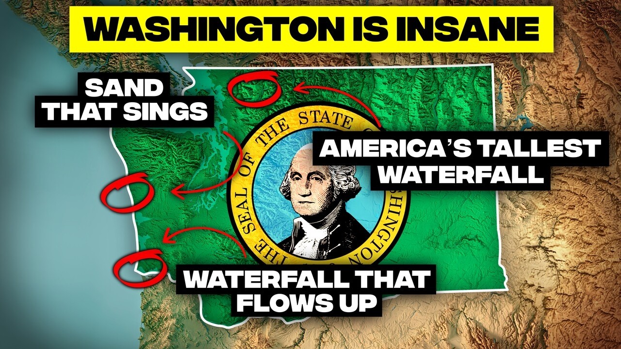
Cape Disappointment features waterfalls that flow upwards.
At Cape Disappointment, strong Pacific storms can generate 100 mph gusts that grab waterfalls mid-air and blast them straight back up the cliff. The torrent transforms into a ghostly mist that rises instead of falling, an illusion locals call "ghost falls." It appears as if water defies gravity, overpowered by the wind.
Washington has one of Earth's rare singing beaches.
At places like Moclips, every step across the sand produces a deep, cello-like hum that vibrates through your feet. This phenomenon occurs because the sand grains are perfectly smooth, round, and clean, creating rare conditions that make them sound like tiny instruments. Only about 30 beaches on Earth can do this, and Washington has one.
Mount Rainier's Emmons Glacier moves faster than a walk.
Glaciers are typically slow, but on Mount Rainier, the Emmons Glacier sometimes surges forward faster than a human can walk. When water gets trapped under the ice, it acts like grease, turning the entire glacier into a sliding mass. In a single hour, it can creep forward several feet, an avalanche moving in slow motion.
The ocean glows electric blue in the San Juan Islands.
On summer nights in the San Juan Islands, the ocean lights up like a galaxy. When disturbed, billions of microscopic plankton called dinoflagellates flash an electric blue-green glow. Every paddle stroke or fish darting by leaves a trail of light. It's one of the few places in America where you can literally paddle through a sea of stars.
Mount Rainier's lakes bleed a vibrant, milky turquoise.
High up on Mount Rainier, lakes like Tipsoo and Reflection glow with an unnaturally vibrant turquoise color. This is caused by "rock flour," a fine microscopic powder created as massive glaciers grind rock. When sunlight hits these tiny particles suspended in meltwater, it scatters blue and green light, giving the water its brilliant milky hue.
Whidbey Island is still rising from the sea after the Ice Age.
During the last ice age, the crushing weight of a mile-thick glacier pushed Whidbey Island down. Now that the ice is gone, the land is bouncing back, a process called isostatic rebound. Every year, Whidbey creeps about two millimeters higher, enough over centuries to tilt forests, drain wetlands, and birth new beaches.
A river disappears into ancient lava tunnels in Washington.
Near Mount Rainier, the Little Naches River performs a vanishing act, disappearing underground into tunnels carved by ancient lava. Thousands of years ago, molten rock created hollow tubes within basalt flows. Today, these tunnels act like plumbing, swallowing the river into a roaring underground channel before it bursts back out downstream. You can literally hear the river thundering under your feet.
The mouth of the Columbia River is a ship graveyard.
Off the coast of Washington, the mouth of the Columbia River is nicknamed the "Graveyard of the Pacific," a violent collision point between river and ocean. Over 2,000 ships have been smashed here since 1792, swallowed by 40-foot waves, shifting sandbars, and rip currents. The US Coast Guard trains its elite surf rescue teams in these deadly waters.
Washington's coastline is deceptively long due to glacial carving.
Thanks to the mind-bending maze of islands, inlets, and glacial-carved bays of Puget Sound, Washington boasts over 3,000 miles of coastline. This is more than California's coastline. If straightened out, it would stretch from Seattle to New York, a seascape intricately shredded by glaciers during the Ice Age.
Washington is the glacier capital of the lower 48 states.
Excluding Alaska, Washington has over 3,000 glaciers, more than every other state in the lower 48 combined. From Mount Rainier's icy flanks to the jagged North Cascades, Washington is like a chunk of the Arctic accidentally dropped into the Pacific Northwest, constantly carving valleys and feeding rivers.
America's tallest waterfall remains largely unknown.
Deep in the North Cascades, Colonial Creek Falls drops a jaw-dropping 2,568 feet, over 140 feet taller than Yosemite Falls. It remains largely unknown because it is not one giant plunge, but 13 cascading steps down a wild, unreachable cliffside. There is no gift shop or scenic platform, just a record-breaking waterfall in unspoiled wilderness.
The world, as geography teaches us, is far more alive and unpredictable than any map can capture, and Washington stands as a vibrant testament to this thrilling truth.
Climate's Extremes and Ecological Wonders
A tree of life survives suspended over thin air.
In the heart of the Hoh Rainforest stands the "Tree of Life," a giant Sitka spruce suspended over a gaping void. Its roots stretch across open air, clinging to bits of soil on either side while a hollow cave gapes beneath it. The earth that once supported it has completely eroded away, yet it somehow still lives, green and thriving. Biologists can't fully explain this living bridge between life and gravity.
Eastern Washington is a desert that defies its location.
Just 150 miles east of Seattle, the rainforest vanishes into desert. Eastern Washington sits in a rain shadow created by the Cascade Mountains, which dump all their moisture on the west side. By the time air crosses over, it is bone dry. Towns near Hanford Reach get barely six inches of rain a year, comparable to Las Vegas.
The Hoh Rainforest creates its own rain from fog.
Even on non-rainy days, the Hoh Rainforest harvests water straight from the air using a bizarre trick called "fog drip." Pacific Ocean fog rolls in, condenses on mossy branches and ancient fir needles, and drips onto the forest floor like a hidden faucet. This self-watering ecosystem ensures the Hoh stays soaking wet, like a forest breathing moisture.
Washington is home to the world's largest burrowing clam.
Beneath Puget Sound's tidal flats lives the geoduck, the world's largest burrowing clam. With a shell the size of a softball, its massive siphon or "neck" can stretch over three feet long. These prehistoric-looking creatures can live for more than 150 years, buried deep in the sand, and have become both a local icon and an expensive delicacy.
Washington experiences extreme temperature swings, from Sahara to Siberia.
Washington's weather is far from mild. In June 2021, a heat dome scorched the state to 120 degrees Fahrenheit, hotter than Las Vegas has ever been. Yet, the same state has also recorded a mind-numbing -48 degrees Fahrenheit. This 168-degree temperature swing proves Washington is America's hidden meteorological wild card.
The "rainy state" forgets to rain during summer.
Despite its reputation, Western Washington can go two months straight with zero rainfall during summer, turning lush forests into wildfire fuel. Statewide, Washington does not even crack the top 25 wettest states. It is a land of extremes: monsoon-level drizzles in winter, followed by dangerous drought in July, defying the popular "evergreen" stereotype.
Olympic National Park hosts three ecosystems with no logic.
Olympic National Park is a geographical anomaly, combining towering glacier-wrapped mountains, a dripping rainforest thick with moss and prehistoric ferns, and a wave-battered coastline with sea stacks. You can visit all three diverse ecosystems in a single day without leaving park boundaries, a unique flex of natural diversity in the continental United States.
Drive from jungle to desert in just three hours.
Washington boasts a rainforest receiving 12 feet of rain annually. Yet, drive just three hours east, and you are in a cracked, dusty desert receiving less than seven inches. This dramatic shift is due to the rain shadow effect created by the Cascade Mountains. One side is a jungle; the other, a sunbaked desert, like driving from Jurassic Park into Breaking Bad.
The Hoh Rainforest is the Amazon of the American Northwest.
The wettest place in the lower 48 states is Washington's Hoh Rainforest, where it rains up to 14 feet a year. This is not mere drizzle, but rainforest rain that soaks everything. Trees wear moss like fur coats, ferns grow to the size of furniture, and the ground squishes with every step, creating a lush, green fever dream.
The Quinault Rainforest hides a thousand-year-old king.
Tucked away in the Quinault Rainforest stands the world's largest Sitka spruce, an ancient behemoth over 1,000 years old. It towers 191 feet high, and its trunk is so wide it would take a dozen people holding hands to circle it. This living monument harks back to a time when forests of giants covered the Pacific Northwest.
Echoes of Ancient Earth
Seattle is perched atop a buried, ancient canyon.
During the last ice age, a glacier nearly a mile thick buried the region, and as it melted, torrents of water carved a massive trench 600 feet deep through what is now downtown Seattle. Over millennia, this canyon filled with mud and gravel, and a city eventually rose above it. Engineers still trace its outline using seismic data.
Washington's desert hides a tropical forest trapped in stone.
In the middle of Washington's dry, high desert lies Ginkgo Petrified Forest State Park, home to one of Earth's richest petrified wood collections. 15 million years ago, this was a subtropical swamp. Lava buried it alive, and the trees fossilized into stone, preserving bark, rings, and even cellular structure. Today, it is a kaleidoscope of prehistoric trees flash-frozen in volcanic rock.
A cataclysmic flood built Eastern Washington's farming paradise.
Eastern Washington's Palouse region, with its rolling green hills, was born from violence. Ice Age floods blasted the region to bedrock. Then, for thousands of years, wind layered it with glacial dust, called loess, hundreds of feet deep. This created some of the richest farmland on Earth, a paradox of chaos creating agricultural perfection.
Southern Washington hides nature's most bizarre unsolved puzzle.
In southern Washington, the ground is covered in thousands of perfectly shaped dirt mounds, up to seven feet tall, known as Mima mounds. Scientists have proposed over 30 theories for their origin (earthquakes, melting permafrost, giant gophers), but still cannot agree. They appear like alien code from above, a top-tier American mystery hiding in plain sight.
Fault Lines and Fateful Histories
A magnitude 9 megaquake is overdue off Washington's coast.
Seventy miles off Washington's coast lies the Cascadia Subduction Zone, a 700-mile fault locked tight and storing centuries of tension. The last time it ruptured, on January 26, 1700, the shaking sent a tsunami all the way to Japan. Scientists say these events strike every 300 to 600 years, meaning Washington is currently in the danger window.
A ghost forest marks the site of a devastating ancient earthquake.
In 1700, a magnitude 9 earthquake ripped through the Pacific Northwest, dropping the coastline by several feet in seconds. Saltwater rushed in, drowning an entire forest. Today, those dead cedar trees still stand, ghostly and gray, in a swamp where they once thrived. This ghost forest is a physical time capsule of the last Cascadia megaquake, whispering a warning of future events.
Cartographic Curiosities and Global Connections
Washington is America's second largest wine producer.
While California dominates the narrative, Washington is secretly the second biggest wine state in the U.S., with over 1,000 wineries. Eastern Washington's dry, sun-blasted valleys, volcanic soil, hot days, and cold nights create a perfect recipe for grapes that win international competitions, often beating California's elite. Most people have no clue about this thriving industry.
Seattle is surprisingly farther north than half of Canada.
Get ready to unlearn geography: half of Canada's major cities, including Toronto, Montreal, and Ottawa, lie south of Seattle's latitude. Seattle sits at 47.6 degrees north, the same latitude as Paris. This means insanely long summer days, with sunlight stretching past 9:30 p.m. around the solstice, a fact that often surprises newcomers.
Point Roberts: A US town unreachable without leaving the country.
Point Roberts is a slice of America completely cut off from the rest of the U.S. by the Canadian border. To reach it, you must drive 25 miles through Canada, crossing the border twice. This geographical oddity exists because an 1846 British treaty line overlooked a peninsula hanging below it, creating a unique legal limbo for its 1,200 residents.
Washington grows over 60% of all apples in the United States.
Washington doesn't just grow apples, it floods the country with them, producing over 60 percent of all apples in the U.S. This amounts to 10 to 12 billion apples annually, enough for every American to hold 35. The combination of scorching sun, icy mountain water, and volcanic soil transforms Washington's central valleys into fruit-growing superzones.
Washington is a masterclass in geographical paradox, a land where the earth itself seems to delight in defying expectations. From the colossal forces that shaped its past to the subtle, ongoing shifts of its present, this state offers a potent reminder that our planet is an ever-evolving, often bewildering, marvel. The world, as geography teaches us, is far more alive and unpredictable than any map can capture, and Washington stands as a vibrant testament to this thrilling truth.


