South Dakota, often reduced to the iconic presidential visages of Mount Rushmore, harbors a geographical narrative far more complex and captivating than its postcard fame suggests. This is a land where ancient ice ages clash with scorching prairie fires, where subterranean labyrinths hide crystalline wonders and dark matter laboratories, and where the very earth breathes, erodes at dizzying speeds, or is carved into monuments of human and natural ambition. From the fastest temperature change ever recorded to a continental pole of inaccessibility, the Mount Rushmore State offers a relentless series of plot twists, revealing a landscape shaped by forces both titanic and subtle, where reality frequently outpaces imagination.
Ancient Foundations: The Deep Time of South Dakota
The Black Hills, rising abruptly from the plains, are not merely mountains but a geological anomaly, an island of ancient rock in a sea of younger sediments. These are among North America's oldest exposed rocks, dating back **over two billion years**. To the Lakota, they are *paha sappa*, the hills that are black, a sacred place considered the center of the world, shrouded in thick *ponderosa* pine that gives them their dark appearance from a distance. The core of these hills is a massive formation known as the Harney Peak Granite Batholith, a 1.8 billion year old slab of pink granite, the size of a small state, that formed miles underground as molten rock. Over eons, erosion stripped away overlying layers, exposing this crystalline foundation as the rugged peaks we see today, including Black Elk Peak, South Dakota's highest point at 7,242 feet. This granite, infused with feldspar minerals, gives the central Black Hills a distinctive rosy hue. The entire Black Hills uplift is a geological dome, thrust upward by a tectonic collision 60 million years ago, a pulse of energy from the Laramide Orogeny that also created the Rocky Mountains. This uplift exposes rocks from seven different geological eras in concentric rings, allowing observers in a single valley to witness **more than two billion years of Earth's history** laid bare.
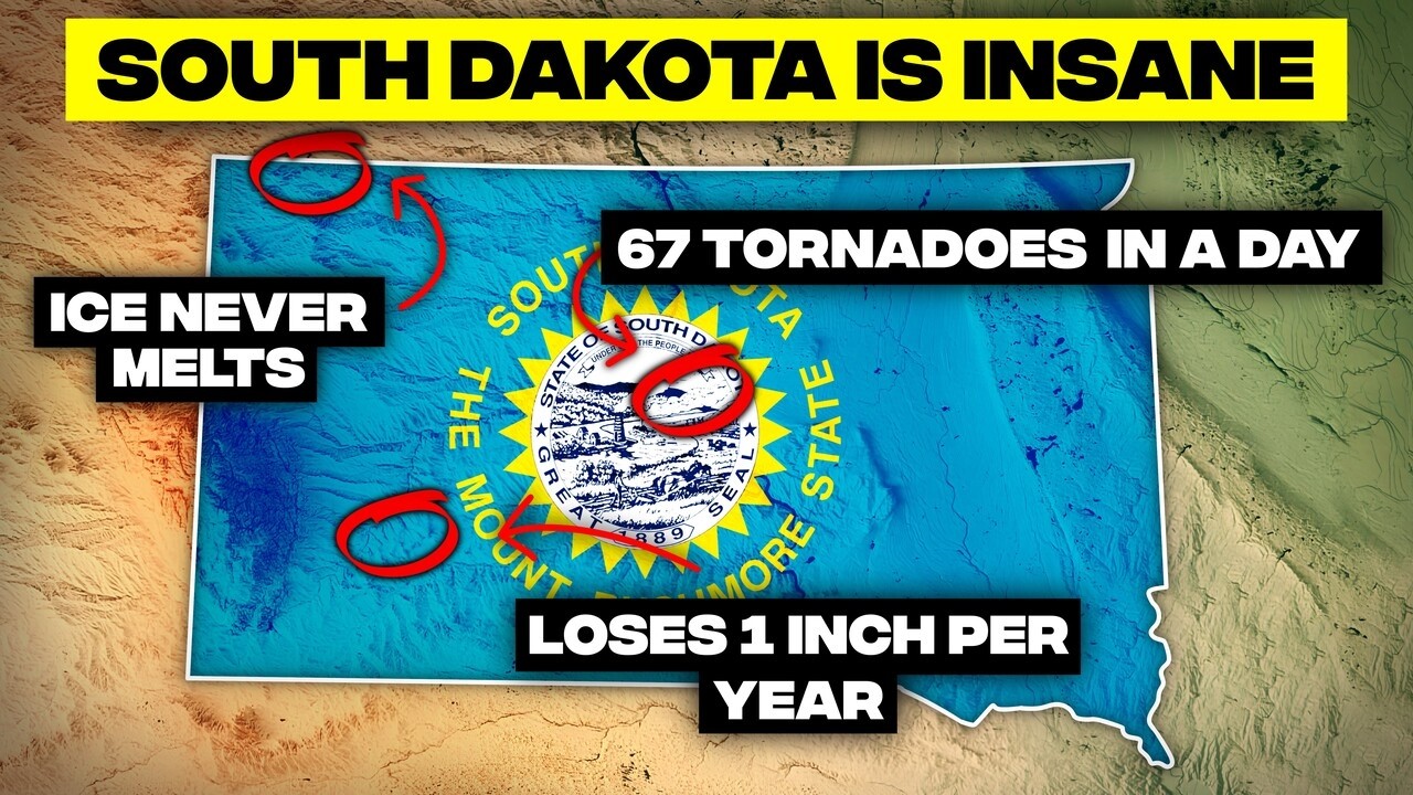
Further east, near Sioux Falls, the ground can glow pink due to the Sioux Quartzite, among the oldest rock in North America at **over 1.6 billion years old**. This transformed sandstone, harder than granite, was historically used in construction. In a truly unusual phenomenon, lightning strikes can occasionally hit the quartzite and create *fulgarites*, glassy black tubes formed when sand melts and fuses into lightning shaped scars. The Badlands, a landscape of stark beauty, are a testament to relentless erosion. Wind and water carve the land at a rate of an inch per year, faster than anywhere else in North America. In half a million years, this sculpted terrain will be leveled to the prairie floor. Yet, as it erodes, it continuously reveals its secrets. The layered cliffs of the Badlands, with their vibrant reds, blacks, and golds, are more than just color; they are a chemical archive. These hues trace back to ancient volcanic eruptions and forest fires 30 million years ago. Red indicates oxidized iron and dry heat, black signifies swamps and volcanic ash, and yellow comes from sulfur rich soil. This once subtropical forest, teeming with rivers and wildlife, is now a scorched record, illustrating a world that burned, flooded, and transformed beyond recognition.
Beneath the Black Hills, a hidden sea persists. Three hundred fifty million years ago, this region was submerged under a warm, shallow ocean. Over eons, the shells of ancient marine life compacted into thick limestone layers. When the sea receded and the land rose, rainwater carved this limestone into the massive cave systems found today. The same layer, known as the Madison aquifer, continues to carry water under the hills, a fossil ocean still flowing through the rock it became. Even the eastern edge of South Dakota bears the mark of ancient forces. The Coteau des Prairies, French for hills of the prairies, rises nearly 900 feet above the plains. It was carved by glaciers during the last ice age, leaving behind a patchwork of lakes, ridges, and fertile soils. Today, wind turbines dot its skyline, spinning where glaciers once flowed, a land born of ice now harnessing the wind. The James River Valley, one of North America's widest and flattest, is another glacial testament. Despite the modest James River flowing through it, the valley's immense scale was not carved by the river itself. Instead, massive glaciers during the last ice age scoured out this deep lowland, and when they returned, they were funneled through this depression, deepening it further. When the ice melted **about 12,000 years ago**, it left behind this oversized valley and the rich glacial soils that now support productive farmland.
Subterranean Secrets: Caves and Underground Labs
South Dakota's geology plunges deep beneath the surface, revealing a world of hidden wonders. In the northern Black Hills, Ice Box Canyon defies the prairie heat, holding onto winter even when summer temperatures soar past 100 degrees Fahrenheit. Tucked into a narrow cliff with steep granite walls, the canyon traps cold air and blocks sunlight so effectively that patches of snow and ice persist year round. The temperature inside can be **40 degrees cooler** than the surrounding area, creating a microclimate that functions as a micro glacier, a relic from the last ice age. Wind Cave National Park, beneath the prairies, hosts one of Earth's most complex cave systems, with over 160 miles of mapped tunnels twisting through limestone and calcite. Explorers believe this is just the beginning. The cave walls feature a delicate honeycomb structure known as boxwork, thin blades of calcite forming a geometric pattern found almost nowhere else. In fact, **95 percent of the world's known boxwork** is preserved here, a geological architecture written in stone.

A constant wind flows in and out of Wind Cave's natural entrance, sometimes strong enough to ruffle hair or blow off hats. This phenomenon occurs due to pressure differences between the vast cave system and the atmosphere above. When barometric pressure drops outside, air rushes out; when it rises, air flows back in. Wind Cave is one of the longest known caves globally, with over 150 miles of mapped passages crammed into just one square mile, a dense and complex geological maze that remains largely unexplored. Just 30 miles west, Jewel Cave, the third longest cave system on Earth, glows in the darkness with over 215 miles of explored passages, and more being discovered. Its walls are lined with shimmering calcite crystals, giving the cave its name. Discovered in 1900 when prospectors heard air whistling from a rock hole, the cave was blasted open. What they found was not gold, but a glittering underground empire still expanding beneath the Black Hills.
"A mine that once pulled 40 million ounces of gold from the Earth now searches for something a lot rarer. Truth itself."
The human quest for discovery also extends underground in the Black Hills. In the town of Lead, one of the world's richest gold mines, the Homestake Mine, has been transformed into a laboratory for fundamental physics. The Sanford Underground Research Facility, nearly a mile underground, occupies the old Homestake Mine, once the deepest in North America. The immense rock overhead provides a shield against cosmic radiation, creating one of the quietest environments on Earth. Here, scientists search for dark matter, study neutrinos, and explore the fundamental particles that compose our universe. This mine, which once yielded **40 million ounces of gold**, now seeks something far rarer: the secrets of existence itself. Like a message to the future, behind the carved faces of Mount Rushmore lies a secret chamber: the Hall of Records. Sculptor Gutzon Borglum envisioned it as a vault for America's most important documents, a time capsule for future civilizations. Though unfinished in his lifetime, in 1998, porcelain panels engraved with the Declaration of Independence, Constitution, Bill of Rights, and biographies of the presidents and Borglum himself were installed. This chamber, buried 70 feet behind Lincoln's head and sealed by a 1,200 pound granite capstone, is accessible only by climbing the mountain, a silent testament to enduring ideals.
When Water Ruled: Glacial Legacies and Riverine Divides
Water, in its various forms, has profoundly shaped South Dakota. The Missouri River does more than simply flow through the state; it divides it into two distinct worlds. Locals refer to the two halves as East River, encompassing areas like Sioux Falls, and West River, around Rapid City. These regions are so different they might as well be separate states. East River is characterized by fertile farmland, small towns, and endless cornfields, embodying an agricultural, Midwestern culture. West River, in contrast, is open range cattle country, with rugged badlands and the Black Hills, embracing a ranching heritage and frontier independence. Even accents shift, weather patterns change, and the land transforms as one crosses the Missouri, an invisible border defining identity, economy, and way of life. The river itself has been dramatically altered by human intervention. Four massive reservoirs, Lake Oahe, Lake Sharpe, Lake Francis Case, and Lewis and Clark Lake, slice through South Dakota along the Missouri River. Sometimes called the "South Dakota Great Lakes," these man made bodies of water, created by dams in the 1950s and 60s, stretch for **more than 900 combined miles**, forming one of North America's largest reservoir systems. Lake Oahe alone covers **370,000 acres**, making it one of the largest man made lakes in the United States. While these dams provide hydroelectric power, flood control, and recreation, their creation came at a significant cost, displacing Native American communities and submerging thousands of acres of farmland and sacred sites. Beneath Lake Oahe lie the ghostly remains of these drowned towns, now archaeological sites preserved in cold, murky water, an accidental Atlantis.
The prairie landscape also holds a watery secret. Northeastern South Dakota is dotted with thousands of circular lakes and ponds known as prairie potholes. About **12,000 years ago**, huge chunks of ice broke off retreating glaciers and were buried in sediment. When they finally melted, they left behind bowl shaped depressions that filled with water. These aren't just random puddles; they are part of the prairie pothole region, one of North America's most vital ecosystems. They store carbon, filter water, and provide nesting grounds for **more than half of the continent's migratory waterfowl**. Every spring, millions of ducks, geese, and shorebirds arrive at these ancient ice graves. Running like a wrinkled spine through central South Dakota, the Missouri Coteau marks the farthest advance of ice age glaciers. This huge ridge of glacial debris, composed of moraines, hills, and jumbled rock, stretches for hundreds of miles and rises several hundred feet above the surrounding plains. From the air, it resembles a scar left by ancient ice. However, this ridge does more than simply mark where glaciers stopped; it divides the continent's drainage systems. Water falling on its eastern slopes flows towards Hudson Bay, while water on the western side flows to the Gulf of Mexico via the Missouri River. The Missouri Coteau literally splits the direction rivers flow, a continental divide created not by mountains but by ice.
Weather's Wildest Whims: From Fire to Ice, Hail to Tornadoes
South Dakota's climate is a study in extremes, capable of bewildering shifts and dramatic events. On January 22, 1943, Spearfish, South Dakota, experienced the fastest temperature change ever recorded. The temperature soared from -4 degrees Fahrenheit to 45 degrees Fahrenheit in just **two minutes**, a 49 degree rise, caused by a Chinook wind rushing down from the Black Hills. Windows shattered, engines cracked, and within hours, the warmth vanished as the cold returned. This was nature flipping a switch, an entire town feeling the atmosphere shift in real time. The state also holds the record for one of the most extreme weather years in American history. In 1936, the temperature in McIntosh plummeted to **-58 degrees Fahrenheit** on February 17, the coldest temperature ever recorded in the state. Less than five months later, on July 5, Gann Valley hit **120 degrees Fahrenheit**, setting the state's all time heat record. This represents a staggering 178 degree temperature range in a single year.
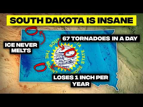
Storms can be equally ferocious. On July 23, 2010, in Vivian, a supercell thunderstorm produced the largest hailstone ever recorded in the United States, measuring **8 inches across and weighing nearly 2 pounds**. This record breaking hailstone left a 10 inch impact crater in the ground, as the storm punched through roofs and shattered windshields. Today, that hailstone is preserved in Colorado's National Center for Atmospheric Research, a frozen monument to the sky's fury. On June 24, 2003, South Dakota experienced one of the most intense tornado outbreaks in American history, with **67 tornadoes touching down** across the state in a single day, tying a US record. An F4 tornado near Manchester passed directly over an instrument probe, recording a pressure drop of 100 millibars in less than a minute, plunging to just 850 millibars, one of the lowest atmospheric pressures ever measured inside a tornado. Even the ground itself can become a source of fire. In the Buffalo Gap National Grasslands, small blue flames occasionally pop up across the soil, igniting seemingly on their own. These ghostly fires result from natural methane seeps, where decaying organic matter and shallow coal seams release flammable gas that can ignite spontaneously or from lightning strikes. Usually extinguished swiftly, these flames give the grasslands a surreal appearance, with literal fire rising from the earth.
"The Red Man has great heroes, too."
Despite its seemingly peaceful geology, much of South Dakota is situated on a fault system prone to earthquakes. Since the first recorded earthquake in 1872 near Sioux City, nearly **100 earthquakes** have been documented, though most are too small to feel. However, in July 1934, a magnitude 4.3 earthquake rumbled from Chadron, Nebraska, with shaking felt as far as the Black Hills, strong enough to rattle dishes and wake sleeping residents. This serves as a reminder that the Great Plains are not as geologically stable as they appear. One of the deadliest floods in US history occurred in Rapid City on June 9, 1972. Torrential rains dumped **over 15 inches in 6 hours** onto the Black Hills, turning Rapid Creek into a churning wall of water that killed 238 people and destroyed over 1,300 homes. Afterward, Rapid City prohibited rebuilding in the flood plain, creating the Greenway Park system that now runs along the creek.
Echoes of Extinction: Fossils, Mammoths, and Petrified Forests
South Dakota's earth is a vast graveyard, preserving an astonishing record of prehistoric life. In Hot Springs, an ancient sinkhole holds one of the most haunting sites of the ice age. Over **26,000 years ago**, mammoths came here to drink from a warm spring but became trapped in the steep, slick clay walls. More than 60 mammoths, along with bears, camels, and other extinct giants, lie exactly where they fell, their bones preserved in the mud of time. This is the largest concentration of mammoth remains ever found. The Badlands are one of Earth's richest windows into prehistory, with layered cliffs containing a fossil bed stretching back **30 million years**. This record details the mammals that replaced the dinosaurs, including saber toothed cats, three toed horses, ancient camels, and enormous pig like predators called entelodonts. Each rock stripe marks a different climate era, turning the land into a carved timeline. Heavy rains continue to wash away sediment, revealing new fossils each year, making it a living excavation site. The White River Badlands, with their beautifully striped cliffs, represent **75 million years of sediment deposition**. These layers, glowing in shades of white, tan, pink, and rust, indicate ancient environments ranging from subtropical forests to savannas and semi arid plains. Beneath these colorful layers lies one of the richest fossil beds on the continent, where paleontologists have excavated entire extinct ecosystems, preserving ancient horses, rhinos, saber toothed cats, and those bizarre entelodonts.
Way below the Badlands' eroding cliffs runs a river that no longer flows with water. The White River Group refers to **30 million year old fossil rich sediments** deposited when ancient rivers carried volcanic ash, mud, and the remains of countless creatures across prehistoric South Dakota. This buried river of fossilized sediment has yielded some of North America's most important prehistoric discoveries, preserving an entire lost world where different giants once roamed. Even the state's mineral treasures speak of deep time. The Fairburn Agate, South Dakota's state gemstone, features intricate multicolored bands in vivid patterns of red, orange, pink, and white. These form over millions of years as silica rich water seeps through volcanic rock. Each Fairburn Agate is unique, with swirling, layered designs, and they are primarily found in the grasslands surrounding the Black Hills, weathered out of ancient sediments. Due to their rarity and beauty, an exceptional specimen can sell for thousands of dollars. In the town of Lemmon, rancher Ole Quammen, during the Great Depression, built **over a hundred structures**, including towers, arches, and castles, entirely from petrified wood. This wood, from the surrounding Badlands, had turned to stone **over 120 million years ago**, each piece still carrying the grain and rings of the trees it once was. The Petrified Wood City stands as a surreal monument to time, a fossil forest rebuilt by human hands.
Human Imprints: Monuments, Gold Rushes, and Cultural Divides
Human ambition and historical events have left indelible marks on South Dakota. The geographic center of the United States, after Alaska and Hawaii joined the Union in 1959, landed near Belle Fourche, a quiet town in northwestern South Dakota. A granite marker and circular stone compass denote the spot, simple yet symbolic. Standing there places one at the exact middle of the United States, a remote yet powerful balance point of a nation. Seventeen miles from Mount Rushmore, another monument is being built that will eclipse it entirely. The Crazy Horse Memorial, still under construction, will eventually stand **563 feet high and 641 feet long**, making it the largest mountain carving on Earth. Even unfinished, its scale is immense; the warrior's face alone measures 87 feet tall, nearly 30 feet higher than any at Rushmore. Sculptor Korczak Ziolkowski began the project in 1948, invited by Lakota Elder Henry Standing Bear, who stated, "The Red Man has great heroes, too." Ziolkowski's family continues the work today, refusing federal funding to maintain its independence, a monument carved in stone, still waiting for completion. Speaking of Mount Rushmore, every president carved into the mountain faces southeast. This is not arbitrary, but a careful design choice by sculptor Gutzon Borglum to capture maximum sunlight from dawn until dusk. This southeastern orientation ensures the faces glow with natural light throughout the day, preventing them from falling into shadow and giving them their iconic golden illumination. Borglum understood that sculpture is not just about shape, but how light interacts with form.
The discovery of gold in the Black Hills in 1874 by Lieutenant Colonel George Armstrong Custer triggered a massive gold rush, drawing thousands of prospectors. This influx, however, violated the 1868 Fort Laramie Treaty, which had guaranteed the land to the Lakota nation. When the Lakota refused to sell, the government seized the land, leading to conflicts culminating in Custer's death at Little Bighorn. In 1980, the Supreme Court ruled the seizure illegal and offered the Sioux Nation **$106 million** in compensation, now worth over $1 billion with interest. For over 40 years, the Sioux have refused the money, maintaining that the Black Hills were never for sale and they want the land back, not a check. The city of Deadwood, founded in 1876 during this Black Hills gold rush, grew overnight into a lawless mining camp, infamous for figures like Wild Bill Hickok, who was famously shot there while playing poker. Instead of modernizing, the town preserved its 19th century architecture, with brick storefronts, wooden sidewalks, and narrow streets frozen in time. Today, Deadwood is one of the few entire towns in America designated a national historic landmark, its Wild West facade still intact.
In Mitchell, South Dakota, stands a building unlike any other: the Corn Palace, an entire arena covered in corn. Every year, artists use **more than 275,000 ears of multicolored corn** to create massive murals on its exterior. The designs change annually, blending corn with grains and native grasses to tell new stories across its walls. Built in 1892 to showcase the region's agricultural promise, it became a permanent landmark, part art, part harvest, and part civic pride. Today, it still hosts basketball games and concerts, but outside, it remains a living canvas of the prairie. South Dakota has also crowned itself the pheasant capital of America. The state releases millions of pheasants every year for hunting, and during the fall season, some counties have more pheasants than people. Small towns thrive on the hunting crowd, with motels, diners, and gun shops packed with hunters from across the country. Ironically, the ring necked pheasant isn't even native; it came from Asia in the 1880s, but South Dakota embraced it so thoroughly it became central to its identity.
The Prairie's Peculiar Formations: Buttes, Badlands, and Inaccessibility
The diverse landscape of South Dakota offers an array of unique formations and geographical quirks. In northwestern South Dakota, the Slim Buttes appear like flat topped mesas dropped onto the plains. These are not volcanic, but are carved from layers of ancient sedimentary rock. Millions of years ago, the area was covered in sediment from inland seas and rivers. Over time, wind and water eroded the softer rock, leaving behind these hard, resistant caps standing alone on the prairie, nature's sculptures slowly whittled down. Deep in Spearfish Canyon, the Spearfish Creek offers a rare glimpse of erosion in real time, carving through **400 million years of Earth's history** in fast forward. It has created one of the fastest eroding canyons in North America, with limestone cliffs that visibly crumble year after year. The canyon walls expose layers of red sandstone, white limestone, and dark shale, each representing different ancient environments from tropical seas to desert dunes. Geologists call it the living canyon, where waterfalls cascade over crumbling ledges and rock slides reshape the walls as the creek continues its relentless work. Near the southern Badlands, the fragile sandstone caves of Buffalo Gap are not carved by water, but entirely by relentless prairie winds that constantly reshape them. The soft sandstone erodes quickly, creating arches, alcoves, and hollows that shift season by season. Locals refer to them as living sculptures of the prairie, temporary art that nature continuously remodels.
The Black Hills are considered a biological island, an isolated ecosystem surrounded by a sea of prairie. Rising from the plains, the hills create their own microclimate with cooler temperatures and more precipitation than the surrounding grasslands. This supports **over 200 plant and animal species** found nowhere else in the region, including ponderosa pine forests, mountain goats, and unique wildflowers. Step outside the Black Hills' borders, and the ecosystem changes almost instantly from forest to open grassland, a striking biotic boundary. In the 1960s, NASA found an unlikely training ground for astronauts in South Dakota's Badlands. The park's eroded cliffs and barren formations so closely resembled early images of Mars that the agency used it as a field classroom. Apollo astronauts learned to identify rock layers, collect samples, and navigate alien terrain among the spires and canyons. Even today, planetary scientists return here to study erosion patterns similar to those found on Mars. Sometimes, the best place to study another world is right here on ours. Finally, in northwest South Dakota, near the town of Allen, lies the continental pole of inaccessibility, the spot in North America farthest from any ocean, **more than 1,000 miles from the nearest coastline**. There's no monument, no visitor sign, just open prairie stretching to every horizon. Standing here means being as inland as it's possible to be, surrounded by silence, distance, and sky. Meanwhile, at the Cosmos Mystery Area near Rapid City, the laws of physics seem to bend. Balls roll uphill, water appears to flow against gravity, and people standing in different spots seem to grow or shrink before one's eyes. While scientists dismiss it as an optical illusion created by tilted environments and slope terrain that tricks the brain's sense of level, visitors swear something stranger is happening. Whether clever architecture or genuine mystery, the Cosmos has been baffling tourists since the 1950s.
South Dakota, then, is a place where the familiar gives way to the utterly bizarre, where the forces of geology, climate, and human history conspire to create a landscape of continuous wonder. It is a testament to the idea that geography is not just about lines on a map, but a dynamic, ever evolving narrative, full of unexpected turns and profound revelations. The world, it seems, is always stranger and more captivating than school ever taught us, and South Dakota stands as a powerful reminder of this enduring truth.


