New Hampshire, the Granite State, often conjures images of quaint New England towns and picturesque autumn leaves. Yet, beneath this tranquil facade lies a landscape of astonishing geographic contradictions and wild phenomena. Imagine a mountain revered for its granite that isn't actually made of granite, or a peak that endures some of Earth's most severe weather despite its modest elevation. This is a place where forests float, rivers vanish underground, and the very ground beneath your feet can be a 12-million-pound relic of the Ice Age. Prepare to discover a state where the familiar gives way to the truly outlandish, proving that even in seemingly settled corners of the world, geography holds endless plot twists.
Ancient Earth & Sculpted Stone
North America's first mica mine, a glittering underground wonderland.
Ruggles Mine in Grafton is a 40-foot deep, man-made cavern, North America's first mica mine, opened in 1803. It features glittering mica, amethyst, rose quartz, and garnet, with a single 15-foot stone pillar supporting the ceiling. Long abandoned, it reopened in 2024, offering a unique underground experience, even hinting at traces of uranium ore.
Wildfire reveals a natural Abnaki chief's profile in cliffs.
After a wildfire in the early 1900s, Mount Pimeawaset revealed a natural rock formation resembling an Abnaki chief's profile, named Indian Head. Visible from Franconia Notch, this "portrait" wasn't carved but exposed by chance, becoming a local landmark. A park and lookout now allow thousands to view this natural wonder watching over the valley.
A frog-shaped boulder lost its Victorian-era tourist fame.
Near New Boston, a 10-foot granite boulder nicknamed Bullfrog Rock once attracted Victorian tourists who picnicked beneath its stony form. For decades, it was a photographed oddity, but the forest eventually reclaimed it. Today, only locals know the trail to this moss-covered, forgotten natural curiosity.
A surveyor's error made New Hampshire bigger.
In 1652, Massachusetts Bay Colony surveyors marked a glacial rock near Laconia, intending to set a boundary. Their miscalculation gave New Hampshire extra territory when the line was finalized. This carved boulder, now Endicott Rock, is considered America's oldest public monument, a 370-year-old error that literally enlarged the state.
Fallen Old Man of the Mountain rebuilt as optical illusion.
After the Old Man of the Mountain collapsed in 2003, New Hampshire created a memorial plaza at Franconia Notch. Engineers positioned steel beams to recreate the iconic profile through an optical illusion from one specific angle. This sculpture ensures the Old Man's shadow still watches over the mountains, a testament to the state's spirit.
Cold River sculpts granite into a natural art gallery.
At Sculpted Rocks Natural Area in Hebron, the Cold River spent millennia carving solid granite into smooth curves, polished bowls, and natural bridges. This gorge, looking handcrafted, features swirling hollows that resemble abstract art or animal faces. It's a prime example of erosion with patience, revealing nature's slow-motion sculpture.
Glacial meltwater drilled a flawless 30-foot pothole.
Just outside Lincoln, The Basin is a perfectly round, 30-foot wide pothole bored into granite by glacial meltwater. Thousands of years ago, pebbles spun by meltwater acted like a drill bit, creating this flawless natural feature. Henry David Thoreau called it the most remarkable curiosity of its kind in New England, a granite mixing bowl carved by time.
Roadside boulder bears a cryptic, cherished love note.
On a Newbury dirt road, a massive boulder is inscribed with "Chicken farmer, I still love you," painted in the 1980s. The identity of the farmer and painter remains a mystery, but locals protect and touch up the faded letters. This graffiti evolved from vandalism into beloved folk art, New Hampshire's strangest Valentine.
It's the only location on Earth where architects seriously calculated will this building take off and decided industrial strength chains were non-negotiable.
Peaks of Power & Weather's Fury
Mount Washington experiences some of Earth's worst weather.
Mount Washington, at 6,288 feet, endures hurricane-force winds 110 days annually and receives over 25 feet of snow each year. Temperature swings are legendary, with 70°F sunshine turning into blizzards within minutes. Its summit, where three storm tracks converge, earned it the title "home of the world's worst weather."
Mountain recorded a world-record 231 mph wind gust.
On April 12, 1934, Mount Washington recorded a wind gust of 231 mph, faster than Category 5 hurricane winds, shattering the world record for 62 years. Observers crawled on hands and knees to avoid being swept away. This wasn't just a spike; sustained winds topped 100 mph for hours, a testament to the mountain's meteorological fury.
Summit buildings are chained to bedrock to prevent liftoff.
Structures on Mount Washington's summit, including the Tip-Top House and observatory, are braced with massive steel chains bolted into bedrock. This is because architects calculated the risk of buildings being lifted off by extreme winds. It's the only place on Earth where industrial-strength chains were deemed non-negotiable for structural integrity.
Cliff named after a painter, not a monster.
Frankenstein Cliff, towering above Crawford Notch, is named after Godfrey Frankenstein, a 19th-century German-American painter who owned the land. The name predates Mary Shelley's novel's American fame, having nothing to do with the monster. The sheer granite face attracts climbers and artists, its intense atmosphere often drawing lightning strikes.
Mount Monadnock: one of Earth's most climbed mountains.
Mount Monadnock, a 3,165-foot granite peak, rises solitarily, its Abenaki name meaning "mountain that stands alone." On clear days, Boston's skyline is visible 60 miles away. It's also one of the most climbed mountains on Earth, second only to Mount Fuji, due to its accessibility and year-round trails.
Arethusa Falls: New England's tallest single-drop waterfall.
Arethusa Falls, located in the Pemigewasset Wilderness, drops approximately 160 feet down sheer granite, making it New England's tallest single-drop waterfall. A challenging 1.4-mile hike leads to this powerful cascade, which can form moonbows. Its beauty justifies the effort, especially during spring snowmelt or summer's gentle flow.
North America's first passenger aerial tramway opened in 1938.
In 1938, Cannon Mountain launched North America's first passenger aerial tramway, a daring feat. A statue of the Grim Reaper was installed at the base, humorously acknowledging the perceived risk. The tram safely carried millions to the summit, proving high-altitude cable cars were viable and changing how Americans experienced mountains.
World's first mountain-climbing cog railway, built 1869.
In 1869, the Mount Washington Cog Railway, the world's first mountain-climbing cog train, debuted. Skeptics called it "the railway to the moon," but 150 years later, it still grinds 3.5 miles up Mount Washington. Steam engines puff smoke as it defies gravity, hauling millions of passengers to the summit using a rack and pinion system.
Cog Railway features a staggering 37% maximum grade.
The Mount Washington Cog Railway averages a 25% grade, peaking at nearly 37% on Jacob's Ladder, making it one of the world's steepest railway lines. This means climbing 37 feet vertically for every 100 feet horizontally. Passengers tilt backward, and looking out at the sheer drop is not for the faint of heart.
Watery Labyrinths & Flowing Secrets
Lake Winnipesaukee boasts over 260 islands.
Lake Winnipesaukee, a freshwater labyrinth spanning 72 square miles, contains over 260 islands. Some host full communities, while others are tiny rocks. Becky's Garden, the smallest, measures barely 10 feet across. The MS Mount Washington steamboat still cruises between these islands, and the Sophie C. delivers mail.
Winnipesaukee, "smile of the great spirit," has a floating post office.
The Abenaki called Lake Winnipesaukee "Winnipesaukee," meaning "smile of the great spirit." The Sophie C. Mailboat, America's last floating post office, still delivers mail, groceries, and gossip to island residents. This waterborne mail route connects a modern state to its indigenous roots and maritime past, blurring lines between nature and nostalgia.
Lake Umbagog's name means "shallow water."
Lake Umbagog, straddling the New Hampshire-Maine border, derives its Abenaki name from "shallow water." Despite covering 7,000 acres, its average depth is only 12 to 14 feet, shallower than many swimming pools. Post-glacial sediments created a surprisingly flat-bottomed lake, forming a rich habitat for moose, loons, and waterfowl.
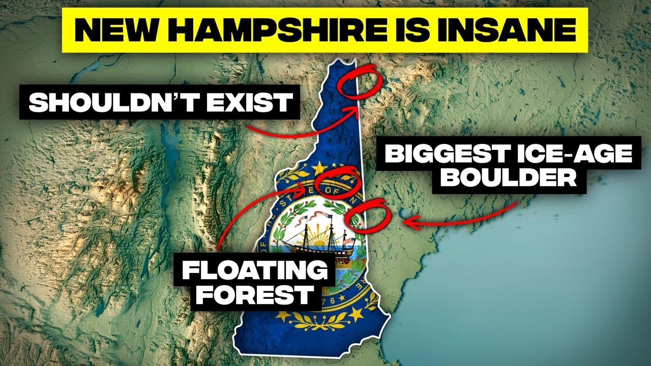
Lake Umbagog has a floating, drifting forest island.
On Lake Umbagog, Harper's Meadow is a massive, sponge-like peat island that literally drifts with the wind. Trees, moss, and shrubs grow atop this buoyant wetland, which moves like a giant lily pad. It's one of only a handful of floating bogs in North America and was declared a national natural landmark in 1968.
Lost River Gorge: a stream that disappears underground.
At Lost River Gorge in Kinsman Notch, the river plays hide-and-seek, diving beneath massive granite boulders and vanishing underground before re-emerging downstream. Boardwalks and ladders trace its subterranean path through glacial meltwater-carved caves. Thoreau called New Hampshire's wilderness a labyrinth of granite, a testament to this shape-shifting stream.
Piscataqua River has one of North America's fastest tidal currents.
The Piscataqua River boasts one of North America's fastest tidal currents, rushing at over 8 knots between New Hampshire and Maine. This creates whirlpools and standing waves, strong enough to spin boats sideways. Locals call it "tariff" due to its unpredictable nature, as it's an ocean inlet flexing its powerful muscles.
Glacier rerouted Winnipesaukee's drainage into a new watershed.
Lake Winnipesaukee once drained eastward, but the last ice age left a debris dam at Alton Bay. This blocked its eastern outlet, forcing the water to reroute westward into the Pemigewasset and Merrimack River systems. A massive ice sheet fundamentally reorganized the lake's drainage, permanently changing its flow toward an entirely different watershed.
Mighty Connecticut River begins as a small puddle.
The 410-mile-long Connecticut River, shaping four states, originates as a small puddle in Pittsburg, just 300 yards from the Canadian border. Fourth Connecticut Lake, a quiet pond, serves as its official source. From this tiny basin, a brook grows into New England's longest waterway, draining into Long Island Sound.
New Hampshire is the "Mother of Rivers."
New Hampshire is nicknamed the "Mother of Rivers" because five major New England rivers originate in its highlands: the Connecticut, Merrimack, Androscoggin, Saco, and Pemigewasset. These rivers flow in every direction, making New Hampshire the hydrological heart of New England. With 1,300 lakes and 40,000 miles of streams, the nickname is simply geographic fact.
Wilderness & Ancient Footprints
An inexplicable, ancient, carved egg-shaped stone found.
In 1872, workers near Lake Winnipesaukee unearthed a perfectly smooth, egg-shaped stone, 4 inches long, with mysterious symbols and a precisely drilled hole. Its origin is unknown, with theories ranging from Native American to alien artifact. Over 150 years later, this enigmatic relic remains in a museum, defying explanation.
Mystery Hill: a debated ancient site, America's Stonehenge.
Hidden in Salem, Mystery Hill features stone chambers, standing slabs, and underground passages. Its builders are unknown, with theories suggesting ancient Native American observatories or early European settlers. Now called America's Stonehenge, its carvings align with solstices and equinoxes, but the mystery remains unsolved, sparking ongoing debate.
Ancient 4,000-year-old forest stumps revealed by low tide.
At Odiorne Point and Jenness Beach, extremely low tides occasionally reveal blackened tree stumps from a 4,000-year-old forest. Rising seas drowned this ancient forest millennia ago, preserving its cedars and pines in peat. Twice daily, the Atlantic uncovers this underwater time capsule, a powerful reminder of shifting coastlines.
Ponemah Bog hosts three native carnivorous plant species.
Ponemah Bog, north of Amherst, is home to New Hampshire's three native carnivorous plants: pitcher plants, sundews, and bladderworts. Pitcher plants drown prey, sundews use sticky tentacles, and bladderworts vacuum creatures underwater. This nutrient-starved ecosystem forced plants to evolve into predators for survival.
Pisgah State Park holds an untouched, ancient old-growth forest.
Pisgah State Park, New Hampshire's largest, contains a 20-acre old-growth forest that escaped centuries of logging. Its massive trees predate the American Revolution, standing untouched while surrounding areas were cut and regrown. This patch offers a glimpse into a living history, growing since before New Hampshire's founding.
Polar Caves are gaps beneath Earth's largest glacial boulder.
Near Rumney, Polar Caves are not true caves but passages beneath a 25,000-ton granite boulder, measuring 110x50 feet. It's believed to be Earth's largest glacially deposited rock, moved by ice sheets. Gaps beneath provide natural air conditioning, making it a cool exploration spot even in summer.
Tornado carved New England's longest 50-mile track.
In July 2008, a tornado carved an unprecedented 50-mile path from New Hampshire's White Mountains into Massachusetts, plowing through 11 towns. This became New England's longest tornado track by a wide margin. Normally, terrain here kills rotation, but this storm rode valleys like highways, a brutal reminder that tornado country extends eastward.
White Mountain National Forest covers a quarter of New Hampshire.
The White Mountain National Forest spans over 750,000 acres across New Hampshire and Maine, covering nearly a quarter of New Hampshire's total land area. It's the largest contiguous wilderness in New England and the easternmost national forest in the US, offering glacial valleys, alpine ridges, and the Appalachian Trail.
For a brief bizarre moment, New Hampshire hosted an accidental micro nation within its borders.
Borders, Byways & Uncommon Ground
New Hampshire has America's shortest coastline, 18.5 miles.
New Hampshire possesses America's shortest coastline, stretching just 18.5 miles, wedged between Maine and Massachusetts. This sliver of rocky shore, anchored by Portsmouth, packs in colonial architecture, lighthouses, and beaches. While short, it offers scenic ocean views and enough lobster rolls to rival any coastal state.
Pittsburg: New England's largest, most remote town.
Pittsburg, New Hampshire's largest town at 291 square miles, borders Maine, Vermont, and Canada. It lies north of the 45th parallel, containing the four Connecticut Lakes and vast unbroken forest. Locals call it "Big Sky Country of the East" due to its immense size and remote wilderness, home to more moose than people.
A border dispute created the Republic of Indian Stream.
In the 1830s, unclear US-Canada border surveying created a no man's land in northern Coös County. Residents, tired of dual taxation, declared independence as the Republic of Indian Stream, governing themselves for several years. The 1836 border resolution placed it within American boundaries, a bizarre accidental micro-nation.
Pittsburg contains all New Hampshire land west of Connecticut River.
Pittsburg holds every piece of New Hampshire land located west of the Connecticut River. South of Pittsburg, the river forms the entire NH-VT border. However, north of Stewartstown, the river bends east, creating a wedge of New Hampshire territory squeezed between Vermont and Canada. This isolated block exists purely due to surveying lines.
Pittsburg hosts New Hampshire's sole Canada border crossing.
Pittsburg is the only place to drive from New Hampshire into Canada. A tiny road heading towards Chartier, Quebec, serves as the state's sole official border crossing, complete with a small customs station. Every car, truck, and snowmobile must pass through this remote gateway, making Pittsburg New Hampshire's only international doorway.
Kancamagus Highway: a scenic byway with no billboards.
The Kancamagus Scenic Byway, or "Kanc," is a 34.5-mile stretch of Route 112 through the White Mountains. It features no traffic lights, no billboards, and stunning views, especially during autumn. As the Northeast's first national scenic byway, it climbs nearly 3,000 feet, defining New England's fall beauty.
Entire Connecticut River belongs to New Hampshire.
The entire Connecticut River, up to Vermont's low water mark, belongs to New Hampshire. A 1933 US Supreme Court ruling settled centuries of disputes, affirming New Hampshire's ownership. This means if your kayak touches the water between the banks, you're in the Granite State, and you don't cross into Vermont until your paddle hits its mud.
Winnipesaukee is New England's third-largest lake.
At 72 square miles, Lake Winnipesaukee is New Hampshire's largest and New England's third-largest lake, trailing only Lake Champlain and Moosehead Lake. Its scale and importance drive tourism, boating, and fishing, essentially defining summer for many within driving distance. This makes it a genuine regional heavyweight.
Defining Peaks & Enduring Forests
President Grant's ride legitimized the Cog Railway.
When the Cog Railway debuted in 1869, many considered it a death trap until President Ulysses S. Grant rode it to Mount Washington's summit. His trip transformed public opinion overnight, effectively endorsing this engineering marvel. That same year, the Tip-Top House Hotel opened, cementing Mount Washington as a presidential retreat and tourist destination.

North America's largest glacial erratic weighs 12 million pounds.
Madison Boulder is New Hampshire's geological heavyweight, an 85-foot long, 37-foot wide, and 23-foot tall glacial erratic. Weighing an estimated 12 million pounds (36 blue whales), it was casually dragged here by ancient glaciers from a ledge two miles away. It's the largest known glacial erratic in North America.
Purgatory Falls features the Devil's Bean Pot pothole.
At Purgatory Falls in Lyndeborough, a circular depression called the Devil's Bean Pot was carved by swirling river currents. Local legend claims Satan cooked beans there, leaving his "fiery pot" etched into the bedrock. In reality, it's a textbook glacial pothole, but folklore gives this erosion a more entertaining personality.
Mount Washington isn't actually made of granite.
Despite being the "Granite State," Mount Washington's summit is not granite but schist and quartzite, formed from ancient ocean sand. Around 250 million years ago, continental collisions pushed these layers skyward into a 15,000-foot range. Millennia of erosion left us with 6,000-foot peaks, the worn-down stumps of ancient giants.
Over 100 miles of Appalachian Trail challenges hikers.
Over 100 miles of the Appalachian Trail (AT) slice through New Hampshire, particularly through the White Mountains. This section is legendary for punishing climbs, relentless weather, and stunning views, including Mount Washington. Hikers say New Hampshire either humbles you or hardens you forever, with its brutal, breathtaking wilderness.
New Hampshire's "48 4,000-footers" are a hiking right of passage.
New Hampshire's "48 4,000-footers" are mountains in the White Mountains over 4,000 feet. Summiting all 48 is a right of passage for hikers, offering brutal climbs, alpine views, and unpredictable weather. Finishing earns entry into a tight-knit club, defining the land and spirit of New Hampshire where mountains outnumber cities.
New Hampshire is America's second most forested state.
New Hampshire is the second most forested state in America, with roughly 83% tree cover, trailing only Maine. This vast woodland, from coastal spruce to northern hardwoods, supports a massive timber industry and produces more toothpicks than any other state. This dense cover creates genuinely wild habitat despite the state's small size.
All four Connecticut Lakes are river headwaters.
All four Connecticut Lakes (First, Second, Third, and Fourth) are within Pittsburg's boundaries, serving as the headwaters for the 410-mile Connecticut River. These mountain ponds connect through streams, feeding the river's initial trickle. Standing at Fourth Connecticut Lake, the highest source, one feels the journey begin to Long Island Sound.
New Hampshire proves that the world is far stranger and more geographically complex than most textbooks let on. From mountains that are not what they seem to rivers that belong entirely to one state, its landscape is a masterclass in unexpected twists and turns. These facts are more than just trivia; they are a reminder that even in familiar places, the forces of nature and the quirks of history conspire to create a tapestry of wonders, waiting to be discovered by the curious mind.


