Indiana, often dubbed "The Crossroads of America," is typically envisioned as an expanse of flat farmland, a transit point rather than a destination of geographical intrigue. Yet, beneath its seemingly placid surface and across its varied terrain lies a landscape riddled with geological plot twists. From ancient tropical oceans preserved in bedrock to subterranean rivers navigable by boat, this state defies its humble reputation. It is a place where glaciers sculpted towering dunes, meteorites left buried scars, and entire towns vanished beneath man-made lakes, proving that even the most unassuming states hold profoundly wild secrets.
Ancient Seas and Deep Time
Hidden faults beneath Indiana's calm surface.
Indiana's quiet exterior belies an active fault network, notably the Wabash Valley Seismic Zone. These ancient scars from continental collisions still adjust, releasing stress through frequent small earthquakes. A magnitude 6 quake here could be felt across five states, demonstrating the unexpected seismic potential of the Midwest's dense bedrock.
Valleys carved by colossal, non-existent rivers.
Many Indiana river valleys appear disproportionately large for the streams that flow through them today. These massive troughs were not carved by modern rivers, but by catastrophic floods during the Ice Age. As glaciers melted, immense lakes drained in sudden bursts, releasing ocean-scale amounts of water that blasted through the land, leaving behind "misfit rivers" in canyons built for giants.
Indiana was once a tropical ocean near the equator.
Approximately 330 million years ago, Indiana was submerged under warm, shallow seas near the equator, akin to today's Bahamas. These ancient waters teemed with corals, crinoids, and brachiopods, whose accumulated remains formed the thick limestone that now underpins much of the state. Plate tectonics slowly dragged this tropical seascape northward, transforming a vibrant marine environment into modern farmland, with its rocks as tangible proof.
Walk on a 390-million-year-old fossilized coral reef.
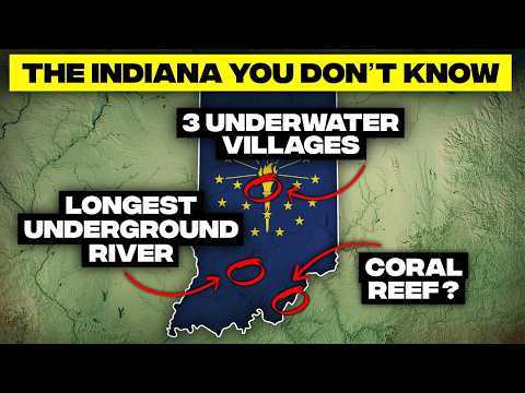
At the Falls of the Ohio, when river levels are low, one of Earth's largest Devonian fossil beds is revealed. Here, visitors can literally walk across a 390-million-year-old coral reef, once a vibrant tropical sea teeming with over 600 identified fossil species. This limestone landscape, rich with corals, brachiopods, and trilobites, offers a rare glimpse into Indiana's prehistoric marine past.
A prehistoric reef now towers over a modern river.
Hanging Rock, near Lagro, appears as a dramatic cliff overhanging the Wabash River, but its origins are far grander. It began as a living reef in the Silurian Sea 420 million years ago. Glacial and river erosion later carved the resistant dolomite into the 65-foot overhang seen today, a testament to Indiana's strange geological history where an ancient ocean floor became a prominent river landmark.
A massive meteor crater hidden under cornfields.
Near Kentland, a massive meteor impact crater, nearly 7 kilometers wide, lies buried completely under quiet farmland. Geologists identified this ancient impact site when quarry workers observed twisted and shattered limestone layers. Today, farmers plant crops above it, unaware of the profound geological event that warped the ground beneath them millions of years ago, leaving shatter cones and shocked quartz as evidence.
Ice Age giants roamed Indiana's ancient landscapes.
Indiana is a vast graveyard for Ice Age giants, with mammoth and mastodon fossils discovered in at least 80 of its 92 counties. These massive animals roamed spruce forests 11,000 to 13,000 years ago, often becoming preserved in bogs and floodplains. Farmers still unearth tusks thicker than fence posts, revealing a prehistoric world that once thundered with these colossal creatures.
Powerful earthquakes made the Wabash River flow backward.
The New Madrid earthquakes of 1811 to 1812 shook Indiana so violently that chimneys toppled and the Wabash River reportedly flowed backward. These were among the strongest quakes ever recorded east of the Rockies. Shawnee leader Tecumseh famously warned rival tribes he would "stomp his foot" and make their houses fall, and when the quake struck that very night, many believed he caused it. Indiana still bears scars from these seismic convulsions.
Glacial Sculptures and Shifting Sands
The Knobs, rugged hills the glaciers forgot.
Southern Indiana features a rugged region of steep, conical hills called the Knobs, a stark contrast to the state's flatter northern plains. This dramatic topography exists because Ice Age glaciers stopped just short of this area. While the north was bulldozed flat, the south remained untouched, allowing millions of years of erosion to sculpt hills, some rising nearly 500 feet above their surroundings, all because the ice never came.
Ice Age plant relics thrive in Hoosier canyons.
Turkey Run and Shades State Parks harbor cool, narrow sandstone canyons that act as natural refrigerators. These canyons shelter plants like eastern hemlock, typically found in Canada and the northern Appalachians. These hemlocks are relics from the last Ice Age, surviving in shaded ravines where summer temperatures can be 10 to 20 degrees cooler than the surrounding forest, preserving fragments of an ancient boreal ecosystem.
Lake Michigan's brutal winter snow machine.
Northwest Indiana endures notoriously harsh winters due to Lake Michigan's lake effect snow. Cold northwest winds scoop up lake moisture, dumping it inland in narrow, intense snow bands. These storms can bury one neighborhood in 20 inches of snow while an area just 30 miles away receives nothing. Annual totals often reach 60 to 80 inches, making it one of America's snowiest non-mountain regions.
A million-acre wetland drained into farmland.
Northwest Indiana once boasted the Grand Kankakee Marsh, a million-acre wetland so vast that early travelers reported birds darkening the sky. However, in the early 1900s, settlers drained this "Everglades of the North" for farmland. Engineers straightened the Kankakee River into an 82-mile ditch, obliterating over 250 miles of river meanders and millions of birds' habitats, leaving only tiny preserves as faint reminders.
Indiana's lake-filled, glacial district.
Northeast Indiana, particularly Kosciusko County, resembles Minnesota with over 100 natural lakes. These kettle lakes formed 14,000 years ago when giant blocks of ice broke off retreating glaciers, melted, and left behind deep, cold depressions. Lake Wawasee, at 3,410 acres, is Indiana's largest natural lake, while Lake Tippecanoe plunges 120 feet, making this region a freshwater maze created by melting ice giants.
Canadian boulders stranded in Hoosier fields.
Northern Indiana's fields are dotted with giant granite and quartzite boulders, known as glacial erratics, which do not belong locally. These rocks hitched a ride from Canada and Minnesota during the Ice Age, trapped inside mile-thick glaciers that bulldozed south. When the ice melted 10,000 to 15,000 years ago, these boulders, some weighing several tons, were dumped randomly, serving as oversized souvenirs from a time when ice sheets moved mountains.
Mount Tom, Indiana's Sahara-sized migrating dune.
Mount Tom, rising 192 feet above Lake Michigan, is Indiana's tallest dune. Climbing it feels like scaling a sand volcano, with every step sinking. The reward is a panoramic view of the lake and even Chicago. These dunes are not static; Mount Tom was forested in the 1800s but is now mostly bare sand, having migrated inland and swallowed entire forests, demonstrating Indiana's dynamic, freshwater Sahara.
Mount Baldy, a slow-moving, living dune.
Mount Baldy, a 126-foot dune on Lake Michigan, is a slow-moving geological beast, migrating about 4 feet inland every year. Lacking stabilizing grasses, it is relentlessly pushed by strong lake winds, swallowing entire forests over time. Buried tree trunks rot away, creating hidden air pockets that can collapse, making this constantly reshaping shoreline both dynamic and unpredictable, a sandy glacier in motion.
A sand dune that swallowed a 6-year-old boy.
In 2013, a 6-year-old boy disappeared into Mount Baldy, swallowed by an 11-foot-deep hole that collapsed under his weight. Rescuers miraculously pulled him out alive. These hidden voids are formed by rotting, buried tree trunks, making Mount Baldy a living, shifting dune with invisible traps. The incident prompted changes in how Great Lakes dunes are monitored, revealing the dangers hidden beneath their soft surfaces.
Indiana's Lake Michigan shore is an active sand river.
Along Indiana's Lake Michigan shore, sand moves like a river, pushed by wind and waves in a process called littoral drift. Millions of tons of sand shift eastward each year, causing entire beaches to disappear from one area and reappear miles away. Dunes creep inland, swallowing forests and parking lots. The shoreline you walk on today will not be in the same place in a decade, as this migrating, reshaping sand machine behaves more like a slow-motion current than solid ground.
Indiana's landscape is a testament to the fact that geography is never as simple as a map suggests.
Subterranean Wonders
A hidden river flows beneath Indianapolis.
Thousands of people walk daily across downtown Indianapolis, unaware of Pog's Run, a river flowing in total darkness beneath them. Buried in 1915 to prevent flooding and align with city planning, this 2.5-mile waterway rushes through tunnels under train stations, stadiums, and parking lots. It is a literal underground river system that few know exists, an eerie, echoing watercourse beneath the city's paved surface.
The Lost River literally vanishes underground.
Southern Indiana's Lost River performs a remarkable hydrological trick: it disappears. Flowing over limestone, the river slips into sinkholes and caves, draining completely underground for up to 23 miles before re-emerging at Orangeville Rise. This hybrid river-cave system, one of America's largest, has miles of unmapped passages. During dry weather, its entire riverbed can sit empty, a disappearing river that refuses to behave like one.
Vanishing creeks disappear into limestone sinkholes.
Southern Indiana's karst ground gives creeks a supernatural party trick: they vanish. Near Orleans and Mitchell, streams flow normally until they reach a limestone sinkhole, where they drop underground instantly, leaving a dry creek bed. Miles away, the same water gushes out of a spring. Dye tests show water travels faster underground through cave passages than on the surface, revealing Indiana's bedrock as Swiss cheese, full of hidden, unpredictable channels.
A massive cave system snakes beneath cornfields.
Beneath Indiana's cornfields lies one of America's largest cave networks, the Binkley Cave System. Over 44 miles long and still expanding, it winds beneath Harrison and Crawford counties like a subterranean maze. Featuring underground rivers, vast chambers, and a 35-foot waterfall, this system, discovered in segments since 1811, is the seventh-longest cave in the U.S., a massive underground world hiding beneath everyday farmland.
America's longest navigable underground river flows here.
Underneath Bedford flows the Mystery River, America's longest underground river you can boat through. Nearly 3 miles of pitch-black subterranean waterway, fed by over 50 smaller streams, snake through 21 miles of mapped passages in Blue Spring Caverns. Discovered in 1940, an hour-long boat tour allows visitors to glide through a world where sound echoes forever, illuminated only by lamps bouncing off limestone, feeling like a journey to another planet.
Gibraltar, one of the world's largest stalagmites.
Deep within Wyandotte Cave, a colossal stalagmite known as Gibraltar rises, so immense that early explorers considered it a world wonder. Standing over 30 feet tall and spreading 80 feet wide at its base, it resembles a three-story building growing from the cave floor. Formed mineral drop by mineral drop over possibly 200,000 years, it is a silent, sparkling pillar, a testament to geology's slow, grand pace.
Teenagers discovered Marengo Cave in 1883.
One of Indiana's greatest natural landmarks, Marengo Cave, was not discovered by scientists but by two teenagers. On September 6, 1883, 15-year-old Blanche Hiestand and her younger brother Orris squeezed into a hillside crack and stumbled upon a glittering, unseen underground world. The news spread instantly, and within weeks, the cave drew crowds. Marengo Cave, now a National Natural Landmark spanning 5 miles, stands as an extraordinary accidental discovery.
Underground bone mountain holds Ice Age secrets.
Deep inside the Binkley Cave system lies Big Bone Mountain, a massive pile of Ice Age animal remains. Cavers found bones from flat-headed peccaries, giant bison, Ice Age bears, and even a nearly complete jaguar skeleton. Scientists believe these animals fell through a sinkhole over 20,000 years ago, preserved in the cave's cool, dry conditions, offering a glimpse into Indiana's lost Ice Age ecosystem, a Hoosier Serengeti frozen in stone.
Rivers, Falls, and Wetlands
America's longest free-flowing river east of the Rockies.
The Wabash River, flowing 503 miles from Ohio to southern Indiana, is America's longest free-flowing river east of the Mississippi. Over 400 miles of its course run completely unobstructed by dams, from Huntington Dam to the Ohio River. Locals nickname it "Indiana's Nile," and paddlers describe it as untouched, winding through farmland, forests, bluffs, and wetlands, a rare survivor in a country where damned rivers are the norm.

Indiana's tallest waterfall system, a mini Niagara.
Tucked into quiet Owen County, Cataract Falls is Indiana's tallest waterfall system, a two-tier cascade dropping a combined 75 feet. The Upper Falls plunges 45 feet, with the Lower Falls adding another 30, creating a scene unexpected in a state known for cornfields. After heavy rains, the falls transform into a thundering wall of water, shaking the ground and spraying mist, a wild Midwestern surprise.
A river teeming with globally significant mussel treasures.
The Tippecanoe River, though appearing peaceful, is one of the planet's richest mussel habitats. Over 45 species thrive here, including critically endangered ones like the threehorn wartyback. This diversity rivals entire river systems worldwide, thanks to perfect gravel beds, clean flowing water, and minimal dam interference. Scientists travel globally to study this river, where shells scattered like treasure are a living reminder of healthy, hidden river secrets.
A bald cypress swamp in "Yankee" country.
Far southwest Indiana hosts Twin Swamps Nature Preserve, one of the northernmost bald cypress swamps in the United States. Complete with cypress knees, tupelo trees, tea-dark swamp water, and Spanish moss, these trees are remnants from a time when the ancient Mississippian bayment stretched far north. Early settlers were shocked to find a bayou this far north, a living time capsule from a lost ecosystem, making it a mini Louisiana in the Midwest.
A lost wetland drained then miraculously restored.
Northern Indiana once held Limberlost Swamp, a 13,000-acre wetland that inspired classic novels, but it was completely drained for farmland by the early 1900s. However, in the 1990s, conservationists bought farmland, broke drainage tiles, and reflooded nearly 1,500 acres. The swamp began rising from the dead, with cranes, otters, and other species returning, making Limberlost a rare example of a Midwestern ecosystem revived through sheer determination and science.
Strip mine scars transformed into blue water lakes.
Southwestern Indiana's landscape, once scarred by massive strip mining operations for coal, now showcases nature's remarkable ability to rewrite chapters. When mining ceased, the pits filled with groundwater and rain, creating over 120 deep blue lakes surrounded by reclaimed forests. Hills built from mining spoil now rise like rugged ridge lines, hiding quiet lakes. Green Sullivan State Forest, with its 500-plus acres of water, is a fisherman's paradise born from industrial destruction.
Architectural and Resource Riches
The limestone that built American landmarks.
If you have seen the Empire State Building, the Pentagon, or 35 U.S. state capitals, you have seen a piece of ancient Indiana. Salem limestone, also known as Indiana limestone, formed 330 million years ago from a tropical sea. Its uniform texture and carvability made it the go-to stone for architects in the late 1800s and early 1900s. Massive quarries in Bedford and Bloomington shipped blocks nationwide, literally building America's greatest monuments from Indiana's prehistoric ocean.
Glittering geodes hide in Indiana's bedrock.
Southern Indiana's creek beds conceal one of the Midwest's coolest natural treasures: geodes. These ordinary-looking gray rocks, when cracked open, reveal sparkling crystal chambers lined with quartz, amethyst, or calcite. Formed inside ancient limestones, some Indiana geodes are as big as basketballs. Monroe, Lawrence, and Washington counties are famous hunting grounds, where locals find these mini caves, formed tens of millions of years ago, disguised as boring river rocks.
Diamonds found in Indiana's cornfield creeks.
It sounds impossible, but Indiana has produced real diamonds, not from mines, but from creek beds. In the 1800s and early 1900s, prospectors in Morgan and Brown counties occasionally pulled out tiny but genuine diamonds. These gems did not form in Indiana; they were scraped off ancient Canadian deposits by glaciers and dropped here, geological hitchhikers. Gold flakes also appear for the same reason, making the idea of Hoosiers discovering diamonds in farm country a strange legacy of the Ice Age.
Indiana's explosive gas and oil boom of the 1800s.
In the late 1800s, Indiana literally lit up. The Trenton Gas Field became the world's largest natural gas field, transforming towns like Kokomo and Muncie into roaring boomtowns. Gas pressure was so intense that entire streets were lit by massive flame arches burning non-stop. In 1876, coal miners in Eaton accidentally hit a gas pocket, terrifying them with its roar. By 1900, oil was also discovered, briefly making Indiana a national energy leader, leaving a wild chapter of Hoosier history written in fire and rapid depletion.
From its deep-time geological relics to its modern-day boundary quirks, the Hoosier State continually reminds us that the world is far stranger, more intricate, and more surprising than any textbook might lead us to believe.
Borders, Time, and Vanished Places
Two time zones divide the Hoosier State.
Indiana appears simple on a map until you consider its time zones. Most of Indiana observes Eastern Time, but the northwest corner, tied to Chicago, and the southwest corner, tied to Evansville, operate on Central Time. This strange arrangement exists because Indiana straddles the 88th meridian, allowing communities to choose the most economically sensible time zone. For visitors, it is chaos, as you can drive one hour and somehow arrive at the same time or earlier.
Indiana almost lost its Lake Michigan shoreline.
Indiana's 45 miles of Lake Michigan shoreline, home to beaches and a national park, almost never existed. Under the original Northwest Ordinance, all lakefront was intended for Illinois and Michigan, leaving Indiana landlocked. However, in 1816, surveyors argued Indiana needed lake access for economic survival. Congress then nudged Indiana's northern border 10 miles higher, carving out a strange, smile-shaped notch that created everything from Gary's industrial harbor to the Indiana Dunes.
A subtle continental divide crosses Indiana.
Most continental divides follow mountain ridges, but Indiana hosts one you can walk across without breaking a sweat. Near South Bend lies part of the St. Lawrence Continental Divide, a subtle rise that determines the fate of every raindrop. Water falling north flows to the Great Lakes and the Atlantic, while water falling south heads to the Wabash, Mississippi, and ultimately the Gulf of Mexico. This barely noticeable bump in a cornfield dictates continental watersheds, making Fort Wayne a strategic portage route.
Three states meet at a point in the Ohio River.
Indiana's southernmost tip is not on land but in the middle of the Ohio River, where Indiana, Illinois, and Kentucky converge. This tripoint drifts slightly with the river's current, marked more by GPS than a physical monument. If you boat to the coordinates where the Wabash joins the Ohio, you can literally float in three states at once. Onshore in Posey County, you can stand in Indiana while looking directly into both Illinois and Kentucky, a geographic glitch created by a wandering river.
A chunk of Kentucky is marooned in Indiana.
Along the Ohio River lies Green River Island, a 2,000-acre piece of Kentucky stranded on the Indiana side. Kentucky's boundary was defined in 1792 as the north bank of the Ohio River's low watermark. Over decades, the Ohio shifted south, isolating this Kentucky land next to Indiana farms. The U.S. Supreme Court ruled in 1890 that it was, and still is, officially Kentucky. Today, you can stand north of the Ohio River, connected to Indiana by road, while technically standing in Kentucky.
Three entire towns lie submerged beneath a lake.
Patoka Lake, beloved for boating and fishing, hides a secret: three entire towns lie underwater at its bottom. When the Army Corps of Engineers built the reservoir in the 1970s, the communities of Ellsworth, Newton Stewart, and Elon were evacuated, torn down, and flooded forever. Scuba divers can still find foundations and drowned roads, and during low water, fence posts and old building pads occasionally poke above the surface like ghosts resurfacing. Every time you glide across Patoka Lake, you are literally boating over three forgotten Indiana towns.
A massive sand dune mined away for mason jars.
Hoosier Slide, once an iconic 200-foot dune along Lake Michigan, was literally erased from the land. Between 1890 and 1920, companies mined 13.5 million tons of its sand, perfect for glass, to make Ball Brothers' famous blue Mason jars. By the time mining stopped, Hoosier Slide was gone, replaced by a flat industrial yard. The only remaining trace is the soft blue tint in antique Mason jars, the color of a vanished Indiana dune preserved in kitchen cabinets.
Lake Michigan's beaches produce singing sands.
Walk along Indiana's Lake Michigan beaches on a dry summer day, and you might hear something bizarre: the sand squeaks, chirps, or even sings under your feet. Early explorers thought the dunes were haunted. The truth is scientific: the quartz grains are unusually round, uniform, and dry, allowing them to vibrate against each other when they slide. This vibration creates sound, like millions of tiny tuning forks, making the beach literally make music when you walk on it.
Unique Formations and Hidden Gems
Jug Rock, Indiana's bizarre balancing rock.
Near Shoals stands Jug Rock, a 42-foot sandstone pillar shaped exactly like a giant jug with a lid. It is the largest rock formation of its kind east of the Mississippi. Millions of years of erosion carved a narrow pedestal topped by a massive cap rock, creating a shape that looks too top-heavy to stand, yet it does, perfectly balanced. Native American stories reference it, and the local high school mascot is even the Shoals Jug Rocks.
A secret box canyon of frozen waterfalls.
Hemlock Cliffs feels like a Utah slot canyon teleported into southern Indiana. Hidden within Hoosier National Forest, this sandstone box canyon drops nearly 100 feet into a world of sheer golden walls, moss, hemlock groves, and waterfalls that freeze into towering ice columns in winter. Rock shelters once used by prehistoric people line the trail, leading to a horseshoe-shaped amphitheater that looks nothing like the flat Midwest stereotype, a secret world carved by Ice Age meltwater.
Portland Arch, Indiana's own natural stone bridge.
Tucked into a ravine near Covington is Portland Arch, a rare Hoosier oddity. Bear Creek carved this 7-foot sandstone bridge over thousands of years, leaving an arch with water still flowing beneath it. Hikers exploring the preserve feel transported to a mini-Utah scene, complete with cliffs, ledges, and a stone span shaped entirely by erosion. It is one of the only natural bridges east of the Mississippi, a hidden geological surprise in the woods.
Seven Pillars, Indiana's natural temple of nature.
Floating down the Mississinewa River, you encounter the Seven Pillars, impressive limestone columns sculpted by centuries of river erosion. These 25-foot-tall pillars form recessed alcoves, creating a natural colonnade that appears intentionally carved. For the Miami Nation, this site is sacred, historically used for councils and ceremonies. At sunrise, mist and reflections make the cliffs glow, transforming the pillars into something mythic, a cathedral built by the river itself.
Hoosier Hill, Indiana's peak of humble elevation.
Indiana's highest point is not a mountain but a barely noticeable rise in a cornfield called Hoosier Hill, standing at 1,257 feet. It features a picnic table, a wooden sign, and little else. This ultimate "blink and you'll miss it" high point rises only about 30 feet above the surrounding terrain. Ironically, a nearby landfill, Mount Trashmore, is growing so tall it may eventually surpass the state's natural peak, making Hoosier Hill a humble, charming metaphor for Indiana itself.
Eyeless fish evolving in Hoosier subterranean darkness.
Indiana is home to the Hoosier Cavefish, a tiny, ghost-white species with no eyes, found only in underground streams feeding the Blue River. For decades, it was mistaken for a Kentucky species, but 2014 genetic testing proved Indiana's fish are unique. They navigate pitch-black water using ultra-sensitive lateral lines, having evolved without pigment or vision. These incredibly rare fish, threatened by pollution, are one of Indiana's most fragile natural wonders, living in complete darkness, relying entirely on touch and flow.
Indiana's landscape is a testament to the fact that geography is never as simple as a map suggests. It is a dynamic canvas, shaped by forces spanning millions of years and occasionally, by human ambition. From its deep-time geological relics to its modern-day boundary quirks, the Hoosier State continually reminds us that the world is far stranger, more intricate, and more surprising than any textbook might lead us to believe.


