Illinois, often dismissed as the quintessential flatland, harbors a geographic identity far stranger than its cornfields suggest. Beneath its placid surface lie the scars of ancient volcanoes, the footprints of colossal glaciers, and the remnants of tropical seas. This state, which once cradled a prehistoric metropolis, now hosts everything from desert dunes to arctic bogs, often just miles apart. Prepare to have your perceptions of the Prairie State completely reshaped, as we uncover 50 facts that prove Illinois is a geological marvel masquerading as mundane.
The Great Leveling: Glaciers and Flatlands
America's second flattest state, shaped by ice.
Illinois holds the distinction of being the second flattest state in America, surpassed only by Florida. This extreme flatness is not a natural accident, but the direct result of massive ice sheets that steamrolled the land during successive glacial periods, smoothing out hills and filling valleys over thousands of years. Early surveyors noted the horizon appeared perfectly level in every direction, a testament to this glacial engineering.
Illinois's highest point is shorter than a skyscraper.
The state's highest natural elevation, Charles Mound, stands at a modest 1,235 feet. For perspective, Chicago's Willis Tower (formerly Sears Tower) soars to 1,450 feet, making Illinois's tallest natural feature shorter than its most famous manmade one. The entire vertical difference between the state's highest and lowest points is less than 1,000 feet, a range smaller than many Rocky Mountain foothills.
An exclusive peak, open only on select weekends.
Charles Mound, Illinois's highest point, offers a unique peak bagging experience. It sits on private farmland, with the owners graciously opening it to the public only on the first weekends of June, July, August, and September, as well as President's Day weekend in February. Miss those specific dates, and your ascent ends at a locked gate, making it one of America's most exclusive, and least strenuous, high points.
Invisible mountains: the legacy of ancient ice.
Many of the gentle rises and subtle ridges across Illinois are actually glacial moraines, long curving hills formed 16,000 years ago. These "invisible mountains" were created when glaciers stalled and melted, depositing enormous piles of rock and soil. They can stretch for miles and reach 50 to 100 feet high, often defining county high points, yet their gradual slopes make them largely unnoticed by casual observers.
The land the glaciers forgot, rugged and untouched.
Not all of Illinois was flattened by ice sheets. The far northwest corner, known as the Driftless Area, and a strip in the far south, escaped glaciation. These regions feature steep dolomite bluffs, deep valleys, and rocky outcrops, resembling parts of Wisconsin more than the typical Illinois landscape. This unglaciated terrain preserves rare species and explains why Charles Mound, the state's highest point, remains prominent: the ice simply couldn't grind it down.
A distinct line where glacial terrain abruptly ends.
An invisible line stretches across Illinois, roughly from Peoria to Carlinville, marking the abrupt boundary of ancient glaciation. North of this line, the landscape is characterized by flat farmland and young glacial deposits. South of it, the terrain quickly shifts to rolling hills, steep bluffs, and hardwood forests, representing the rugged, preglacial land the ice never touched. This geological divide means stepping across it is like entering a preserved fragment of the pre ice age Midwest.
Beneath the Surface: Hidden Depths and Ancient Earth
Illinois's sleeping almost volcano, a crypto volcano.
Deep in Hardin County lies Hicks Dome, a 10-mile wide, 300-foot high bulge in the land. This unusual feature is a "crypto volcano," a volcanic explosion that occurred 270 million years ago but never erupted through the surface. Magma forced its way upward, fracturing the crust and leaving behind strange minerals like fluorite scattered across southern Illinois, a quiet testament to ancient geologic forces.
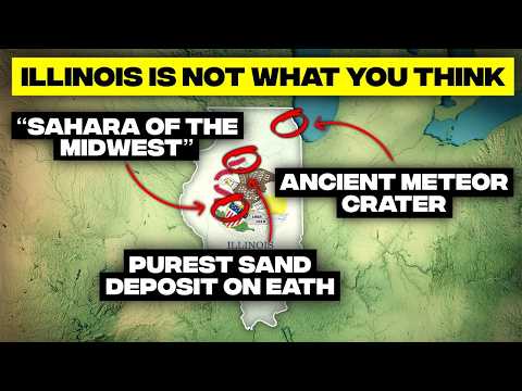
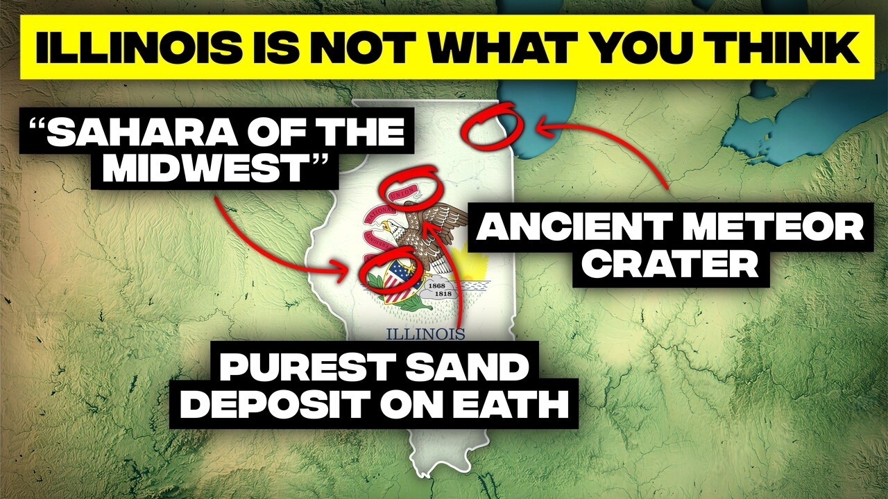
Chicago's hidden meteor crater, buried underground.
Beneath O'Hare Airport lies the Des Plaines Disturbance, a 5-mile wide impact zone created approximately 280 million years ago by a space rock. The impact shoved bedrock downward, then caused the center to rebound upward by nearly 800 feet. Today, this ancient crater is buried under glacial sediment, invisible to the eye, yet perfectly preserved in the fractured rock below, a geological secret beneath suburban Chicago.
America's biggest earthquakes once rocked Illinois.
In 1811 and 1812, the New Madrid earthquakes, among the largest ever recorded east of the Rockies, shook Illinois. So powerful were these quakes, estimated at magnitude 7 plus, that they made the Mississippi River run backward and caused the prairie to roll like waves. Chimneys collapsed in St. Louis, and church bells rang in Boston, a stark reminder of Illinois's seismic potential, as the fault remains active today.
The land of 10,000 sinkholes, a Swiss cheese landscape.
Parts of southwestern Illinois, specifically Monroe and St. Clair counties, sit on what is known as the Sinkhole Plain, home to over 10,000 sinkholes. This makes it one of the densest sinkhole regions in North America. Rainwater dissolves the underlying limestone, creating a subterranean world of caves and underground rivers, where entire streams can vanish into sudden swallow holes, a challenging landscape for farmers.
Illinois's alien state fossil, a prehistoric enigma.
The Tully Monster, Illinois's official state fossil, is a soft-bodied, foot-long creature with stalked eyes and a claw-like mouth, found nowhere else on Earth. Discovered in the Maison Creek beds, these 300-million-year-old fossils are so bizarre that scientists debated their classification for decades. Experts now believe it was a primitive cordate, yet its unique anatomy continues to defy easy categorization, making it a truly unique Illinois oddity.
Ancient rainforests now form Illinois's coal seams.
Illinois's vast coal seams are not merely rock, but the compressed remains of a massive tropical rainforest. During the Carboniferous period, about 300 million years ago, Illinois was near the equator, covered by steaming swamps of giant ferns and 100-foot-tall club moss trees. When these jungles died, they were buried and transformed into coal, with some mines even revealing fossilized forests preserved on their ceilings, a prehistoric Pompeii.
Illinois remains earthquake country, with active faults.
Despite its calm appearance, southern Illinois lies on two active fault systems: the New Madrid and Wabash Valley seismic zones. These faults are capable of producing major earthquakes, as evidenced by a magnitude 5.2 quake in 2008 near Mount Carmel, which rattled buildings as far as Chicago. Geologists estimate a 25 to 40 percent chance of a magnitude 6 plus earthquake in the next 50 years, making earthquake preparedness a necessity.
The ice age glacier that gave Illinois its name.
One of North America's major glacial periods is literally named after Illinois: the Illinoisan glaciation. Around 300,000 years ago, massive ice sheets pushed farther south than almost any other ice age event, reaching nearly to the Mississippi River near Carbondale. These glaciers flattened northern Illinois, carved lowlands, and deposited the rich black soils that characterize the state today, making Illinois a defining location in glacial history.
A buried Grand Canyon hides beneath cornfields.
Underneath central Illinois's flat cornfields lies the Mahomet Bedrock Valley, a buried canyon so vast it rivals major river systems. This ancient valley stretches 120 miles long and drops 300 feet deep, carved long before glaciers existed. When the ice age arrived, glaciers filled it with sand and gravel, sealing it from view. Today, it forms one of the largest aquifers in the Midwest, storing trillions of gallons of groundwater.
Chicago built upon a 425 million year old coral reef.
Chicago rests on top of a 425-million-year-old tropical coral reef. During the Silurian period, Illinois was covered by a warm, shallow sea teeming with corals and other marine life. When the sea receded, it left behind thick layers of fossil-rich Niagara limestone. The massive Thornton Quarry, 90 meters deep, offers a dramatic cross-section of this ancient reef system, a prehistoric tropical paradise now underlying a major modern city.
Chicago's ghost shorelines, now city streets.
Many of Chicago's subtle hills are not hills at all, but ancient shorelines. After the ice age, Glacial Lake Chicago was much larger and 20 feet higher than modern Lake Michigan. Its waves built long ridges of sand and gravel that now form city streets and neighborhoods. Roads like Ridge Avenue literally trace these old beach dunes, preserving the sandy memory of a vanished lake within the city grid.
Illinois was once an oceanfront 70 million years ago.
About 70 million years ago, Illinois had a coastline, specifically the western shore of the Western Interior Seaway, an ancient ocean that split North America in two. Southern Illinois was a steamy tropical coastline of lagoons and sandy beaches. Marine fossils and ancient beach sediments in extreme southern Illinois confirm this. Wells tapping the Owl Creek Formation still yield shark teeth and shells, remnants of a time when giant mosasaurs cruised where cornfields now stand.
Illinois's calm geography hides an apocalyptic past.
Water's Wild Power: Rivers, Lakes, and Floods
Where the mighty Mississippi gets truly humbled.
At the very southern tip of Illinois, near Cairo, the Ohio River meets the Mississippi. Despite the Mississippi's legendary status, the Ohio arrives with nearly 50 percent more water, about 7,960 cubic meters per second compared to the Mississippi's 5,900. Hydrologically, the Mississippi should arguably be renamed the Ohio from this point onward, as the two rivers run side by side in distinct colors before blending.
An ice age mega-flood that reshaped the state.
Around 19,000 years ago, Illinois experienced a flood so immense it dwarfed modern rivers. The Kankakee Torrent, unleashed by a broken glacial dam, carried 10 times the Amazon's flow. In just days, it carved the Illinois River Valley, ripped out truck-sized boulders, and gouged deep canyons like those at Starved Rock State Park, sculpting cliffs and waterfalls in a geological instant.
Chicago's inland tsunami, a freshwater monster.
On June 26, 1954, Chicago was struck by a 10-foot wave on Lake Michigan, sweeping fishermen off piers and claiming eight lives. This was not a storm surge or earthquake, but a seiche, a giant standing wave caused by sudden pressure changes sloshing water across the lake. Lake Michigan's long, narrow shape amplified the wave into a genuine freshwater tsunami, a rare but powerful reminder of the Great Lakes' might.
A single lake could drown the entire state.
Illinois only touches a sliver of Lake Michigan, yet that sliver belongs to a true inland ocean. The lake contains an astonishing 1,180 cubic miles of water, enough to submerge the entire state of Illinois under 100 feet of water. Its sheer size creates ocean-like waves during storms and influences northeast Illinois's climate, cooling summers and fueling lake effect snow.
America's great rivers converge in Illinois.
Illinois sits at a critical river crossroads. At Grafton, the Mississippi, Missouri, and Illinois rivers meet, forming an outrageous triconfluence. Farther south in Cairo, the mighty Ohio River joins the Mississippi. These systems collectively drain over 40 percent of the continental United States, funneling water from the Appalachians, Great Plains, and Rockies past Illinois, making it a central hub for North American waterways.
Illinois's only federally designated wild and scenic river.
While not known for pristine rivers, Illinois boasts one federally designated Wild and Scenic River: the Middle Fork of the Vermilion River. This emerald green stretch cuts through 75-foot sandstone bluffs and flows freely, a rarity in Illinois, hosting otters, great blue herons, and endangered muscle species. Its wild character, requiring bushwhacking to access some sections, offers a hidden wilderness experience for paddlers.
Ancient mega-flood left behind hanging waterfalls.
The Kankakee Torrent, the colossal flood that ripped through Illinois 19,000 years ago, left a unique geological signature: hanging waterfalls. When the torrent carved the Kankakee and Illinois River valleys incredibly deep, smaller tributary streams couldn't erode downward fast enough. This left them perched above the new valley floor, spilling over cliffs. At Kankakee River State Park, Rock Creek drops over an intense waterfall because the main gorge sits far deeper than it naturally should, a scar of catastrophic flooding.
Oxbow Lake, a bayou born from the Mississippi.
Just across from St. Louis, Horseshoe Lake, a 2,400-acre oxbow, appears so swampy it resembles Louisiana. Formed when the Mississippi River abandoned one of its giant meanders, this crescent-shaped lake is shallow, only 3 to 4 feet deep, yet teems with life. Lotus blooms, cattails, and swamp timbers evoke the deep south, with Spanish moss hanging from trees. It is Illinois's second largest natural lake, a direct result of the river redrawing its own path.
Kettle lakes, footprints of long vanished ice.
Northern Illinois is dotted with kettle lakes, formed by literal chunks of dead glaciers. When the Wisconsinan glacier retreated 14,000 years ago, giant blocks of ice broke off, got buried in sediment, and slowly melted over centuries. Each disappearing block left behind a water-filled depression. The Chain O'Lakes region is a prime example, a maze of shallow lakes connected by channels, each a shimmering basin that marks where frozen blocks once sat.
America's ancient Nile, a fertile flood plain.
The American Bottom, a massive Mississippi flood plain up to 10 miles wide and 80 miles long in southwestern Illinois, once rivaled the Nile Delta in fertility. Its rich soils supported Cahokia, a city of 20,000 people and the largest civilization north of Mexico. Before modern levies, it was a patchwork of marshes and oxbow lakes, an ecological powerhouse that fed a continent-scale civilization, with remnants still visible today.
Cave-in Rock, a notorious pirate hideout.
On the Ohio River banks sits Cave-in Rock, a 55-foot wide cavern carved into a towering limestone bluff. In the late 1700s and early 1800s, this cave became a notorious hideout for river pirates, counterfeiters, and bandits who ambushed flatboats. The cave stretches over 100 feet into the rock, with a natural stone arch framing the Ohio River. Before outlaws, indigenous peoples used it for shelter, and even Abraham Lincoln passed by.
Bald eagles flock to Illinois each winter.
Every winter, Illinois transforms into one of the best bald eagle habitats in the lower 48 states. Thousands of eagles migrate to the Mississippi and Illinois rivers, drawn by open water below locks and dams that create ideal fishing grounds. Some winters, counts exceed 3,000 eagles, turning river bluffs into giant roosting platforms. This makes Illinois one of the most reliable wintering spots for America's national bird, a quiet spectacle in corn country.
It's one of the most surreal landscapes in the Midwest, the kind of place that makes you double check the map to confirm you didn't teleport to Louisiana.
Ecological Anomalies: Deserts, Bogs, and Prairies Lost
Illinois's surprising desert dunes, a Sahara remnant.
Illinois once harbored a desert, and small parts still exist. After the Kankakee Torrent left enormous fields of loose sand, winds whipped these deposits into dunes that stretched for miles. This created a barren environment early settlers called the "Sahara of the Midwest." Today, Sand Ridge State Forest preserves what remains, with rolling dunes and dry prairie supporting species like prickly pear cactus and heat-loving lizards, a bizarre ecological mashup.
The cactus that shouldn't exist, thriving in Illinois.
Yes, Illinois has wild cactus, and not just a few stray plants, but thriving native populations. The eastern prickly pear grows in sandy prairies and dunes across the state, bursting with bright yellow flowers in summer. These cacti are not invaders; they are remnants of a 1,000-year drought period after the last ice age, when desert-like conditions extended much farther east. They stubbornly remained as the climate shifted back to wetter weather.
The Prairie State lost almost all its prairie.
Illinois proudly calls itself the Prairie State, yet almost none of its namesake ecosystem remains. Before European settlement, approximately 22 million acres, or 61 percent of Illinois, were covered in tallgrass prairie. Today, less than 2,500 acres survive, a loss so profound that the ecosystem is functionally extinct in the state. Most remaining patches exist in old pioneer cemeteries, untouched by the plow, offering a glimpse of Illinois's vanished natural heritage.
The bog that moves under your feet.
North of Chicago lies Volo Bog, a true Arctic-style quaking bog where the ground literally moves. Thousands of years ago, it was a deep glacial lake. Over time, sphagnum moss grew across the surface, forming a floating peat mat that wobbles like a giant waterbed. Visitors walk boardwalks past carnivorous sundews and rare orchids, but stepping off means sinking straight through the vegetation into cold water. The entire surface trembles when people walk, making it a bizarre, alien ecosystem.
Illinois's coastal wilderness, a unique shoreline.
Illinois Beach State Park protects the state's last untouched stretch of Lake Michigan shoreline, a wild 6.5-mile corridor of dunes, swales, oak savanna, and rare coastal wetlands. This area is a living snapshot of the Great Lakes post-ice age, hosting prickly pear cactus, carnivorous plants, rare orchids, and over 650 plant species. Visitors can traverse from beach to desert-like hollows to swamp forest within minutes, revealing a unique Midwest coastal wilderness.
The blackest, richest soil on Earth.
Illinois's agricultural power stems from its jet-black prairie soil, specifically Drummer Silty Clay Loam, the official state soil. It features a 16-inch layer of organic matter so dark and nutrient-dense that early settlers called it "black velvet." This soil was built grain by grain as prairie grasses grew, died, and decomposed for millennia. Though erosion has taken its toll, Illinois still possesses some of the most productive soil on Earth, a literal remnant of the ancient tallgrass prairie.
Life in the underworld, an alien cave ecosystem.
Descending into an Illinois cave reveals an ecosystem that might as well be extraterrestrial. The state's cave networks, particularly in the sinkhole plain, host creatures found nowhere else. Blind cavefish navigate by touch, translucent amphipods, bright orange cave salamanders, and insects so adapted to darkness they've lost their eyes and pigmentation entirely. Some species have evolved underground for so long that sunlight is literally fatal to them, forming an inverted rainforest beneath cornfields.
Unseen Heights: Cliffs, Canyons, and Unexpected Bluffs
Illinois's Garden of the Gods, a piece of Utah.
Southern Illinois hosts the Garden of the Gods within Shawnee National Forest, a place that feels like a piece of Utah dropped into the Midwest. It features towering 300-million-year-old sandstone formations, hoodoos, balanced rocks, and sheer cliffs that glow orange at sunset. This landscape exists because glaciers never reached this uplifted plateau, allowing erosion to carve unreal shapes over millions of years, so iconic it appeared on a US quarter.
Waterfalls in flatland, a surprising spectacle.
Illinois is not known for waterfalls, yet southern Illinois hides cascades reaching 60 to 100 feet after heavy rain. Burden Falls in Shawnee National Forest drops around 20 feet in a single freefall before tumbling down nearly 80 more feet of rocky rapids. Nearby Packen Tuck Falls boasts Illinois's biggest sheer drop at over 60 feet. These waterfalls roar like something from the Appalachians in spring, shrinking to trickles in dry summers.
An underground wonderland, Illinois's longest cave.
Southern Illinois doesn't just have sinkholes, it has an entire underground world beneath them. The region contains a sprawling cave network, including Fogelpole Cave, a labyrinth stretching over 15 miles long. This makes it the longest cave in Illinois and one of the top 60 longest in the US. Its chambers host stalactites, bat colonies, and unique creatures like blind cavefish, forming Illinois's own subterranean Ozarks.
Waterfalls and canyons in Little Egypt.
Southern Illinois, often called Little Egypt, defies the state's flat reputation with its rugged sandstone canyons. These hide some of the state's most insane waterfalls. Burden Falls drops nearly 100 feet through fern-lined cliffs. Jackson Falls pours into a box canyon popular with rock climbers. Bellsmith Springs features turquoise pools and natural stone bridges, all carved from tough Pennsylvanian sandstone that resisted glacial erosion, creating a water-sculpted world.
Towering palisades on the Mississippi River.
In far northwestern Illinois, the Mississippi River flows between 200-foot dolomite cliffs known as the Mississippi Palisades. These sheer rock walls rise straight from the water, resembling Midwestern fjords. Once lookout points for Native American nations, they now host peregrine falcons and rare cliff-dwelling plants. The cliffs are ancient Silurian reef rock, carved into vertical ramparts by millions of years of erosion, igniting with autumn foliage over the wide river.
Dust-built hills, fertile but surprisingly unstable.
Western Illinois features hills built not by water or glaciers, but by massive dust storms. During the last ice age, winds lifted fine glacial flour from dry riverbeds, depositing it in thick layers along the Mississippi and Illinois river valleys. The result is "loess hills," towering 30-foot thick blankets of wind-blown silt. This soil is incredibly fertile, some of the best farmland on Earth, yet also extremely unstable and prone to landslides after heavy rain.
Geological Riches and Shifting Landscapes
Fluorite treasure trove, Illinois's state mineral.
Southern Illinois once produced more fluorite than anywhere else in America. Miners discovered pockets lined with soccer ball-sized violet crystals sparkling in the dark. Fluorite, Illinois's official state mineral, forms perfect geometric cubes ranging from neon purple to blue, green, and rainbow hues. The Illinois, Kentucky Fluorspar District supplied steel mills nationwide, with mines in Hardin and Pope counties plunging over 1,000 feet underground. Much of this mineral wealth traces back to Hicks Dome's volcanic activity.
Glass sand capital, the purest silica on Earth.
Ottawa, Illinois, sits atop one of the purest silica sand deposits on Earth: the St. Peter Sandstone. Over 99.5 percent pure silica, it's so uniform and clean that it's ideal for high-quality glass, from mason jars to smartphone screens. Ottawa hosts North America's largest silica sand mine, shipping over 2 million tons annually. These sands began as beaches in an Ordovician sea 450 million years ago, naturally refined by geologic processes.
From scorching heat to arctic cold, extreme swings.
Illinois experiences one of the most chaotic weather identities in the country. The state's record high is 117 degrees Fahrenheit in East St. Louis, while its record low is -38 degrees Fahrenheit in Mount Carroll. This absurd 155-degree swing means Illinoisans can experience tropical humidity in summer, with cornfields amplifying heat, and polar vortex events in winter, pushing wind chills near -60 degrees Fahrenheit, resembling conditions in northern Canada.
A continental divide you can easily walk across.
Most continental divides are towering mountain chains, but Illinois's is a half-submerged swamp. The Chicago Portage is one of the lowest continental divides on Earth, only about 600 feet above sea level, so subtle you could cross it without realizing. A raindrop falling on one side eventually reaches the Gulf of Mexico via the Mississippi, while a drop a few blocks away flows to the Atlantic via Lake Michigan and the St. Lawrence Seaway. This ridge was Chicago's original shortcut and reason for global city status.
A town that literally moved to survive the river.
After the catastrophic 1993 flood submerged Valmeyer, Illinois, under more than 15 feet of water, residents made a radical decision: relocate the entire town. Houses, churches, businesses, and even cemeteries were rebuilt 2 miles away and 400 feet higher on safe bluffs above the flood plain. Today, New Valmeyer thrives on high ground, while the old town sits abandoned, a ghost grid of foundations visible only when river levels drop, one of America's most insane climate adaptation stories.
Dunes by the inland sea, a Great Lakes anomaly.
Illinois Beach State Park boasts a dune system so intense it feels like a mini Outer Banks grafted onto Lake Michigan. Waves and wind sculpted these ridges over thousands of years, building 30-foot dunes with wet swales between them. These swales host rare orchids and carnivorous plants, while the dunes support prickly pear cactus and six-lined racerunner lizards. The dunes are alive, literally migrating as wind, storm surges, and vegetation patterns shift, creating a weird freshwater hybrid of desert, forest, and coast.
Illinois's hidden bayou, a Southern landscape.
If someone showed you a photo of the Cache River wetlands, you'd swear it was Louisiana, not Illinois. Deep in the far southern tip of the state lies one of the northernmost cypress-tupelo swamps on Earth, where thousand-year-old bald cypress trees rise from dark, tea-colored water. Their massive trunks and knobby knees create a scene straight out of the Deep South. This swamp is so biologically rich it earned a Wetland of International Importance designation, making you double-check the map to confirm you didn't teleport.
Illinois proves that even the most seemingly ordinary landscapes conceal extraordinary geographic narratives. What appears uniform on the surface often hides deep-time processes, cataclysmic events, and ecological plot twists. The world, as Across The Globe always reminds us, is far stranger and more dynamic than any textbook can fully capture, and Illinois, the unassuming heartland, is a testament to that wild, unfolding story.


