Forget everything you think you know about Iowa, the supposed pancake-flat heartland of endless corn. Beneath its agricultural veneer lies a geological tapestry woven with cosmic impacts, prehistoric oceans, and landscapes so bizarre they defy easy categorization. This is a state where glaciers skipped entire regions, leaving behind alpine-like bluffs and ice-filled caves that grow thickest in June. It is home to mountains made of windblown dust found in only one other place on Earth, and a lake that can quadruple its size in days, transforming from a reservoir into an inland sea. Iowa's geography is a masterclass in unexpected twists, a land far wilder and more ancient than any school textbook might suggest.
Iowa's Unseen Alps: The Driftless Anomaly
In a geological paradox, a vast pocket of northeast Iowa, spanning some 24,000 square miles, remained untouched by the mile-thick glaciers that flattened much of the Midwest during the last Ice Age. While the rest of the region was steamrolled into a tabletop, this area was mysteriously bypassed, a fact that went unnoticed by researchers for centuries. The prevailing theory suggests that fractured bedrock beneath this "Driftless Area" efficiently drained glacial meltwater, denying the ice sheets the lubrication they needed to advance. The result is a landscape locals affectionately call the "Switzerland of Iowa," characterized by dramatic 500-foot bluffs, deep river valleys, and a labyrinth of karst caves, a stark contrast to the state's popular flatland image.
These ancient formations hold remarkable secrets, including natural air conditioning systems hidden within their hillsides. Fissures vent air from year-round underground ice, creating microclimates that have preserved Ice Age plants and allowed the endangered Iowa Pleistocene snail to survive for 10,000 years beyond its presumed extinction. This quarter-inch ghost, with a lineage stretching back 400,000 years, was rediscovered in 1955 on these same algific talus slopes, which are fractured rock hillsides that maintain a chilling 50 degrees Fahrenheit even during humid July days. Iowa's Driftless Area contains over half of the world's known algific talus ecosystems, literal fragments of the Pleistocene tucked between, unexpectedly, cornfields.
The region also boasts other hydrological marvels. Big Spring in Clayton County acts as a high-speed plumbing system for the countryside, normally flowing at 20,000 to 30,000 gallons per minute, but exploding at an outrageous 150,000 gallons per minute during heavy rains. Despite these surges, the water maintains a steady 48 to 50 degrees Fahrenheit, creating an ideal oxygen-rich environment for the 150,000 rainbow trout raised there annually. Scientists have used this site since 1981 to track the alarmingly fast speed at which surface fertilizer from agricultural fields travels through the aquifer and erupts into the spring, highlighting the dangerous connection between Iowa's surface and subterranean waters.
This karst topography also manifests in over 40,000 sinkholes and depressions across the state, a landscape secretly resembling Swiss cheese. These pits sit above ancient soluble limestone, where entire creeks routinely vanish underground, only to resurface miles away. Early surveys missed the sheer scale of these features, but modern LIDAR mapping has revealed their true extent. Beyond the geographical curiosity, these sinkholes act as direct conduits, bypassing the soil's natural filtration and allowing surface contaminants like fertilizer or manure to reach drinking water supplies in mere hours, emphasizing the fragility of the state's interconnected water systems.
Maquoketa Caves State Park, the self-proclaimed caving capital of the Midwest, showcases 13 primary caves carved into 430 million-year-old dolomite, all packed into a single park. Highlights include Dance Hall Cave, a massive 1,100-foot passage with a paved walkway, a dramatic 50-foot natural arch, and a 17-ton balanced rock perched precariously by millennia of erosion. In Decorah, Dunning Spring Falls plunges approximately 200 feet down a karst bluff, a multi-stage waterfall fed by the Galena aquifer at a constant 45 degrees Fahrenheit. Every drop is filtered through ancient limestone before cascading past a picturesque stone bridge, a vertical wilderness in a region most people imagine as perfectly level. Even the last glacier to visit Iowa, the Des Moines lobe, arrived late, 13,800 years ago, thousands of years after the Ice Age's peak, pushing south at a breakneck 1 to 2 kilometers per year and flattening established spruce forests, leaving behind fertile kettle plains.
One of the most striking examples of this backward geography is the Decorah Ice Cave, where ice grows thickest in June and melts in winter. This 120-foot limestone passage traps sinking winter air, which freezes groundwater, battling straight through the summer heat. The mystery was famously solved in 1898 by a local teenager, Alois Kovaric, who later became a Yale physicist and was the first person to date the Earth using radioactivity. Despite a rockfall in the 1990s limiting access, it remains a freak of nature, an Ice Age remnant where one can touch midsummer glaciers in the Iowa cornfields.
Echoes of Ancient Oceans and Cosmic Impacts
Long before cornfields, Iowa was a canvas for dramatic planetary events. The state literally swallowed one of the most violent episodes in North American history: the Manson impact structure. A 22-mile wide crater created when a 1.2-mile wide asteroid slammed into Pocahontas County at an astounding 45,000 miles per hour. This is the biggest confirmed impact site in the American interior, yet it remained unnoticed until the 1950s, buried beneath 500 feet of glacial debris. The collision pulverized 1.5 billion-year-old rock, forcing the ground to rebound and splash upward like water, forming a central peak 4,000 feet high. For five years, Manson was even considered the leading suspect in the extinction of the dinosaurs, until 1998 when USGS scientists redated shocked feldspar from the site to 74.1 million years ago, approximately 10 million years too early to be the killing blow. Even as a runner-up, the blast was catastrophic, vaporizing everything within 650 miles and launching shocked quartz as far as Colorado.

The impact left a lasting mark, even on the local water supply. The town of Manson, unaware of its cosmic heritage, became famous for its mysteriously soft water. In 1912, drillers discovered a strange jumbled mess of rock fragments underground, later identified as impact breccia, the pulverized rock acting as a natural filter. This made the water so uniquely soft that the town branded itself the "soft water capital of the world." There was a catch, however: the super-soft water carried fluoride levels of 10 milligrams per liter, more than double the EPA limit. Today, Manson uses a treatment plant to manage this surge, a direct consequence of drawing water from a million-year-old aquifer trapped inside an ancient cosmic scar.
Remarkably, Iowa harbors not one, but two buried craters. Directly under the streets of Decorah lies a 3.5-mile wide basin formed 470 million years ago when a meteor slammed into a shallow tropical sea with the force of 1,000 megatons. Confirmed in 2012 by gravity and electromagnetic surveys, this crater sits as little as 50 feet below the surface. Its shale-filled basin preserves a unique fossil ecosystem, including the *Pentecopterus decorahensis*, a 5.5-foot sea scorpion that is the oldest known eurypterid on Earth. Scientists even had to dam a section of the Upper Iowa River and pump it dry to reach the fossil layer, a race against the current to uncover a monster buried for nearly half a billion years. These invisible cosmic scars highlight Iowa's deep geological history.
Hundreds of millions of years before the first dinosaur, Iowa was a tropical paradise situated just south of the equator. During the Devonian Age of Fish, a buzzing barrier reef thrived here in shallow 86-degree Fahrenheit seas. The Great Flood of 1993, while devastating, accidentally revealed a window into this ancient world. Water flowing over the Coralville Lake spillway for 28 straight days stripped away 17 feet of soil and 5 feet of solid limestone, exposing a 375 million-year-old seabed. Today, the Devonian Fossil Gorge allows visitors to walk across a prehistoric tropical ocean floor, with fossilized coral and ancient sea life, such as honeycomb corals, trilobites, and *Hexagonaria*, frozen in Iowa's bedrock. It drew 100,000 visitors in just months after the floodwaters receded, a natural disaster transforming into one of the world's most accessible paleontology sites. The spookiest resident of these ancient seas was the *Dunkleosteus*, a 30-foot armored predator whose bony plates have been found on site.
During the Pennsylvanian period, roughly 300 million years ago, Iowa entered its jungle phase, sitting directly on the equator of the supercontinent Pangea. Instead of corn, it was covered in thick tropical swamps filled with 100-foot *Lepidodendron* scale trees, massive bark-covered club mosses that were not actual wood. These massive jungles thrived when waters receded, eventually compressing into the coal deposits found today. Due to oxygen levels way higher than modern atmospheres, this Iowa jungle was home to dragonflies with two-foot wingspans and millipedes the size of canoes. About 340 million years ago, the area around Burlington was covered by a sea so rich in crinoids, feathery animals related to starfish, that their skeletons built up to form limestone beds hundreds of feet thick. This Burlington limestone, often called encrinite, is famous globally as a geological reference. The Des Moines County Heritage Center houses the world-renowned Tibbetts collection of 3,000 specimens, including rare, perfectly preserved crinoid crowns, cementing Burlington's claim as the "crinoid capital of the world." In 1931, farmer Bernice Bean unknowingly saved a prehistoric mass burial when she pulled a 600-pound limestone slab from a rock crusher at the Leland Quarry. This 3 by 5-foot slab contained 183 starfish, 12 sea urchins, and 2 trilobites, with preservation so outrageous that some species still showed their original color differences after 340 million years.
Iowa's ancient past also connects to pivotal moments in exploration. The only surviving natural history specimen from the Lewis and Clark expedition came from Iowa. In 1804, Sergeant Patrick Gass discovered a Cretaceous fish jawbone, *Squalicorax falcatus*, in the Missouri River bluffs of Harrison County, which became the first fossil ever described from the famous Niobrara Chalk. While nearly all 122 animal specimens collected during the journey disappeared, this jawbone and around 220 pressed plants survive at Philadelphia's Academy of Natural Sciences, a testament to an Iowa riverbank's unexpected contribution to history. Despite its rich fossil record, finding dinosaur fossils in Iowa is nearly impossible, as the state spent the Cretaceous period submerged under the Western Interior Seaway. Iowa's entire dinosaur record is limited to a handful of hadrosaur vertebrae; one famous 4-inch bone, pulled from a 1930s gravel pit, spent decades as a household doorstop before its true value was realized. In a more recent discovery, August 2024 saw archaeologists pull a three-foot long mastodon skull from a Wayne County Creek, preserved for 13,600 years in oxygen-free saturated sediment, offering a glimpse into the moment when giants and humans shared the same Iowa land.
In the absolute northwest corner of Iowa, Gitchie Manitou State Preserve showcases the state's ancient skeleton: pinkish-red Sioux Quartzite outcrops, around 1.6 billion years old. Among the oldest exposed rocks in the Midwest, this stone, composed of 95 percent quartz sand coated in iron oxide, is harder than steel. Glaciers couldn't crush it; instead, they polished its surfaces to a glass-like shine, leaving deep grooves, or striae, from rocks dragged by ice 500,000 years ago. This ancient rock also hints at a dramatic continental event. One billion years ago, North America nearly ripped itself apart, and the seam runs directly through Iowa. The Midcontinent Rift System is a 1,900-mile failed ocean where the Earth's crust began to tear open, an event that produced enough lava to bury the entire modern United States under 900 feet of basalt. In Iowa, this ancient scar is buried beneath 15,000 feet of sediment and rock, a massive volcanic feature the size of Minnesota's mineral-rich Duluth complex, suggesting that Iowa literally held North America together.
Wind-Sculpted Peaks: The Loess Hills Enigma
Rising 200 feet above the Missouri River flood plain, Iowa's Loess Hills are a geological anomaly that most people drive past without a second glance. This 200-mile ridge system is not made of rock, but of glacial flour, fine silt ground by Ice Age glaciers and drifted into massive piles by strong winds over thousands of years. While loess deposits exist worldwide, formations this thick and intricately carved are found in only two places on Earth: western Iowa and China's Shanxi Province. It is a globally rare terrain hiding in a state most people fly over without a second thought.
Tucked within these hills is a terrifying bookmark from 640,000 years ago: a gray ribbon of volcanic ash from the Yellowstone supervolcano. While the primary fallout was several inches thick across the Midwest, specific pockets in Harrison County still hold massive 15-inch lenses of this ancient debris. This was a supersonic cloud of glass shards that choked wildlife across the heartland, and today, this ash layer sits inside Iowa's windblown hills as a grim reminder that the state once sat directly downwind of America's most famous geological ticking time bomb.
Up on Murray Hill in Harrison County, Iowa behaves more like a desert than anyone would believe. This mountain of dust rises 350 feet above the flood plain, spearing razor-thin ridgelines less than 10 feet wide, with near-vertical 60-foot drops on either side that resemble fins, not rolling hills. Because these windblown slopes drain water instantly, they create a truly bizarre microclimate. Just feet from thick forest, you'll find yucca and prickly pear cactus thriving on parched, sunbaked spines, a rugged desert environment hidden in the heart of the Midwest. The Loess Hills are an "impossible ecosystem," a pocket of Great Plains life shoved deep into the Midwest where it has no business existing. These vertical prairies are so steep and well-drained that they support species found nowhere else in Iowa, including soapweed yucca at its absolute easternmost limit, alongside the plains spadefoot toad and the ornate box turtle. In 1986, researchers discovered the prairie moonwort, a tiny fern thought to be completely endemic to this single Iowa landform.
"Iowa's unique geography connected to the biological pulse of the entire continent through a column of spinning birds."
However, these unique formations are actively eating themselves. The Loess Hills are disappearing at 40 tons per acre annually, eight times the sustainable rate for most soils. Because saturated silt has zero structural strength, these hills are essentially consuming themselves. This instability creates "cat steps," distinct stair-like terraces formed by slumping soil and livestock movement. Even more unsettling is "piping," where water carves hidden tunnels through the soft silt underground, which eventually collapse, triggering sudden sinkholes with no warning. Between miles-long gullies and subterranean voids, the Loess Hills are one of America's fastest disappearing natural wonders.
Despite significant changes to its natural landscape, Iowa still holds precious fragments of its original wilderness. While 99.9 percent of Iowa's original prairie is gone, one 4,500-acre piece at Broken Kettle Grasslands still resembles the year 1800. This is the state's biggest remaining tallgrass prairie, home to a genetically pure herd of over 200 bison, reintroduced from South Dakota in 2008. The preserve is a sanctuary for specialists, hosting Iowa's only verified population of prairie rattlesnake, rediscovered in 1999 after decades of presumed extinction, and the state's only nesting site for the black-billed magpie. It is a last fraction of a percent still holding on.
The Loess Hills also funnel the sky, creating a premier raptor migration corridor. At Hitchcock Nature Center, an observation tower sits 45 feet above a ridge that monitors one of North America's most important migratory routes. In a single record-breaking season, spotters logged 16,000 raptors across 20 different species. On the right day, one might witness a "kettle," a swirling vortex of hundreds of broad-winged hawks rising together like a raptor tornado. Iowa's unique geography, therefore, is connected to the biological pulse of the entire continent through a column of spinning birds.
A Nation's Hydrological Heartbeat
Iowa is the only U.S. state where its entire eastern and western borders are defined by navigable rivers, the Mississippi to the east and the Missouri and Big Sioux to the west. While other states border major waterways, none are bookended by parallel navigable rivers for their full length. Iowa's 491-mile Mississippi stretch alone has 11 locks and dams, serving as a vital industrial artery. Geographically, Iowa stands as the definitive river-locked heart of the nation, a state held in place by two of the biggest rivers on the continent.

Every raindrop that falls in Iowa, without exception, ultimately reaches the Gulf of Mexico. Every single square inch of the state sits within the Mississippi and Missouri drainage basin, the fourth largest on the planet. Whether a drop falls in the northwest corner or the southeast tip, gravity pulls it towards the same destination. This massive natural funnel covers 41 percent of the lower 48 states, and Iowa is completely immersed in it, with over 70,000 miles of internal streams fueling the flow. It is a 90-day, 2,000-mile journey from an Iowa cornfield to the Louisiana coast.
Most people picture the Rocky Mountains when they hear "continental divide," but Iowa has its own version, nestled in a cornfield. On Highway 44, a sign marks the Missouri and Mississippi watershed divide at 1,440 feet. This hydrological ridge dictates the fate of every raindrop: drops falling mere yards apart embark on wildly different 2,000-mile journeys, one flowing to the Missouri River system, the other to the Upper Mississippi. Both eventually meet in the Gulf, but this regional divide separates the continent's two biggest river systems, Iowa's humble, flatland version of a mountain peak, marked with a roadside sign.
The Missouri River, however, is a ghost of its old self. A century ago, it was 200 miles longer, a chaotic 2,540-mile beast of shifting mud flats and massive oxbow loops. Starting in 1912, the Army Corps of Engineers began to tame it, cutting through bends, straightening channels, and shortening the river's path by about 10 percent. Between Sioux City and St. Louis alone, 127 miles of river simply disappeared. This made barge travel efficient, but the price was an 83 percent loss of the river's natural wetlands, 200 miles of river erased to make shipping faster.
One of the most peculiar geographic accidents resulting from river alteration is Carter Lake, an Iowa town stranded behind a wall of Nebraska soil. In March 1877, a massive ice jam forced the Missouri River to carve a new channel over a mile to the southeast in a single night. This left a 1,200-acre chunk of Iowa physically stuck on the wrong side of the river, inside Omaha. The Supreme Court ruled the land remained Iowan, creating a legal island within a Nebraska city. For decades, this jurisdictional limbo turned the town into a "sin city" hub for gambling and underground boxing, as Nebraska police had no authority and Iowa was too far away to effectively care.
The engineers, however, were not always in charge. Driven by a 212 percent Rocky Mountain snowpack, the 2011 Missouri River flood became a three-month slow-motion disaster. Runoff surged to 246 percent of normal, turning Interstate 29 into a lake and making the river uncrossable for 100 miles. The saturated ground turned to soup, and floodwaters completely surrounded the Fort Calhoun nuclear power station, which survived as an island behind a rubber aqua dam that famously collapsed during the ordeal. With record-shattering releases from Gavins Point Dam, the river spent the entire summer proving exactly who was in charge.
In 1960, the Army Corps of Engineers inadvertently created an accidental bird sanctuary. They cut off a massive U-shaped Missouri River meander to clear dangerous flight paths for Omaha's airport, creating Dodge Lake, a seven-mile oxbow. This lake accidentally became one of the most important bird sanctuaries on the continent, with peak migration counts exploding to 700,000 snow geese, turning the lake white during spring flyovers. The project also unearthed something nobody expected: the 1865 wreck of the steamboat Bertrand, buried in the silts of the abandoned channel, containing 250,000 perfectly preserved artifacts. A safety project that became an archaeological jackpot and a bird paradise, none of which was planned.
Water's Wrath and Engineered Resilience
Iowa has a tumultuous relationship with water, exemplified by its history of devastating floods. In July 1993, the Raccoon River breached its levee and drowned Des Moines's water treatment plant. 250,000 residents lost potable water for 19 straight days. Every single Iowa county was declared a federal disaster area. As the state's runoff surged downstream toward St. Louis, the Mississippi, at its peak, was flowing at 1,080,000 cubic feet per second, a volume capable of filling Bush Stadium in just 70 seconds. Iowa did not just flood, it shut off.
Even further back, in 1851, the sky over Iowa unleashed an unprecedented deluge. While the state normally receives a chill 32 inches of precipitation a year, that single season dumped a world record 74.5 inches, more than double the annual average. The "Great Freshet" basically deleted towns; the settlement of Dudley was wiped completely off the map, forcing survivors to flee and found the town of Carlisle on higher ground. Even though dozens of Iowa counties did not even exist yet, this 175-year-old record still has not been touched, remaining one of the most written-about catastrophes in Iowa's history.
More recently, on June 13, 2008, the Cedar River ambushed Cedar Rapids, cresting at 31.12 feet, shattering the 1929 record by 11 feet. In a single day, water swallowed 1,300 city blocks and around 14 percent of the city across 10 square miles. Downstream in Iowa City, an iconic volunteer effort produced over 6 million sandbags, exceeding the amount used during the initial response to Hurricane Katrina. Fueled by a record wet spring, this remains one of the most destructive and fast urban flooding events in American history, a river that went from normal to catastrophic in hours.
To mitigate such disasters, Iowa has engineered impressive solutions. Lake Red Rock, created by six major floods, is Iowa's geographic shapeshifter. Normally a 15,250-acre reservoir, it transforms into a 65,500-acre inland sea during floods, quadrupling in size to hold 467 billion gallons and shielding downstream cities. Its power was proven during its 1969 debut when the Army Corps expected the reservoir to take three years to fill, but a massive flood surged it to maximum capacity in just five days. It is a lake that spends its entire life waiting to become an ocean.
"Iowa has lost 95 percent of its original wetlands and an outrageous 99 percent on the Des Moines lobe, ranking third nationally in total wetland loss."
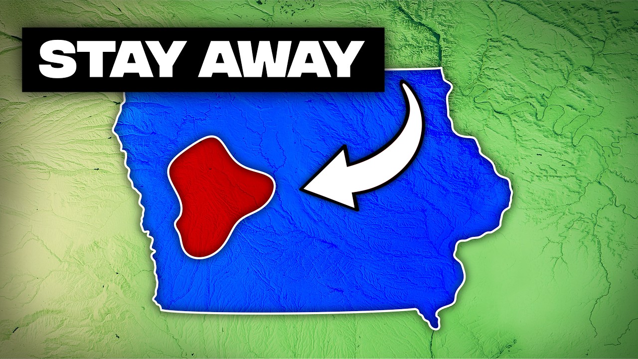
Despite its massive rivers, Iowa surprisingly has very few natural lakes. Of its hundreds of bodies of water, only 34 are naturally occurring, and every single one is a kettle lake, a 14,000-year-old scar left by the retreating Des Moines lobe glacier. These depressions cluster in the northwest, headlined by West Okoboji, a blue-water beauty plunging 136 feet deep. Without that specific glacial surge, Iowa's natural lake count would be zero. Today, Iowans build what nature did not; nearly 70 percent of the state's lakes are man-made reservoirs, 34 gifts from the Ice Age, with everything else being the result of engineering.
This engineering, however, came at a cost. Before corn dominated the horizon, Iowa operated as a massive liquid sponge. Early settlers in the north counted 200 prairie pothole wetlands per square mile, making straight-line travel nearly impossible. Today, that sponge has been wrung completely dry. Iowa has lost 95 percent of its original wetlands and an outrageous 99 percent on the Des Moines lobe, ranking third nationally in total wetland loss. Starting in the late 1800s, quasi-governmental drainage districts used eminent domain to install thousands of miles of underground tiles. The state fundamentally re-engineered the heartland's hydrology, trading millions of acres of natural filters for high-yield productivity. The water had to go somewhere, and Iowa decided where.
The High Ground and the Hurricane's Fury
At 1,670 feet, Hawkeye Point is Iowa's highest peak. Yet, it rises just 20 feet above the surrounding cornfields. Until a 1971 survey corrected the record, the title belonged to Ocheyedan Mound, a glacial hill that at least looked like something. For decades, Iowa's true summit sat on the Stern family's private farm before they donated it for public access. Today, a red granite marker and signpost guide dedicated high-pointers to a farm field that is still Iowa's humble, literal, and figurative peak, with the corn next to it almost as tall.
Think of Iowa as a massive continental pedestal: its floor is surprisingly elevated. The state's lowest point, a 480-foot riverbank in Keokuk, is higher than the lowest spots in 36 other states, including all of New England. Only 13 states, mostly in the mountainous west, have bottoms higher than Iowa's. At Keokuk, this elevation drop powers Lock and Dam number 19, the largest hydroelectric generator on the Upper Mississippi. From that gate to its highest cornfield, Iowa's chill 1,190-foot rise proves you are always standing on higher ground than you think.
The stereotype of Iowa being "pancake flat" is geographically inaccurate. According to University of Kansas researchers, Iowa ranks as only the 18th flattest state. Almost 64 percent of its terrain is officially classified as not flat. Several of Iowa's own neighbors are far more level: Illinois ranks second, and Minnesota fifth. Between the rugged Loess Hills in the west and the carved Driftless Area in the northeast, Iowa is not a level field; it is a land of subtle, constant movement that defies the laziest stereotype in American geography.
Finally, Iowa's most dangerous weather does not come from the coast; it comes from the sky directly above. The August 2020 Midwest Derecho, an inland hurricane, proved that Iowa can suffer hurricane-force destruction without an ocean anywhere in sight. This storm sustained 140-mile-per-hour winds for nearly an hour, mirroring a Category 4 storm, and ripped across 57 counties. It flattened 14 million acres of crops and caused $11.2 billion in damage, making it the costliest thunderstorm in U.S. history. In Cedar Rapids, 65 percent of the urban tree canopy disappeared in minutes. The devastation was so intense that satellites captured a massive brown scar cutting through the heartland's green terrain, a storm that attacked without warning and left a mark visible from space.
Iowa, it turns out, is a land of constant geographical plot twists, a place where the world is stranger and more dynamic than any map or stereotype could convey. It is a testament to the enduring power of natural forces, the deep currents of time, and the unexpected ways in which geology shapes both landscape and life, proving that even in the most seemingly ordinary places, the extraordinary is always lurking just beneath the surface.


