Kentucky, a state often painted with strokes of bourbon barrels and bluegrass pastures, secretly harbors a geological landscape so bizarre it defies easy categorization. Deep beneath its rolling hills, an entire subterranean world unfolds, a realm of endless caves, disappearing rivers, and ancient marine fossils. Above ground, meteorite impacts scar the land, ancient mountains guard hidden ecosystems, and rivers carve canyons older than the Appalachians themselves. It's a place where the ground beneath your feet is rarely as solid as it seems, a testament to Earth's relentless, imaginative forces.
The Subterranean Kingdom
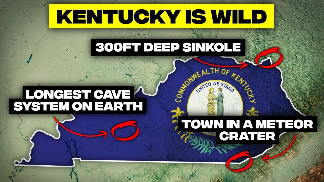
The world's longest cave system, still growing.
Mammoth Cave, the longest cave system globally, boasts over 400 miles of mapped passages, with hundreds more likely hidden. This vast underground labyrinth, capable of swallowing New York City's subway system, continues to expand as new tunnels are discovered annually, carved by acidic water dissolving limestone over millions of years.
Hidden River Cave hosts the longest underground swinging bridge.
Deep within Hidden River Cave, a swinging bridge stretches hundreds of feet above a subterranean river, suspended in complete darkness. This engineering marvel, once threatened by pollution, has been remarkably restored, offering a thrilling, albeit dark, walk above the confluence of two underground rivers.
Over 5,000 caves make Kentucky a subterranean maze.
Kentucky is home to more than 5,000 documented cave systems, one of the densest underground networks in the United States. Geologists believe this number is just the beginning, with many more caves, from small cracks to football-field-sized chambers, still awaiting discovery beneath its limestone bedrock.
A quarter of Kentucky is built like Swiss cheese.
Approximately one quarter of Kentucky exhibits classic karst topography, meaning the ground beneath is riddled with holes, caves, and unseen rivers. This landscape allows surface water to disappear underground, creating unstable terrain where sinkholes can open overnight, proving that solid ground is often anything but.
Cedar Sink, a massive collapsed cave crater.
Within Mammoth Cave National Park, Cedar Sink is a 7-acre crater, 300 feet deep, formed when a cave ceiling collapsed. This dramatic sinkhole, with its vertical walls and unique microclimate, serves as a stark reminder that in Kentucky, the ground can suddenly give way, revealing vast underground voids.
The Lost River disappears into a bottomless hole.
In Bowling Green, the Lost River flows for a mere 400 feet before plunging over 430 feet into a vertical pit. It is one of the shortest rivers on Earth, yet also one of the deepest, vanishing into a gaping blue hole with a surreal, sapphire glow, a testament to Kentucky's unique hydrological quirks.
Kentucky cave shrimp are blind, translucent ghosts.
The Kentucky cave shrimp, a tiny crustacean, has evolved without eyes and is entirely translucent, appearing almost alien in underground streams. These federally endangered creatures navigate by touch and smell, relying on pristine, undisturbed cave ecosystems for survival, making them sensitive indicators of environmental health.
Eyeless Mammoth Cave crayfish lost their sight.
Joining the cave shrimp in eternal darkness is the eyeless Mammoth Cave crayfish, a pale, ghostly crustacean. Having shed the need for vision over generations, these translucent scavengers navigate by feel and scent, their bodies stripped down to essential functions, illustrating nature's efficiency in extreme environments.
Mammoth Cave holds ancient underwater cavern fossils.
Deep within Mammoth Cave, scientists have unearthed fossilized fish, shark teeth, and amphibian bones embedded in its walls and sediment. These fossils, some 300 million years old, represent a layered record of ancient marine life and Ice Age creatures, making the cave a unique, dark time capsule.
The Green River carved the world's longest cave system.
The Green River, winding for 384 miles through Kentucky, is not just scenic, it's integral to Mammoth Cave's formation. This unpredictable waterway literally helped carve the longest cave system on Earth, offering unique experiences like kayaking under rock ceilings and then bursting back into daylight.
You could be walking over an untouched underground canyon and never know it, because in Kentucky, the terrain isn't always on top of the earth.
Echoes of Deep Time
Shark teeth fossils found in Mammoth Cave walls.
Mammoth Cave has yielded fossilized teeth from an extinct pedalodont shark species, previously unknown to science. These spoon-shaped dental structures were found embedded directly in the limestone, proving the cave's bedrock formed from ancient seabeds where prehistoric sharks hunted 300 million years ago.
Mammoth Cave holds over 70 prehistoric fish species.
Beyond its geological wonders, Mammoth Cave is a fossil repository containing remains from over 70 prehistoric fish species, including ancient sharks and ray-like creatures. The limestone bedrock itself is largely compressed marine organism remains, effectively solidifying Kentucky's submarine past.
Kentucky was once a tropical fossil beach.
Central Kentucky, 350 million years ago, lay beneath a warm, shallow sea. Today, that ancient seafloor forms thick beds of limestone, packed with fossilized crinoids, brachiopods, and other sea creatures, serving as the bedrock for towns, farms, and even bourbon distilleries.
A parking lot made of 385-million-year-old shells.
North of Lexington, exposed bedrock appears like a pavement of seashells, but these are 385 million years old. This limestone is densely packed with fossilized trilobites, brachiopods, and crinoids, remnants of a vibrant tropical seabed that existed long before dinosaurs.
The Falls of the Ohio reveal a reef older than trees.
At the Falls of the Ohio in Louisville, a mile of exposed bedrock reveals a 385-million-year-old Devonian coral reef. This massive fossil bed, packed with crinoids, corals, and brachiopods, dates from a time when Kentucky was a shallow sea near the equator, predating trees and winged insects.
Big Bone Lick, an Ice Age mammoth graveyard.
Big Bone Lick in northern Kentucky is a crucial Ice Age fossil site, where mineral-rich springs created a salt lick that trapped woolly mammoths, mastodons, and giant sloths. Bones, still surfacing after heavy rains, were studied by Lewis and Clark, helping to establish modern paleontology.
Kentucky's coal was once a tropical rainforest.
Eastern Kentucky's coal fields originated from a vast tropical swamp during the Carboniferous period, 300 million years ago. Fossils from this era reveal brachiopods and giant insects, showing that coal is not just fuel, but the compressed remains of a forgotten, steamy jungle ecosystem.
Fossilized swamp trees grew to towering heights.
Coal seams in Eastern Kentucky contain fossilized calamites, towering treelike plants that once dominated Carboniferous swamp forests. These ancient relatives of modern horsetails grew to immense sizes in a warm, humid atmosphere, their distinctive patterns preserved within the coal and rock layers.
Ancient monsters lurk in riverbed gravel.
Western Kentucky's riverbeds hold surprising secrets: prehistoric fish fossils from over 100 million years ago. Spiny sturgeon armor and bony turtle plates, some suggesting fish the size of canoes, wash up after storms, linking modern rivers to ancient Mesozoic waterways ruled by giant fish.
Ancient palm pollen reveals a subtropical past.
Soil cores across Kentucky have revealed microscopic ancient palm pollen, evidence that the region once supported subtropical forests. These fossils indicate interglacial periods thousands of years ago when the planet warmed, showcasing how Kentucky's landscape is a temporary phase in a much longer climatic story.
Peaks, Gorges, and Natural Bridges
Red River Gorge is the Arch Capital of the East.
The Red River Gorge, within Daniel Boone National Forest, boasts over 150 natural sandstone arches, one of the highest concentrations anywhere on Earth. These formations, ranging from small windows to massive bridges, rival well-known western formations and make the gorge a world-class destination for rock climbers and hikers.
Natural Bridge, a stone arch you can walk across.
At Natural Bridge State Resort Park, a massive sandstone arch, 78 feet long and 65 feet high, stands as a testament to millions of years of erosion. This majestic formation, known to Native Americans long before settlers, can be hiked across, though one day, gravity and time will inevitably bring it down.
Kentucky hides thousands of unnamed natural arches.
Kentucky features over 2,000 natural arches, more than any state east of the Rockies, many tucked away in Daniel Boone National Forest and the Big South Fork region. Sculpted by wind and water, dozens remain unnamed and unexplored in remote hollows, offering a quiet goldmine for arch hunters.
Cumberland Falls hosts a rare moonbow phenomenon.
Cumberland Falls, a 68-foot cascade, is one of only two places in the Western Hemisphere where a moonbow can be seen. On clear nights during a full moon, the mist refracts moonlight into actual rainbow colors, offering a breathtaking, ethereal spectacle that few people ever witness.
Yahoo Falls is the state's tallest waterfall.
Tucked deep in the Appalachian forest, Yahoo Falls plunges 113 feet over a sandstone cliff, making it Kentucky's tallest waterfall. This intense, ribbon-like cascade drops into a verdant forest basin, its sound echoing off rocks, creating a place that feels wild and steeped in legend.
The Palisades, a canyon older than mountains.
Snaking through central Kentucky, the Palisades feature sheer cliffs up to 200 feet tall, carved by the Kentucky River over millions of years. This 100-mile canyon, older than the Appalachia, harbors a cool microclimate, sheltering rare plants and endangered bats not found elsewhere in the state.
Pine Mountain and Cumberland Plateau form rugged barriers.
Kentucky's eastern border is defined by rugged highlands like Pine Mountain and the Cumberland Plateau, reaching 2,500 feet. These southernmost Appalachians create significant geographic and cultural barriers, fostering unique ecosystems and preserving isolated communities for decades.
The Knobs, nature's fence around the bluegrass.
The Knobs are a distinctive necklace of steep, conical hills that encircle Kentucky's bluegrass region like a natural fortress. These erosion survivors, limestone outcrops standing like sentinels, mark the abrupt transition from gentle farmland to wilder terrain, a geological perimeter that early pioneers dreaded.
Daniel Boone National Forest, a vast Appalachian wilderness.
The Daniel Boone National Forest spans 708,000 acres across 21 counties, protecting over 1,600 square miles of Appalachian wilderness. This colossal forest, encompassing cliffs, gorges, and natural bridges, provides habitat for black bears and elk, showcasing successful land reclamation after heavy logging.
Cumberland Gap, the pass that built Kentucky.
The Cumberland Gap, at 1,300 feet elevation, is one of only three natural breaks in the Appalachian chain, serving as a gateway to the American frontier. This crucial pass, carved by a soft band of rock, funneled over 300,000 settlers into Kentucky via Daniel Boone's Wilderness Road, shaping American history.
Paddle through it and you're not just on a river, you're navigating a 100-mile canyon older than Appalachia itself.
Water, Wildlands, and Human Hands
Kentucky Lake, an inland sea with vast shoreline.
Kentucky Lake, a man-made giant, stretches 184 miles long and covers over 160,000 acres, giving Kentucky more shoreline than California. Built in 1944 by damming the Tennessee River, it's the largest lake by surface area east of the Mississippi, reshaping the region into a lakeside economy.
Record-breaking fish thrive in Kentucky Lake.
Kentucky Lake is a hotspot for anglers, with numerous state records set for species like white bass, buffalo carp, and yellow perch. Its ideal environment, characterized by submerged timber, varying depths, and a strong food chain, allows prize fish to grow to enormous sizes, supporting a thriving ecosystem.
Land Between the Lakes, a wilderness born from engineering.
Land Between the Lakes is a 171,000-acre peninsula created between two man-made reservoirs, Kentucky Lake and Lake Barkley. Dams created the lakes, but nature reclaimed the land, now home to roaming bison, elusive elk, and bald eagles, a testament to nature's comeback when humans step back.
Southern swamp forests thrive in western Kentucky.
Beyond rolling hills, western Kentucky harbors unexpected southern swamp forests. Bald cypress and water tupelo trees rise from dark standing water, complete with Spanish moss and alligator snapping turtles. This bayou-like ecosystem, rare for its latitude, supports species typically found much further south.
The Ohio River flowed backward during the 1937 flood.
In 1937, relentless rain caused the Ohio River to swell so dramatically it reversed its flow in some areas. This catastrophic flood displaced over one million people, submerged Louisville, and led to massive federal investments in dams and levies that still define the region's rivers today.
Kentucky is a critical stop on the Mississippi Flyway.
Kentucky sits squarely beneath the Mississippi Flyway, a major migratory route for millions of birds traveling between Arctic and tropical regions. River valleys like the Ohio and Mississippi act as natural highways, guiding birds to critical wetlands and forests for rest and refueling during their thousands-of-miles-long journeys.
Rewilded megafauna roams Land Between the Lakes.
In a 17,000-acre prairie restoration zone at Land Between the Lakes, free-roaming herds of elk and bison have been successfully reintroduced after centuries of absence. This rewilding effort, one of the largest in the Southeast, restores an ancient rhythm to the land, with these megafauna acting as ecosystem engineers.
Blanton Forest protects Kentucky's last old growth.
Blanton Forest on Pine Mountain represents Kentucky's last significant old-growth Appalachian forest, ancient trees that escaped logging due to remoteness. This sanctuary harbors boreal relic species, plants and animals clinging to southern mountains like ecological refugees, offering a living museum of Kentucky's pre-settlement landscape.
Canada on a Kentucky mountaintop, Ice Age relics.
At the highest ridges near Cumberland Gap, Appalachian spruce-fir forests create a miniature Canada. These Ice Age relics, more suited to Nova Scotia, cling to mountain tops where temperatures remain just cold enough, offering a glimpse into past climates, though now threatened by warming temperatures.
Lotus leaves grow to manhole cover size.
Kentucky's mineral-rich limestone springs and karst aquifers foster giant American lotus flowers. In certain wetlands, blooms grow to the size of dinner plates, and floating leaves stretch nearly 6 feet across, making them some of the largest documented lotus specimens in the United States, thanks to supercharged aquatic plant life.
Cosmic Scars and Climate Extremes
Middlesboro, a town living in a meteor crater.
Middlesboro, Kentucky, is uniquely situated inside a 3-mile wide impact crater, formed roughly 300 million years ago when a meteorite struck southeastern Kentucky. Homes, stores, and schools now sit within this cosmic scar, making it the only place on Earth where coal is mined within a meteor crater.
Kentucky may have been hit by two meteor strikes.
While Middlesboro Crater is confirmed, geologists suspect a second, even older meteor impact in western Kentucky. Strange circular landforms and shocked quartz crystals hint at a cosmic blast millions of years older, potentially making Kentucky one of the most sky-punched places on the continent.
Western Kentucky's hills were built by the wind.
The Loess Bluffs of western Kentucky, rising 300 to 500 feet, were not carved by rivers but built by wind. During the last ice ages, powerful gusts carried fine silt across the land, piling it into fertile but fragile mounds, a rare monument to the power of air in a water-shaped state.
Ice storms that shatter forests and infrastructure.
Kentucky's winters can bring destructive ice storms, where warm Gulf moisture collides with Arctic air, turning the state into a frozen glass sculpture. A 2009 storm, for example, knocked out power to over 600,000 people, with frozen branches cracking like rifle shots, reshaping the land with glittering disaster.
Kentucky experiences extreme weather swings.
With a recorded temperature range of 151 degrees Fahrenheit, Kentucky can swing from a sweltering 114°F (Greensburg, 1930) to a brutal -37°F (Shelbyville, 1994). This volatility, due to its geographic crossroads of Gulf moisture and Arctic air, impacts everything from farming to wildlife patterns.
Alligators occasionally migrate into Kentucky.
Though unexpected, alligators occasionally appear in western Kentucky, far from their native swamps. Warm summer heat and river currents from the Gulf create temporary migration highways along the Tennessee and Ohio rivers, allowing these reptiles to cruise hundreds of miles north, making surprising cameos.
A recent storm erased towns in Eastern Kentucky.
In February 2025 (referring to a recent event, likely 2022), Eastern Kentucky experienced devastating floods, with nearly 9 inches of rain turning mountain streams into violent rivers. This rapid disaster claimed 22 lives, destroyed over 300 roads, and saw entire towns vanish under walls of water and mud, highlighting the region's vulnerability.
Fulgarites, natural lightning-struck glass sculptures.
When lightning strikes sandy ridgetops at over 3,000°F, it can fuse sand grains into glass tubes called fulgarites. These rare, delicate natural sculptures twist into the earth, preserving the exact path of the lightning strike, tangible proof of skyfire touching the ground.
The Eastern Hellbender breathes through its skin.
The Eastern Hellbender, North America's largest salamander at 2 to 3 feet long, is a slimy, ancient resident of clean Appalachian streams. Lacking gills or lungs, it absorbs oxygen through skin folds, requiring crystal-clear, cold water, making it a fragile indicator of stream health.
The relict darter, a rare endemic survivor.
The relict darter, found only in about 33 stream miles across two isolated populations in western Kentucky's Bayou de Chien system, is one of North America's most geographically restricted vertebrates. This federally threatened fish is an evolutionary remnant, representing an ancient lineage surviving in a tiny refuge.
From ancient seabed to meteor-scarred terrain, Kentucky proves that geography is far more than just lines on a map. It's a dynamic, ever-changing narrative, where deep time and sudden events sculpt a landscape stranger and more compelling than any textbook ever taught. The Bluegrass State, it seems, has been quietly staging some of Earth's wildest geological plot twists, daring us to look closer and discover the astonishing stories hidden beneath its surface.


