Forget what school textbooks taught you about the American South. Georgia, a state often stereotyped for its peaches and hospitality, is in fact a geological anomaly, a landscape of profound and unexpected extremes. Its terrain tells a story millions of years in the making, from mountains older than the Himalayas to rivers that disappear underground. This is a land where ancient seas left behind inland deserts, where farming errors carved canyons overnight, and where the very ground beneath your feet can tremble. Prepare to see the Peach State not just as a place, but as a dynamic, evolving canvas of Earth's raw power and peculiar artistry.
Ancient Earth, Enduring Stone
Georgia's mountains are the skeletons of ancient giants.
The Blue Ridge peaks in North Georgia are not small, they are what remains. Around 300 million years ago, Africa collided with North America, creating a mountain range likely as tall as today's Himalayas. Wind, rain, and time have since eroded miles of rock, leaving behind these ancient stumps.

This granite mountain refused to erode over millennia.
Stone Mountain stands as one of the largest exposed granite outcrops on Earth, rising 825 feet above the Piedmont and stretching five miles around. Formed deep underground over 300 million years ago, it was later uncovered as softer rock eroded away, a stubborn survivor of a vanished environment.
Arabia Mountain hosts an alien world on bare rock.
This granite outcrop is riddled with shallow rock pools that briefly trap rainwater, creating unique ecosystems. In spring, these pits burst with crimson elf orpine. Endangered species like the black spor quill wart thrive here, proving that ecosystems can flourish without soil, given the right geological loophole.
A farming disaster created this Georgia canyon.
Providence Canyon, nicknamed Georgia's Little Grand Canyon, looks ancient but is younger than the United States. Poor farming practices in the 1800s caused erosion, deepening shallow ruts into 150 foot tall gullies. It is a rare example of a natural wonder formed rapidly, within just two centuries, due to human error.
An ancient beach runs right through central Georgia.
The Fall Line marks a buried coastline where seas crashed against the continent over 100 million years ago. North of it lies hard Piedmont rock, south are soft coastal sands. Cities like Macon and Columbus formed where rivers crossed this boundary, creating waterfalls ideal for mills.
Georgia possesses an inland desert, far from any coast.
The Fall Line sand hills are ancient beach dunes, stranded inland after seas retreated millions of years ago. Their sand can be 80 feet deep, creating drought conditions where only desert-adapted plants, like cacti and gopher tortoises, survive. It is a fossilized shoreline pretending it never moved.
Georgia's iconic red dirt is a product of chemistry.
Over millions of years, intense weathering stripped away most minerals from Georgia's soil, leaving behind iron that oxidized, literally rusting the ground. This ult becomes sticky when wet and brick-hard when dry, profoundly shaping farming and construction across the state. Georgia isn't just on red clay, it's built from it.
Georgia marble built some of America's iconic structures.
Marble from Tate, Georgia, was so pure it rivaled Italy's Carrara, finding its way into the Lincoln Memorial, US Capitol columns, and even Lincoln's massive seated statue. North Georgia quarries quietly supplied stone that shaped national monuments, its legacy polished and permanent in American history.
Rock Town is a city of stone hidden in the forest.
Deep in northwest Georgia's Crockford Pigeon Mountain Wilderness, massive sandstone boulders, some 40 feet tall, are scattered like abandoned skyscrapers. These rocks broke free from the Cumberland Plateau's caprock and weathered into unreal shapes, forming corridors, caves, and arches, a truly otherworldly landscape.
A mysterious stone wall sits atop Fort Mountain.
An 885 foot long stone wall, covered in moss and vines, runs along Fort Mountain in North Georgia. Its construction style does not match known Cherokee designs, and archaeologists remain divided on its purpose. Legends speak of mysterious builders, with some theories dating it back over 1,500 years.
Fairy crosses are hidden in Georgia's mountains.
Georgia's state mineral, staurolite, forms naturally into crystal crosses, perfectly intersecting at right angles. Found primarily in North Georgia's metamorphic rocks, these "fairy crosses" form under intense heat and pressure. For centuries, people collected them as good luck charms, believing nature itself had shaped these symbolic stones.
Peaks, Plunges, and Hidden Depths
Brasstown Bald is Georgia's rooftop in the clouds.
At 4,784 feet, Brasstown Bald is Georgia's highest point, often sitting above cloud layers. An observation tower offers views into four states on clear days. This elevation creates cooler microclimates where northern plant species survive, and winter snow is common. The Cherokee called it "Enotah," meaning "new green place."
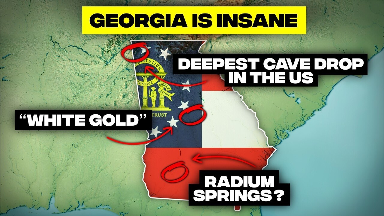
America's deepest cave drop is in Georgia.
Ellison's Cave contains the Fantastic Pit, a vertical drop that plunges 586 feet straight down, the deepest unobstructed cave shaft in the continental US. One could drop the Statue of Liberty into it twice. The cave system, stretching over 12 miles underground, has claimed lives of unprepared explorers.
A 70-story waterfall plunges in Georgia.
Amicalola Falls drops 729 feet, making it Georgia's tallest waterfall and one of the highest east of the Rockies. The creek plunges down multiple tiers over resistant quartzite. Visitors can climb over 600 steps alongside the falls, gaining elevation and breathtaking views rapidly.
Tallulah Gorge is a thousand-foot canyon in the East.
This gorge is shockingly deep for the eastern US, nearly 1,000 feet carved in just two miles through hard quartzite bedrock. Once thundering with six massive waterfalls, a 1913 dam silenced most of its power. Today, controlled releases attract elite kayakers to its roaring rapids.
The Appalachian Trail officially begins in Georgia.
Springer Mountain marks mile zero of the Appalachian Trail, the southern terminus of the 2,190 mile footpath to Maine. Georgia's 78 mile section offers no warm-up, featuring steep climbs, rocky ridges, and Blood Mountain, testing hikers early. It is a symbolic start and a trial by fire.
Georgia has warm springs without any volcanoes.
In Warm Springs, mineral-rich groundwater emerges at a constant 88 degrees Fahrenheit, heated deep underground by Earth's natural geothermal gradient. Franklin D. Roosevelt sought relief from polio here, building his Little White House nearby. These springs pump nearly 900 gallons per minute.
A radioactive blue spring flows in southwest Georgia.
Radium Springs, near Albany, looks unreal, a crystal-clear turquoise pool pumping 70,000 gallons per minute from underground limestone. The water contains trace amounts of radium, leading to a 1920s health craze. While the radioactivity is harmless, the spring remains a surreal relic of geology and human optimism.
America's first gold boom happened in Georgia.
Before California, the first major gold rush exploded in Dahlonega, Georgia, in 1828. Thousands of prospectors flooded the region, triggering displacement of Cherokee communities. The boom was so intense that the US government opened a federal mint in Dahlonega in 1835, stamping coins with a 'D'.
Wind, rain, and time shaved miles of rock off their height.
Coastal Labyrinths and Tidal Rhythms
Georgia hosts perfectly aligned, mysterious swamp ovals.
Thousands of eerie, oval-shaped wetlands, called Carolina Bays, dot Georgia's coastal plains, all tilted in nearly the same direction. Their origin is still debated, with theories ranging from meteor impacts to ice age winds. Grand Bay, near Valdosta, is a massive oval swamp with no rivers flowing in or out, filled only by rain.
Georgia's wildest island has no human rules.
Cumberland Island, stretching 17.5 miles long, is one of the largest undeveloped barrier islands on the East Coast. It is home to roughly 150 feral horses that roam completely unmanaged. There is no bridge, requiring boat access, preserving a protected fragment of the past with empty beaches and vast salt marshes.
One-third of the East Coast's salt marshes live here.
Georgia's coastline, though only about 100 miles long, contains nearly one-third of all salt marshes on the entire US East Coast, roughly 400,000 acres. These marshes flood and drain twice daily, feeding shrimp, crabs, and fish, supercharging food chains far beyond Georgia's waters.
Georgia's tides rise like elevators, not gently.
Georgia's coast experiences average tidal swings of 6 to 9 feet, with spring tides exceeding 10 feet, among the highest on the southeast Atlantic coast. The Georgia Bite acts like a funnel, forcing ocean water to pile up. These powerful tides flush nutrients into marshes, fueling their immense productivity.
Georgia's coastline refuses to be straight.
Though it measures just 100 miles straight, Georgia's twisting tidal edges stretch over 2,300 miles when every creek, marsh, and inlet is counted. Unlike the straight beaches of the Carolinas, Georgia's shore bows inward, forming a maze of drowned river valleys and shifting estuaries, known as the Golden Isles.
A Jekyll Island beach is made of dead trees.
Jekyll Island's Driftwood Beach looks post-apocalyptic, with massive oak and pine skeletons sprawled across the sand. These trees did not drift in, they grew here. Coastal erosion and rising seas killed the maritime forest, toppling trees where they stood. It is a constantly shifting boneyard shoreline, a haunting reminder of barrier island movement.
Wilderness, Wildlife, and Waterways
The Alapaha River vanishes mid-flow in Georgia.
South Georgia's Alapaha River performs a full disappearing act. During dry periods, it drains straight into a massive sinkhole called Dead River Sink, leaving up to 15 miles of dry riverbed. The water travels underground through porous limestone, reemerging in Florida to join the Suwannee River, a true hydrological magic trick.
Georgia's Altamaha River is a little Amazon.
The Altamaha River is one of the wildest rivers left on the East Coast, flowing undammed for 137 miles through a flood plain up to five miles wide. Cypress swamps and blackwater channels dominate, supporting over 120 rare species. Its massive 26 square mile delta is critical habitat for migrating birds.
The Florida Aquifer is Georgia's underground ocean.
Most of Georgia's fresh water comes from beneath your feet. The Florida Aquifer, one of the largest freshwater aquifers on Earth, lies beneath southern Georgia and nearly all of Florida. This massive limestone reservoir stores rainwater, feeding iconic springs and supplying drinking water, a hidden underground sea.
Rockpools act like tiny, vibrant ecosystems.
Georgia's granite outcrops host some of the smallest and strangest ecosystems. Shallow depressions collect rainwater, forming miniature ponds on bare rock. In spring, crimson dwarf succulents explode in color, and endangered quillworts sprout underwater. These ecosystems are ancient, fragile, and easily destroyed, with over 20 species documented in a few square feet.
A whale nursery hides off Georgia's coast.
Georgia's shoreline plays a critical role in saving one of Earth's rarest mammals. Each winter, North Atlantic Right Whales, with only about 380 individuals left worldwide, migrate over 1,000 miles to give birth in the shallow waters off Georgia and northern Florida. These calm seas are the species' only known calving grounds.
Gray's Reef is Georgia's hidden underwater world.
Just 19 miles offshore, beneath Georgia's often murky waters, lies Gray's Reef, a 22 square mile underwater ecosystem. Instead of coral, sandstone ledges rise from the seafloor, forming a rare hard-bottom habitat covered in sponges, sea fans, and soft corals. It shelters over 200 species of fish, sea turtles, and sharks.
Okefenokee is the land that trembles underfoot.
Covering roughly 700 square miles, the Okefenokee Swamp is larger than Los Angeles. Its floating peat mats quiver underfoot, inspiring its Native American name. Spanish moss drapes cypress trees above tea-dark water filled with alligators and black bears. It is a living fossil environment, barely changed for millennia.
Georgia has a sky-high, ancient earthen pyramid.
Etowah Indian Mounds near Cartersville rival ancient monuments in scale and sophistication. Built between 1000 and 1550 AD, Mound A rises 67 feet high, over seven stories tall, and once supported the home of a powerful priest-chief. The complex shows evidence of palisade walls and watchtowers.
Paddle here and you'll see no levies, no cities, no canals, just Spanish moss, mirror dark water, and silence.
Human Footprints and Geological Quirks
Columbus unleashed urban whitewater by blowing up dams.
In 2013, Columbus, Georgia, did something wild: it blew up two dams. This unleashed 2.5 miles of natural rapids on the Chattahoochee River, creating the longest urban whitewater course in the world. During scheduled releases, flows hit 13,000 cubic feet per second, making these the highest volume rapids east of the Mississippi.

A world record fish came from a hidden Georgia pond.
In 1932, George Perry pulled a 22 pound, 4 ounce largemouth bass from Montgomery Lake, a remote pond. This set a world record that stood for 85 years. The lake, far from highways, still draws fishermen chasing the dream, proving history's biggest moments can happen in the smallest places.
Georgia is the biggest state east of the Mississippi by land.
Many get this wrong, but Georgia is the largest state entirely east of the Mississippi River by land area. It packs 59,425 square miles of land, larger than New England and nearly equal to Illinois and Massachusetts combined. This vast footprint contains wildly diverse ecosystems, from mountains to subtropical wetlands.
A Georgia mountain range doesn't belong to the Appalachians.
Pine Mountain rises abruptly from west central Georgia like it missed a meeting with the Appalachians. Stretching nearly 50 miles, this ridge is a geological loner made of extremely old, erosion-resistant rock. It hosts northern plant species that should not exist this far south, relics from colder climates.
Georgia's coast statistically dodges the worst hurricanes.
Georgia's coastline has a strange reputation for avoiding the worst hurricanes. Statistically, only a handful of Category 3 or stronger storms have made direct landfall here. The most powerful was the 1898 Georgia Hurricane, a Category 4. Storms often veer north or south, possibly influenced by the curve of the Georgia Bite.
From furnace to freezer, Georgia swings hard on temperature.
Georgia experiences extreme temperature variations. The state's record high is 112 degrees Fahrenheit, while the record low plunges to -17 degrees Fahrenheit, a staggering 129 degree spread. North Georgia mountains regularly see snow, even as coastal areas remain mild, compressing multiple climate zones into one state.
The sweet Vidalia onion secret is Georgia's soil.
Vidalia onions are sweet because of where they grow. South Georgia's sandy loam soil contains unusually low sulfur levels, the element that gives most onions their harsh bite. Less sulfur means fewer tear-inducing compounds and more sugar. They are grown exclusively in a protected 20-county region, forming a $150 million industry.
The Gnat Line is Georgia's buggy, invisible border.
Georgia has an invisible border most maps don't show: the Gnat Line. Roughly following the Fall Line, it separates the relatively gnat-free Piedmont from the gnat-dominated coastal plain. South of the line, sandy soils and humid heat create perfect breeding conditions for biting midgets, known locally as "sand gnats" or "nosiums."
Monsters once lurked beneath Georgia's soil.
Georgia's past was terrifying. During the Cretaceous period, massive marine predators ruled the shallow seas that once covered the state. Fossils of mosasaurs, giant marine reptiles, and megalodon teeth, some over 4 inches long, have been found. Georgia made the megalodon tooth its official state fossil, revealing a brutal, ocean-dominated world.
You can theoretically see seven states from Lookout Mountain.
On top of Lookout Mountain, Rock City Gardens claims you can see seven states from one viewpoint. From roughly 2,000 feet above sea level, the horizon stretches about 120 miles, theoretically enough to glimpse Georgia, Tennessee, Alabama, North Carolina, South Carolina, Kentucky, and Virginia. Atmospheric haze usually limits visibility to five states.
Unseen Riches and Unexplained Mysteries
The State of Dade is Georgia's almost micro-nation.
Dade County sits in Georgia's far northwest corner, boxed in by mountains. Until 1939, there was no direct road connecting it to the rest of Georgia, fostering isolation. Local legend claims the county seceded from Georgia in 1861, earning it the nickname "The Independent State of Dade," a badge of rugged pride.
Georgia hides a baryte bonanza, a heavy crystal treasure.
North of Atlanta, the Cartersville mining district in Bartow County hides one of North America's richest baryte regions. It produces dense, glassy white crystals so heavy they feel unnatural. Baryte's extreme density makes it indispensable for oil drilling mud and radiation shielding. Some specimens are museum quality.
White gold from an ancient sea is found in Georgia.
Georgia is the kaolin capital of the world, producing over $1 billion worth of the clay each year. Kaolin formed around 70 million years ago when a shallow tropical sea covered central Georgia. As mountains eroded, ultra-pure clay settled along what is now the Fall Line, creating a narrow "white gold" belt.
World-class gem mines are in plain sight in Georgia.
Georgia's northeast hides mineral deposits that attract collectors. Graves Mountain Mine is legendary for producing stunning rutile crystals, lazulite, kyanite, pyrophyllite, and blue quartz, many considered museum-grade. During World War II, Georgia pegmatites were mined for strategic minerals, uncovering gem-quality aquamarine and smoky quartz.
Ancient cosmic glass rests in Georgia's soil.
Hidden in Georgia's red clay are tiny, olive-green glass stones called Georgiatites, and they are not from Earth. These rare tectites formed when a massive asteroid slammed into Chesapeake Bay 35 million years ago. The impact launched molten debris high into the atmosphere, which cooled into glass droplets and rained across the southeast.
A state line error cost Georgia a river.
A simple surveying mistake in 1818 changed Georgia's future. Surveyors placed the Georgia-Tennessee border about one mile too far south, cutting Georgia off from direct access to the Tennessee River. That missing mile still matters today during droughts, creating one of the Southeast's longest-running water disputes.
America's Stonehenge, now gone, stood in Georgia.
For over 40 years, the Georgia Guidestones stood in rural Elbert County, earning the nickname America's Stonehenge. This 19-foot tall granite monument, weighing nearly 238,000 pounds, displayed inscriptions in eight languages. Commissioned in 1979, its true origins were never fully revealed. It was bombed and demolished in 2022.
Georgia's geography is a masterclass in plot twists, proving that the world is far stranger and more compelling than any map initially suggests. From its cosmic glass fragments to its lost river access, the state continually defies expectations, offering a landscape that is both ancient and ever-changing. It reminds us that every corner of our planet holds untold stories, waiting to be discovered, challenging our perceptions, and revealing the profound, sometimes bewildering, beauty of our home.


